
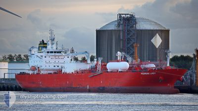
PERMIAN LADY
Tanker D
Current Trip
CHESAPEKE,USA
| Time Travelled | 2 days |
|---|---|
| Remaining Time | --- |
| Distance Travelled | 1025.19 nm |
| Remaining Distance | --- |
| AVG Speed | 12.5 Knots |
| MAX Speed | 18.8 Knots |
| AVG Wind | 12.3 knots |
| MAX Wind | 29 knots |
| MIN Temp | 7.5°C / 45.5°F |
| MAX Temp | 12.2°C / 53.96°F |
| Draught | 8.3 m |
| Position Received | 1 d ago |
Current Position
| Longitude | -4.90971° |
|---|---|
| Latitude | 49.69537° |
| Status | Under way using engine |
| Speed | 16.4 Knots |
| Course | 254.1° |
| Area | English Channel |
| Station | T-AIS |
| Position Received | 1 d ago |
Info
Information
The current position of PERMIAN LADY is in English Channel with coordinates 49.69537° / -4.90971° as reported on 2024-04-23 12:09 by AIS to our vessel tracker app. The vessel's current speed is 16.4 Knots
The vessel PERMIAN LADY (IMO: 9729269, MMSI: 566506000) is a Tanker D It's sailing under the flag of [SG] Singapore.
In this page you can find informations about the vessels current position, last detected port calls, and current voyage information. If the vessels is not in coverage by AIS you will find the latest position.
The current position of PERMIAN LADY is detected by our AIS receivers and we are not responsible for the reliability of the data. The last position was recorded while the vessel was in Coverage by the Ais receivers of our vessel tracking app.
The current draught of PERMIAN LADY as reported by AIS is 8.3 meters
Weather
| Temperature | 11.5°C / 52.7°F |
|---|---|
| Wind Speed | 22 knots |
| Direction | 343° NNW |
| Pressure | 1024.3 hPa |
| Humidity | 66 % |
| Cloud Coverage | 100 % |
Featured Company
Events
| Time | Event | Details | Position / Dest | Info |
|---|---|---|---|---|
| 2024-04-23 12:10 | Status Changed | Default Under way using engine |
49.69415 / -4.91634
CHESAPEKE,USA
|
Speed: 16.4 kn Course: 254.1° |
| 2024-04-23 12:09 | OUT of Coverage |
49.69537 / -4.90971
English Channel
CHESAPEKE,USA
|
Speed: 16.4 kn Course: 254.1° |
|
| 2024-04-23 07:38 | Detected in Sea | United Kingdom part of the English Channel |
49.96121 / -3.09100
English Channel
CHESAPEKE,USA
|
Speed: 14.4 kn Course: 255.7° |
| 2024-04-23 07:36 | Status Changed | Under way using engine Default |
49.96305 / -3.07959
CHESAPEKE,USA
|
Speed: 14.4 kn Course: 256° |
| 2024-04-23 06:42 | Status Changed | Default Under way using engine |
50.01564 / -2.76356
CHESAPEKE,USA
|
Speed: 13.8 kn Course: 254.7° |
| 2024-04-23 06:36 | Status Changed | Under way using engine Default |
50.02211 / -2.72712
CHESAPEKE,USA
|
Speed: 13.8 kn Course: 255° |
| 2024-04-23 06:26 | Status Changed | Default Under way using engine |
50.03210 / -2.67049
CHESAPEKE,USA
|
Speed: 13.8 kn Course: 254.3° |
| 2024-04-23 05:53 | Status Changed | Under way using engine Default |
50.05877 / -2.47540
CHESAPEKE,USA
|
Speed: 14 kn Course: 259° |
| 2024-04-23 05:50 | Status Changed | Default Under way using engine |
50.05978 / -2.46301
CHESAPEKE,USA
|
Speed: 14 kn Course: 255.3° |
| 2024-04-23 05:45 | Status Changed | Under way using engine Default |
50.06533 / -2.42954
CHESAPEKE,USA
|
Speed: 14.1 kn Course: 256° |