
PERMATA
General Cargo
Current Trip
| Time Travelled | 3 days |
|---|---|
| Remaining Time | --- |
| Distance Travelled | 928.52 nm |
| Remaining Distance | --- |
| AVG Speed | 10.3 Knots |
| MAX Speed | 13.6 Knots |
| AVG Wind | 9.7 knots |
| MAX Wind | 22.8 knots |
| MIN Temp | 18.5°C / 65.3°F |
| MAX Temp | 26.9°C / 80.42°F |
| Draught | 8.7 m |
| Position Received | 2 d ago |
Current Position
| Longitude | 121.77376° |
|---|---|
| Latitude | 25.54889° |
| Status | Under way using engine |
| Speed | 10.4 Knots |
| Course | 59° |
| Area | Eastern China Sea |
| Station | T-AIS |
| Position Received | 2 d ago |
Info
Information
The current position of PERMATA is in Eastern China Sea with coordinates 25.54889° / 121.77376° as reported on 2024-04-20 14:40 by AIS to our vessel tracker app. The vessel's current speed is 10.4 Knots and is heading at the port of FUNABASHI. The estimated time of arrival as calculated by MyShipTracking vessel tracking app is 2024-04-25 03:00 LT
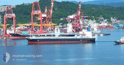
The vessel PERMATA (IMO: 9636137, MMSI: 373078000) is a General Cargo that was built in 2012 ( 12 years old ). It's sailing under the flag of [PA] Panama.
In this page you can find informations about the vessels current position, last detected port calls, and current voyage information. If the vessels is not in coverage by AIS you will find the latest position.
The current position of PERMATA is detected by our AIS receivers and we are not responsible for the reliability of the data. The last position was recorded while the vessel was in Coverage by the Ais receivers of our vessel tracking app.
The current draught of PERMATA as reported by AIS is 8.7 meters
Weather
| Temperature | 18.9°C / 66.02°F |
|---|---|
| Wind Speed | 16 knots |
| Direction | 314° NW |
| Pressure | 1006.8 hPa |
| Humidity | 95.3 % |
| Cloud Coverage | 100 % |
Featured Company
Last Port Calls
| Port | Arrival | Departure | Time In Port |
|---|---|---|---|
| 2024-04-17 21:46 | 2024-04-19 17:54 | 1 d | |
| 2024-04-12 12:24 | 2024-04-13 08:36 | 20 h | |
| 2024-04-10 23:33 | 2024-04-12 08:04 | 1 d | |
| 2024-04-04 05:40 | 2024-04-07 16:04 | 3 d | |
| 2024-03-22 23:16 | 2024-03-27 21:05 | 4 d | |
| 2024-03-12 21:05 | 2024-03-14 07:11 | 1 d | |
| 2024-03-07 22:18 | 2024-03-09 08:39 | 1 d | |
| 2024-02-28 05:16 | 2024-03-01 17:56 | 2 d | |
| 2024-02-22 09:35 | 2024-02-24 08:20 | 1 d | |
| 2024-02-19 10:52 | 2024-02-20 13:10 | 1 d |
Last Trips
| Origin | Departure | Destination | Arrival | Distance | |
|---|---|---|---|---|---|
| 2024-04-13 16:36 | 2024-04-18 05:46 | 854.50 nm | |||
| 2024-04-12 16:04 | 2024-04-12 20:24 | 40.30 nm | |||
| 2024-04-08 01:04 | 2024-04-11 07:33 | 745.75 nm | |||
| 2024-03-28 06:05 | 2024-04-04 14:40 | 758.47 nm | |||
| 2024-03-14 16:11 | 2024-03-23 08:16 | 56.22 nm | |||
| 2024-03-09 17:39 | 2024-03-13 06:05 | 374.82 nm | |||
| 2024-03-02 01:56 | 2024-03-08 07:18 | 1140.13 nm | |||
| 2024-02-24 16:20 | 2024-02-28 13:16 | 710.66 nm | |||
| 2024-02-20 21:10 | 2024-02-22 17:35 | 236.04 nm | |||
| 2024-02-15 17:43 | 2024-02-19 18:52 | 899.75 nm |
Events
| Time | Event | Details | Position / Dest | Info |
|---|---|---|---|---|
| 2024-04-20 14:47 | Status Changed | Default Under way using engine |
25.55833 / 121.79333
JP FNB
|
Speed: 10.4 kn Course: 59° |
| 2024-04-20 14:40 | OUT of Coverage |
25.54889 / 121.77376
Eastern China Sea
JP FNB
|
Speed: 10.4 kn Course: 59° |
|
| 2024-04-20 13:44 | Status Changed | Under way using engine Default |
25.47360 / 121.61455
JP FNB
|
Speed: 10.4 kn Course: 53° |
| 2024-04-20 13:24 | Status Changed | Default Under way using engine |
25.43534 / 121.56616
JP FNB
|
Speed: 10.7 kn Course: 51.9° |
| 2024-04-20 13:08 | Change Sea Area | Taiwanese part of the Eastern China Sea Taiwanese part of the South China Sea |
25.40876 / 121.52446
Eastern China Sea
JP FNB
|
Speed: 10.2 kn Course: 60.4° |
| 2024-04-20 13:06 | Status Changed | Under way using engine Default |
25.40585 / 121.51846
JP FNB
|
Speed: 10 kn Course: 63° |
| 2024-04-20 12:50 | IN Coverage |
25.40876 / 121.52446
Eastern China Sea
JP FNB
|
Speed: 10.2 kn Course: 60.4° |
|
| 2024-04-20 11:40 | Status Changed | Default Under way using engine |
25.30187 / 121.29311
JP FNB
|
Speed: 9.1 kn Course: 63.9° |
| 2024-04-20 11:35 | OUT of Coverage |
25.29586 / 121.28075
South China Sea
JP FNB
|
Speed: 9.1 kn Course: 63.9° |
|
| 2024-04-20 11:18 | ETA Changed | 2024/04/25 03:00 2024/04/25 10:00 |
25.27111 / 121.24066
JP FNB
|
Speed: 9.2 kn Course: 51.4° |