
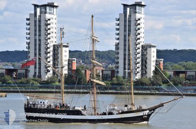
PELICAN OF LONDON
Sailing Vessel
Current Trip
| Trip Time | 61 days |
|---|---|
| Trip Distance | 4074.59 nm |
| AVG Speed | 6.8 Knots |
| MAX Speed | 11 Knots |
| Draught | 4 m |
| AVG Wind | 18 knots |
| MAX Wind | 34 knots |
| MIN Temp | 10.1°C / 50.18°F |
| MAX Temp | 27.3°C / 81.14°F |
| Position Received | 2 m ago |
Current Position
| Longitude | -8.72572° |
|---|---|
| Latitude | 42.24306° |
| Status | Moored |
| Speed | |
| Course | 138° |
| Area | North Atlantic Ocean |
| Station | T-AIS |
| Position Received | 2 m ago |
Info
Information
The current position of PELICAN OF LONDON is in North Atlantic Ocean with coordinates 42.24306° / -8.72572° as reported on 2024-04-25 12:14 by AIS to our vessel tracker app. The vessel's current speed is 0 Knots and is currently inside the port of VIGO.
The vessel PELICAN OF LONDON (IMO: 5273339, MMSI: 235057366) is a Sailing Vessel that was built in 1948 ( 76 years old ). It's sailing under the flag of [GB] United Kingdom.
In this page you can find informations about the vessels current position, last detected port calls, and current voyage information. If the vessels is not in coverage by AIS you will find the latest position.
The current position of PELICAN OF LONDON is detected by our AIS receivers and we are not responsible for the reliability of the data. The last position was recorded while the vessel was in Coverage by the Ais receivers of our vessel tracking app.
The current draught of PELICAN OF LONDON as reported by AIS is 4 meters
Weather
| Temperature | 12.5°C / 54.5°F |
|---|---|
| Wind Speed | 4 knots |
| Direction | 294° WNW |
| Pressure | 1013.6 hPa |
| Humidity | 77 % |
| Cloud Coverage | 72 % |
Featured Company
Last Port Calls
| Port | Arrival | Departure | Time In Port |
|---|---|---|---|
| 2024-04-25 08:23 | |||
| 2024-02-20 20:05 | 2024-02-23 17:03 | 2 d |
Last Trips
| Origin | Departure | Destination | Arrival | Distance | |
|---|---|---|---|---|---|
| 2024-02-23 12:03 | 2024-04-25 10:23 | 4074.59 nm | |||
| 2023-12-22 10:23 | 2024-02-20 15:05 | 1442.22 nm |
Events
| Time | Event | Details | Position / Dest | Info |
|---|---|---|---|---|
| 2024-04-25 08:50 | Status Changed | Moored Under way using engine |
42.24301 / -8.72575
[ES] VIGO
|
Speed: Course: 140° |
| 2024-04-25 08:30 | STOP Moving |
42.24288 / -8.72496
[ES] VIGO
|
Speed: 0.3 kn Course: 198° |
|
| 2024-04-25 08:23 | PORT ARRIVAL |
|
42.24663 / -8.72437
[ES] VIGO
|
Speed: 3.1 kn Course: 168° |
| 2024-04-25 03:50 | ETA Changed | 2024/04/25 08:00 2024/04/24 23:00 |
42.22508 / -8.98898
VIGO
|
Speed: 0.5 kn Course: 232° |
| 2024-04-25 01:48 | IN Coverage |
42.23451 / -8.99601
North Atlantic Ocean
VIGO
|
Speed: 0.5 kn Course: 139.7° |
|
| 2024-04-24 19:15 | OUT of Coverage |
42.04922 / -9.01818
North Atlantic Ocean
VIGO
|
Speed: 1.5 kn Course: 24.7° |
|
| 2024-04-24 19:13 | Destination Changed | VIGO DARTMOUTH |
42.04831 / -9.01887
VIGO
|
Speed: 1.2 kn Course: 6° |
| 2024-04-24 19:13 | ETA Changed | 2024/04/24 23:00 2024/04/21 12:00 |
42.04831 / -9.01887
VIGO
|
Speed: 1.2 kn Course: 6° |
| 2024-04-24 18:16 | Detected in Sea | Spanish part of the North Atlantic Ocean |
42.02993 / -9.04669
North Atlantic Ocean
|
Speed: 2.3 kn Course: 54.2° |
| 2024-04-24 18:16 | IN Coverage |
42.02993 / -9.04669
North Atlantic Ocean
|
Speed: 2.3 kn Course: 54.2° |