
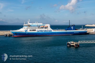
PELAGOS
Ro-Ro/Passenger Ship
Current Trip
| Time Travelled | 23 h, 24 mins |
|---|---|
| Remaining Time | 17 h, 57 mins |
| Distance Travelled | 410.27 nm |
| Remaining Distance | 325.53 nm |
| AVG Speed | 17.9 Knots |
| MAX Speed | 19.7 Knots |
| AVG Wind | 22.8 knots |
| MAX Wind | 32.9 knots |
| MIN Temp | 7.5°C / 45.5°F |
| MAX Temp | 15.1°C / 59.18°F |
| Draught | 6 m |
| Position Received | 7 h, 31 m ago |
Current Position
| Longitude | 1.81300° |
|---|---|
| Latitude | 40.10698° |
| Status | Under way sailing |
| Speed | 18 Knots |
| Course | 219.3° |
| Area | Balearic Sea |
| Station | T-AIS |
| Position Received | 7 h, 31 m ago |
Info
Information
The current position of PELAGOS is in Balearic Sea with coordinates 40.10698° / 1.81300° as reported on 2024-04-23 13:51 by AIS to our vessel tracker app. The vessel's current speed is 18 Knots and is heading at the port of TANGER MED. The estimated time of arrival as calculated by MyShipTracking vessel tracking app is 2024-04-24 15:20 LT
The vessel PELAGOS (IMO: 9136034, MMSI: 228393700) is a Ro-Ro/Passenger Ship that was built in 1997 ( 27 years old ). It's sailing under the flag of [FR] France.
In this page you can find informations about the vessels current position, last detected port calls, and current voyage information. If the vessels is not in coverage by AIS you will find the latest position.
The current position of PELAGOS is detected by our AIS receivers and we are not responsible for the reliability of the data. The last position was recorded while the vessel was in Coverage by the Ais receivers of our vessel tracking app.
The current draught of PELAGOS as reported by AIS is 6 meters
Weather
| Temperature | 15.1°C / 59.18°F |
|---|---|
| Wind Speed | 8 knots |
| Direction | 245° WSW |
| Pressure | 1016.7 hPa |
| Humidity | 60.4 % |
| Cloud Coverage | 38 % |
Featured Company
Last Port Calls
| Port | Arrival | Departure | Time In Port |
|---|---|---|---|
| 2024-04-22 16:35 | 2024-04-22 21:59 | 5 h | |
| 2024-04-20 13:14 | 2024-04-20 23:29 | 10 h | |
| 2024-04-05 11:01 | 2024-04-18 19:45 | 13 d | |
| 2024-04-03 10:59 | 2024-04-03 17:51 | 6 h | |
| 2024-04-01 11:02 | 2024-04-01 17:19 | 6 h | |
| 2024-03-30 08:25 | 2024-03-30 18:08 | 9 h | |
| 2024-03-29 05:38 | 2024-03-29 15:25 | 9 h | |
| 2024-03-27 10:13 | 2024-03-27 20:28 | 10 h | |
| 2024-03-25 09:34 | 2024-03-25 19:05 | 9 h | |
| 2024-03-22 11:32 | 2024-03-23 13:28 | 1 d |
Most Visited Ports (Last year)
| Port | Arrivals | |
|---|---|---|
| 53 | ||
| 47 | ||
| 6 | ||
| 5 | ||
| 5 | ||
| 3 |
Last Trips
| Origin | Departure | Destination | Arrival | Distance | |
|---|---|---|---|---|---|
| 2024-04-21 00:29 | 2024-04-22 18:35 | 739.75 nm | |||
| 2024-04-18 21:45 | 2024-04-20 14:14 | 718.69 nm | |||
| 2024-04-03 17:51 | 2024-04-05 13:01 | 716.06 nm | |||
| 2024-04-01 19:19 | 2024-04-03 10:59 | 712.51 nm | |||
| 2024-03-30 18:08 | 2024-04-01 13:02 | 717.12 nm | |||
| 2024-03-29 16:25 | 2024-03-30 08:25 | 279.25 nm | |||
| 2024-03-27 21:28 | 2024-03-29 06:38 | 516.84 nm | |||
| 2024-03-25 19:05 | 2024-03-27 11:13 | 714.47 nm | |||
| 2024-03-23 14:28 | 2024-03-25 09:34 | 712.18 nm | |||
| 2024-03-20 17:26 | 2024-03-22 12:32 | 716.62 nm |
Events
| Time | Event | Details | Position / Dest | Info |
|---|---|---|---|---|
| 2024-04-23 14:43 | Status Changed | Default Under way sailing |
39.90716 / 1.59629
MAPTM
|
Speed: 18 kn Course: 219.3° |
| 2024-04-23 13:51 | Detected in Sea | Spanish part of the Balearic Sea |
40.10698 / 1.81300
Balearic Sea
MAPTM
|
Speed: 18 kn Course: 219.3° |
| 2024-04-23 13:51 | IN Coverage |
40.10698 / 1.81300
Balearic Sea
MAPTM
|
Speed: 18 kn Course: 219.3° |
|
| 2024-04-23 13:51 | OUT of Coverage |
40.10698 / 1.81300
Balearic Sea
MAPTM
|
Speed: 18 kn Course: 219.3° |
|
| 2024-04-22 22:55 | Status Changed | Default Under way sailing |
43.16755 / 5.03265
MAPTM
|
Speed: 17.8 kn Course: 240° |
| 2024-04-22 22:48 | OUT of Coverage |
43.18215 / 5.07972
Mediterranean Sea - Western Basin
MAPTM
|
Speed: 17.8 kn Course: 240° |
|
| 2024-04-22 21:59 | PORT DEPARTURE |
|
43.34688 / 5.30723
MAPTM
|
Speed: 8 kn Course: 230° |
| 2024-04-22 21:49 | START Moving |
43.33914 / 5.33738
[FR] MARSEILLE
|
Speed: 5.5 kn Course: 299° |
|
| 2024-04-22 21:36 | Destination Changed | MAPTM FRMRS |
43.33918 / 5.34097
[FR] MARSEILLE
|
Speed: Course: 273° |
| 2024-04-22 21:36 | ETA Changed | 2024/04/24 13:00 2024/04/22 16:00 |
43.33918 / 5.34097
[FR] MARSEILLE
|
Speed: Course: 273° |