
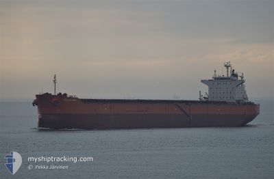
PELAGOS
Bulk Carrier
Current Trip
INKRK
| Time Travelled | 4 days |
|---|---|
| Remaining Time | --- |
| Distance Travelled | 1252.67 nm |
| Remaining Distance | --- |
| AVG Speed | 11.1 Knots |
| MAX Speed | 13.3 Knots |
| AVG Wind | 9.3 knots |
| MAX Wind | 17 knots |
| MIN Temp | 26.4°C / 79.52°F |
| MAX Temp | 29.8°C / 85.64°F |
| Draught | 14.3 m |
| Position Received | 20 d ago |
Current Position
| Longitude | 103.64938° |
|---|---|
| Latitude | 1.17892° |
| Status | Under way using engine |
| Speed | 10.5 Knots |
| Course | 286.1° |
| Area | Singapore Strait |
| Station | T-AIS |
| Position Received | 20 d ago |
Info
Information
The current position of PELAGOS is in Singapore Strait with coordinates 1.17892° / 103.64938° as reported on 2024-03-31 09:01 by AIS to our vessel tracker app. The vessel's current speed is 10.5 Knots
The vessel PELAGOS (IMO: 9375941, MMSI: 636018288) is a Bulk Carrier that was built in 2008 ( 16 years old ). It's sailing under the flag of [LR] Liberia.
In this page you can find informations about the vessels current position, last detected port calls, and current voyage information. If the vessels is not in coverage by AIS you will find the latest position.
The current position of PELAGOS is detected by our AIS receivers and we are not responsible for the reliability of the data. The last position was recorded while the vessel was in Coverage by the Ais receivers of our vessel tracking app.
The current draught of PELAGOS as reported by AIS is 14.3 meters
Weather
| Temperature | 28.6°C / 83.48°F |
|---|---|
| Wind Speed | 17 knots |
| Direction | 106° ESE |
| Pressure | 1008.4 hPa |
| Humidity | 81.8 % |
| Cloud Coverage | 23 % |
Featured Company
Last Port Calls
| Port | Arrival | Departure | Time In Port |
|---|---|---|---|
| 2024-04-13 18:33 | 2024-04-15 22:45 | 2 d | |
| 2024-02-27 07:55 | 2024-02-28 21:04 | 1 d | |
| 2024-02-18 13:35 | 2024-02-23 02:30 | 4 d |
Most Visited Ports (Last year)
| Port | Arrivals | |
|---|---|---|
| 3 | ||
| 1 | ||
| 1 | ||
| 1 | ||
| 1 | ||
| 1 |
Last Trips
| Origin | Departure | Destination | Arrival | Distance | |
|---|---|---|---|---|---|
| 2024-02-29 07:04 | 2024-04-14 00:03 | 6092.47 nm | |||
| 2024-02-23 10:30 | 2024-02-27 17:55 | 1242.77 nm | |||
| 2024-01-11 07:24 | 2024-02-18 21:35 | 8881.67 nm |
Events
| Time | Event | Details | Position / Dest | Info |
|---|---|---|---|---|
| 2024-04-15 22:45 | PORT DEPARTURE |
|
10.83833 / 79.86833
INKRK
|
Speed: 7 kn Course: -1° |
| 2024-04-15 22:39 | START Moving |
10.83833 / 79.85500
[IN] KARAIKAL
|
Speed: 6 kn Course: -1° |
|
| 2024-04-13 18:33 | STOP Moving |
10.84032 / 79.84788
[IN] KARAIKAL
|
Speed: Course: 171° |
|
| 2024-04-13 18:33 | PORT ARRIVAL |
|
10.84032 / 79.84788
[IN] KARAIKAL
|
Speed: 0.6 kn Course: 183° |
| 2024-04-13 15:06 | START Moving | 7.03 nm, East of KARAIKAL |
10.85828 / 79.97369
INKRK
|
Speed: 3.2 kn Course: 110° |
| 2024-04-12 17:12 | STOP Moving | 5.87 nm, East of KARAIKAL |
10.85833 / 79.95333
INKRK
|
Speed: Course: -1° |
| 2024-04-12 14:53 | START Moving | 6.4 nm, East of KARAIKAL |
10.85401 / 79.96367
INKRK
|
Speed: 4.3 kn Course: 78° |