
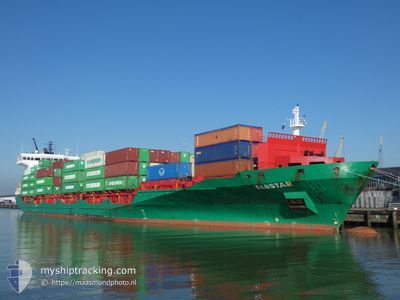
ELBSTAR
Container Ship
Current Trip
| Time Travelled | 1 day |
|---|---|
| Remaining Time | 17 h, 9 mins |
| Distance Travelled | 474.01 nm |
| Remaining Distance | 114.28 nm |
| AVG Speed | 11.2 Knots |
| MAX Speed | 15.3 Knots |
| AVG Wind | 10.4 knots |
| MAX Wind | 20 knots |
| MIN Temp | 2.4°C / 36.32°F |
| MAX Temp | 8.3°C / 46.94°F |
| Draught | 8.4 m |
| Position Received | 1 m ago |
Current Position
| Longitude | 9.79518° |
|---|---|
| Latitude | 54.36206° |
| Status | Under way using engine |
| Speed | 6.9 Knots |
| Course | 251.9° |
| Area | Baltic Sea |
| Station | T-AIS |
| Position Received | 1 m ago |
Info
Information
The current position of ELBSTAR is in Baltic Sea with coordinates 54.36206° / 9.79518° as reported on 2024-04-19 05:45 by AIS to our vessel tracker app. The vessel's current speed is 6.9 Knots and is heading at the port of BREMERHAVEN. The estimated time of arrival as calculated by MyShipTracking vessel tracking app is 2024-04-19 22:56 LT
The vessel ELBSTAR (IMO: 9387592, MMSI: 305978000) is a Container Ship that was built in 2009 ( 15 years old ). It's sailing under the flag of [AG] Antigua Barbuda.
In this page you can find informations about the vessels current position, last detected port calls, and current voyage information. If the vessels is not in coverage by AIS you will find the latest position.
The current position of ELBSTAR is detected by our AIS receivers and we are not responsible for the reliability of the data. The last position was recorded while the vessel was in Coverage by the Ais receivers of our vessel tracking app.
The current draught of ELBSTAR as reported by AIS is 8.4 meters
Weather
| Temperature | 4.2°C / 39.56°F |
|---|---|
| Wind Speed | 14 knots |
| Direction | 201° SSW |
| Pressure | 1001.4 hPa |
| Humidity | 97.6 % |
| Cloud Coverage | 100 % |
Featured Company
Last Port Calls
| Port | Arrival | Departure | Time In Port |
|---|---|---|---|
| 2024-04-16 17:46 | 2024-04-17 14:46 | 20 h | |
| 2024-04-15 11:38 | 2024-04-15 21:02 | 9 h | |
| 2024-04-12 22:32 | 2024-04-14 16:31 | 1 d | |
| 2024-04-11 12:55 | 2024-04-11 23:16 | 10 h | |
| 2024-04-10 15:10 | 2024-04-11 04:41 | 13 h | |
| 2024-04-09 01:02 | 2024-04-09 01:05 | 3 m | |
| 2024-04-07 11:57 | 2024-04-07 21:50 | 9 h | |
| 2024-04-05 23:22 | 2024-04-07 11:53 | 1 d | |
| 2024-04-05 11:28 | 2024-04-05 21:41 | 10 h | |
| 2024-04-03 20:37 | 2024-04-05 09:43 | 1 d |
Most Visited Ports (Last year)
| Port | Arrivals | |
|---|---|---|
| 39 | ||
| 35 | ||
| 14 | ||
| 12 | ||
| 10 | ||
| 9 |
Last Trips
| Origin | Departure | Destination | Arrival | Distance | |
|---|---|---|---|---|---|
| 2024-04-15 23:02 | 2024-04-16 19:46 | 260.23 nm | |||
| 2024-04-14 18:31 | 2024-04-15 13:38 | 273.59 nm | |||
| 2024-04-12 01:16 | 2024-04-13 00:32 | 308.73 nm | |||
| 2024-04-11 06:41 | 2024-04-11 14:55 | 19.05 nm | |||
| 2024-04-09 03:05 | 2024-04-10 17:10 | 347.24 nm | |||
| 2024-04-07 23:50 | 2024-04-09 03:02 | 318.51 nm | |||
| 2024-04-07 13:53 | 2024-04-07 13:57 | 0.68 nm | |||
| 2024-04-05 23:41 | 2024-04-06 01:22 | 16.92 nm | |||
| 2024-04-05 11:43 | 2024-04-05 13:28 | 16.41 nm | |||
| 2024-04-03 10:08 | 2024-04-03 22:37 | 127.07 nm |
Events
| Time | Event | Details | Position / Dest | Info |
|---|---|---|---|---|
| 2024-04-19 04:52 | START Moving | 7.27 nm, West of KIEL |
54.34175 / 9.95327
DEBRV
|
Speed: 3.2 kn Course: 255° |
| 2024-04-19 04:35 | STOP Moving | 7.15 nm, West of KIEL |
54.34220 / 9.95672
DEBRV
|
Speed: 0.3 kn Course: 258° |
| 2024-04-19 03:06 | START Moving | 1.4 nm, South West of STICKENHΟRN SPORT |
54.36658 / 10.13923
DEBRV
|
Speed: 3.1 kn Course: 282° |
| 2024-04-19 03:04 | Destination Changed | DEBRV DEBRV VIA KIEL |
54.36621 / 10.14183
DEBRV
|
Speed: 2.4 kn Course: 282° |
| 2024-04-19 02:29 | STOP Moving | 1.31 nm, South West of STICKENHΟRN SPORT |
54.36572 / 10.14470
DEBRV VIA KIEL
|
Speed: 0.3 kn Course: 283° |
| 2024-04-19 00:10 | Change Sea Area | German part of the Baltic Sea Danish part of the Baltic Sea |
54.56735 / 10.55483
Baltic Sea
DEBRV VIA KIEL
|
Speed: 11.6 kn Course: 246.1° |
| 2024-04-18 23:23 | Detected in Sea | Danish part of the Baltic Sea |
54.58947 / 10.81536
Baltic Sea
DEBRV VIA KIEL
|
Speed: 11.9 kn Course: 261.8° |
| 2024-04-18 21:59 | Change Sea Area | German part of the Baltic Sea Danish part of the Baltic Sea |
54.57105 / 11.31323
Baltic Sea
DEBRV VIA KIEL
|
Speed: 12.9 kn Course: 295.9° |
| 2024-04-18 19:35 | Change Sea Area | Danish part of the Baltic Sea German part of the Baltic Sea |
54.44166 / 12.14156
Baltic Sea
DEBRV VIA KIEL
|
Speed: 12.3 kn Course: 265.2° |
| 2024-04-18 19:17 | Change Sea Area | German part of the Baltic Sea Danish part of the Baltic Sea |
54.48355 / 12.20613
Baltic Sea
DEBRV VIA KIEL
|
Speed: 13.1 kn Course: 194.2° |