
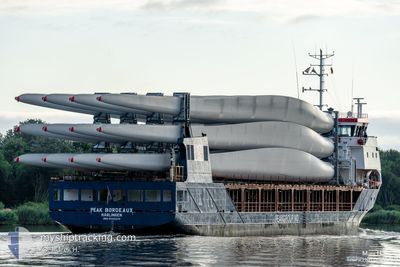
PEAK BORDEAUX
General Cargo
Current Trip
| Time Travelled | 22 h, 36 mins |
|---|---|
| Remaining Time | --- |
| Distance Travelled | 222.44 nm |
| Remaining Distance | --- |
| AVG Speed | 8.6 Knots |
| MAX Speed | 12.3 Knots |
| AVG Wind | 19 knots |
| MAX Wind | 25.6 knots |
| MIN Temp | 8.6°C / 47.48°F |
| MAX Temp | 11.4°C / 52.52°F |
| Draught | 3.9 m |
| Position Received | 4 h, 11 m ago |
Current Position
| Longitude | -5.90998° |
|---|---|
| Latitude | 51.87395° |
| Status | Under way using engine |
| Speed | 11.9 Knots |
| Course | 202° |
| Area | Celtic Sea |
| Station | T-AIS |
| Position Received | 4 h, 11 m ago |
Info
Information
The current position of PEAK BORDEAUX is in Celtic Sea with coordinates 51.87395° / -5.90998° as reported on 2024-04-19 12:08 by AIS to our vessel tracker app. The vessel's current speed is 11.9 Knots and is heading at the port of AVILES. The estimated time of arrival as calculated by MyShipTracking vessel tracking app is 2024-04-21 14:00 LT
The vessel PEAK BORDEAUX (IMO: 9545039, MMSI: 246474000) is a General Cargo that was built in 2011 ( 13 years old ). It's sailing under the flag of [NL] Netherlands.
In this page you can find informations about the vessels current position, last detected port calls, and current voyage information. If the vessels is not in coverage by AIS you will find the latest position.
The current position of PEAK BORDEAUX is detected by our AIS receivers and we are not responsible for the reliability of the data. The last position was recorded while the vessel was in Coverage by the Ais receivers of our vessel tracking app.
The current draught of PEAK BORDEAUX as reported by AIS is 3.9 meters
Weather
| Temperature | 11.4°C / 52.52°F |
|---|---|
| Wind Speed | 12 knots |
| Direction | 299° WNW |
| Pressure | 1023.1 hPa |
| Humidity | 86.6 % |
| Cloud Coverage | 44 % |
Featured Company
Last Port Calls
| Port | Arrival | Departure | Time In Port |
|---|---|---|---|
| 2024-04-18 17:08 | 2024-04-18 17:44 | 36 m | |
| 2024-04-17 20:48 | 2024-04-18 16:44 | 19 h | |
| 2024-04-17 19:37 | 2024-04-17 20:19 | 42 m | |
| 2024-04-16 07:04 | 2024-04-16 18:29 | 11 h | |
| 2024-04-10 07:27 | 2024-04-11 14:37 | 1 d | |
| 2024-04-07 10:42 | 2024-04-08 16:33 | 1 d | |
| 2024-04-01 06:22 | 2024-04-01 12:28 | 6 h | |
| 2024-03-20 07:46 | 2024-03-23 14:57 | 3 d | |
| 2024-03-18 18:14 | 2024-03-18 22:40 | 4 h | |
| 2024-03-10 08:31 | 2024-03-12 13:57 | 2 d |
Last Trips
| Origin | Departure | Destination | Arrival | Distance | |
|---|---|---|---|---|---|
| 2024-04-18 17:44 | 2024-04-18 18:08 | 1.93 nm | |||
| 2024-04-17 21:19 | 2024-04-17 21:48 | 1.89 nm | |||
| 2024-04-16 19:29 | 2024-04-17 20:37 | 227.98 nm | |||
| 2024-04-11 16:37 | 2024-04-16 08:04 | 893.82 nm | |||
| 2024-04-08 18:33 | 2024-04-10 09:27 | 358.59 nm | |||
| 2024-04-01 14:28 | 2024-04-07 12:42 | 1400.43 nm | |||
| 2024-03-23 17:57 | 2024-04-01 08:22 | 1684.18 nm | |||
| 2024-03-19 01:40 | 2024-03-20 10:46 | 331.12 nm | |||
| 2024-03-12 14:57 | 2024-03-18 21:14 | 1474.71 nm | |||
| 2024-03-04 17:07 | 2024-03-10 09:31 | 1170.38 nm |
Events
| Time | Event | Details | Position / Dest | Info |
|---|---|---|---|---|
| 2024-04-19 12:08 | OUT of Coverage |
51.87395 / -5.90998
Celtic Sea
ESAVS
|
Speed: 11.9 kn Course: 202° |
|
| 2024-04-19 11:49 | Detected in Sea | United Kingdom part of the Celtic Sea |
51.93225 / -5.87142
Celtic Sea
ESAVS
|
Speed: 11.9 kn Course: 202° |
| 2024-04-19 11:47 | Status Changed | Under way using engine Default |
51.93840 / -5.86738
ESAVS
|
Speed: 12.3 kn Course: 202° |
| 2024-04-19 11:29 | Status Changed | Default Under way using engine |
51.99520 / -5.82930
ESAVS
|
Speed: 12 kn Course: 201° |
| 2024-04-19 10:47 | Status Changed | Under way using engine Default |
52.12907 / -5.73835
ESAVS
|
Speed: 12 kn Course: 203° |
| 2024-04-19 10:35 | Status Changed | Default Under way using engine |
52.16392 / -5.71327
ESAVS
|
Speed: 12 kn Course: 204° |
| 2024-04-19 10:04 | Status Changed | Under way using engine Default |
52.25958 / -5.64605
ESAVS
|
Speed: 11.2 kn Course: 203° |
| 2024-04-19 10:04 | IN Coverage |
52.25958 / -5.64605
Irish Sea and St. George's Channel
ESAVS
|
Speed: 11.4 kn Course: 203° |
|
| 2024-04-19 07:46 | OUT of Coverage |
52.64168 / -5.40597
Irish Sea and St. George's Channel
ESAVS
|
Speed: 9.8 kn Course: 197° |
|
| 2024-04-19 06:12 | Status Changed | Under way using engine Default |
52.87375 / -5.27555
ESAVS
|
Speed: 9.1 kn Course: 197° |