
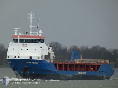
PEAK BELFAST
General Cargo
Current Trip
| Time Travelled | 15 h, 5 mins |
|---|---|
| Remaining Time | --- |
| Distance Travelled | 135.18 nm |
| Remaining Distance | --- |
| AVG Speed | 10 Knots |
| MAX Speed | 12.9 Knots |
| AVG Wind | 7.8 knots |
| MAX Wind | 15 knots |
| MIN Temp | 3.4°C / 38.12°F |
| MAX Temp | 8.4°C / 47.12°F |
| Draught | 3.8 m |
| Position Received | 1 h, 45 m ago |
Current Position
| Longitude | 4.81913° |
|---|---|
| Latitude | 53.59975° |
| Status | Under way using engine |
| Speed | 9.9 Knots |
| Course | 22° |
| Area | North Sea |
| Station | T-AIS |
| Position Received | 1 h, 45 m ago |
Info
Information
The current position of PEAK BELFAST is in North Sea with coordinates 53.59975° / 4.81913° as reported on 2024-04-18 10:28 by AIS to our vessel tracker app. The vessel's current speed is 9.9 Knots and is heading at the port of LYSOYSUND. The estimated time of arrival as calculated by MyShipTracking vessel tracking app is 2024-04-21 08:00 LT
The vessel PEAK BELFAST (IMO: 9544891, MMSI: 246403000) is a General Cargo that was built in 2010 ( 14 years old ). It's sailing under the flag of [NL] Netherlands.
In this page you can find informations about the vessels current position, last detected port calls, and current voyage information. If the vessels is not in coverage by AIS you will find the latest position.
The current position of PEAK BELFAST is detected by our AIS receivers and we are not responsible for the reliability of the data. The last position was recorded while the vessel was in Coverage by the Ais receivers of our vessel tracking app.
The current draught of PEAK BELFAST as reported by AIS is 3.8 meters
Weather
| Temperature | 7.3°C / 45.14°F |
|---|---|
| Wind Speed | 12 knots |
| Direction | 314° NW |
| Pressure | 1019.9 hPa |
| Humidity | 65.2 % |
| Cloud Coverage | 72 % |
Featured Company
Last Port Calls
| Port | Arrival | Departure | Time In Port |
|---|---|---|---|
| 2024-04-17 20:55 | 2024-04-17 21:08 | 13 m | |
| 2024-04-16 18:09 | 2024-04-17 19:23 | 1 d | |
| 2024-04-16 16:21 | 2024-04-16 17:03 | 41 m | |
| 2024-03-28 17:44 | 2024-04-16 16:19 | 18 d | |
| 2024-03-28 17:35 | 2024-03-28 17:44 | 9 m | |
| 2024-03-28 15:47 | 2024-03-28 17:34 | 1 h | |
| 2024-03-27 10:45 | 2024-03-28 12:56 | 1 d | |
| 2024-03-23 07:35 | 2024-03-25 17:49 | 2 d | |
| 2024-03-22 18:24 | 2024-03-22 19:06 | 41 m | |
| 2024-03-20 09:05 | 2024-03-22 08:50 | 1 d |
Last Trips
| Origin | Departure | Destination | Arrival | Distance | |
|---|---|---|---|---|---|
| 2024-04-17 21:23 | 2024-04-17 22:55 | 7.06 nm | |||
| 2024-04-16 19:03 | 2024-04-16 20:09 | 5.66 nm | |||
| 2024-04-16 18:19 | 2024-04-16 18:21 | 0.05 nm | |||
| 2024-03-28 18:34 | 2024-03-28 18:44 | 0.53 nm | |||
| 2024-03-28 18:34 | 2024-03-28 18:35 | 0.04 nm | |||
| 2024-03-28 13:56 | 2024-03-28 16:47 | 24.45 nm | |||
| 2024-03-25 18:49 | 2024-03-27 11:45 | 324.05 nm | |||
| 2024-03-22 20:06 | 2024-03-23 08:35 | 88.22 nm | |||
| 2024-03-22 09:50 | 2024-03-22 19:24 | 83.57 nm | |||
| 2024-03-17 13:23 | 2024-03-20 10:05 | 728.05 nm |
Events
| Time | Event | Details | Position / Dest | Info |
|---|---|---|---|---|
| 2024-04-18 10:38 | Status Changed | Default Under way using engine |
53.62685 / 4.83770
LYSOYSUND
|
Speed: 9.9 kn Course: 22° |
| 2024-04-18 10:28 | OUT of Coverage |
53.59975 / 4.81913
North Sea
LYSOYSUND
|
Speed: 9.9 kn Course: 22° |
|
| 2024-04-18 09:49 | IN Coverage |
53.50057 / 4.76178
North Sea
LYSOYSUND
|
Speed: 9.9 kn Course: 11° |
|
| 2024-04-18 07:49 | Status Changed | Default Under way using engine |
53.20603 / 4.55537
LYSOYSUND
|
Speed: 9.4 kn Course: 29° |
| 2024-04-18 07:38 | OUT of Coverage |
53.18183 / 4.53420
North Sea
LYSOYSUND
|
Speed: 9.4 kn Course: 29° |
|
| 2024-04-18 06:49 | IN Coverage |
53.07360 / 4.42660
North Sea
LYSOYSUND
|
Speed: 9.4 kn Course: 29° |
|
| 2024-04-18 05:47 | OUT of Coverage |
52.92553 / 4.31068
North Sea
LYSOYSUND
|
Speed: 9.4 kn Course: 23° |
|
| 2024-04-18 04:26 | Status Changed | Under way using engine Default |
52.73827 / 4.13065
LYSOYSUND
|
Speed: 9.7 kn Course: 33° |
| 2024-04-18 04:02 | Status Changed | Default Under way using engine |
52.68118 / 4.06733
LYSOYSUND
|
Speed: 9.7 kn Course: 33° |
| 2024-04-17 21:08 | PORT DEPARTURE |
|
51.80160 / 4.62997
LYSOYSUND
|
Speed: 8.6 kn Course: 251° |