
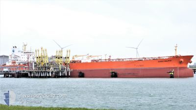
EAGLE HALIFAX
Crude Oil Tanker
Current Trip
| Time Travelled | 7 days |
|---|---|
| Remaining Time | --- |
| Distance Travelled | 1176.00 nm |
| Remaining Distance | 39.40 nm |
| AVG Speed | 11 Knots |
| MAX Speed | 17 Knots |
| AVG Wind | 8 knots |
| MAX Wind | 18.7 knots |
| MIN Temp | 10.1°C / 50.18°F |
| MAX Temp | 25°C / 77°F |
| Draught | 8.5 m |
| Position Received | 1 m ago |
Current Position
| Longitude | -94.44041° |
|---|---|
| Latitude | 29.18773° |
| Status | Under way using engine |
| Speed | 7.5 Knots |
| Course | 304.2° |
| Area | Gulf of Mexico |
| Station | T-AIS |
| Position Received | 1 m ago |
Info
Information
The current position of EAGLE HALIFAX is in Gulf of Mexico with coordinates 29.18773° / -94.44041° as reported on 2024-04-24 22:06 by AIS to our vessel tracker app. The vessel's current speed is 7.5 Knots and is heading at the port of HOUSTON. The estimated time of arrival as calculated by MyShipTracking vessel tracking app is 2024-04-25 00:30 LT
The vessel EAGLE HALIFAX (IMO: 9453987, MMSI: 235076282) is a Crude Oil Tanker that was built in 2010 ( 14 years old ). It's sailing under the flag of [GB] United Kingdom.
In this page you can find informations about the vessels current position, last detected port calls, and current voyage information. If the vessels is not in coverage by AIS you will find the latest position.
The current position of EAGLE HALIFAX is detected by our AIS receivers and we are not responsible for the reliability of the data. The last position was recorded while the vessel was in Coverage by the Ais receivers of our vessel tracking app.
The current draught of EAGLE HALIFAX as reported by AIS is 8.5 meters
Weather
| Temperature | 22.4°C / 72.32°F |
|---|---|
| Wind Speed | 12 knots |
| Direction | 119° ESE |
| Pressure | 1017.7 hPa |
| Humidity | 81.2 % |
| Cloud Coverage | --- |
Featured Company
Last Port Calls
| Port | Arrival | Departure | Time In Port |
|---|---|---|---|
| 2024-04-17 15:19 | 2024-04-17 16:16 | 57 m | |
| 2024-04-15 22:28 | 2024-04-17 12:40 | 1 d | |
| 2024-04-08 16:09 | 2024-04-10 17:23 | 2 d | |
| 2024-03-30 16:07 | 2024-04-01 06:55 | 1 d | |
| 2024-03-21 04:09 | 2024-03-22 10:32 | 1 d | |
| 2024-03-07 21:54 | 2024-03-07 22:38 | 43 m | |
| 2024-02-29 02:19 | 2024-03-01 14:04 | 1 d | |
| 2024-02-25 22:08 | 2024-02-27 18:23 | 1 d | |
| 2024-02-01 22:49 | 2024-02-03 13:11 | 1 d |
Most Visited Ports (Last year)
| Port | Arrivals | |
|---|---|---|
| 8 | ||
| 5 | ||
| 4 | ||
| 2 | ||
| 2 | ||
| 2 |
Last Trips
| Origin | Departure | Destination | Arrival | Distance | |
|---|---|---|---|---|---|
| 2024-04-17 07:40 | 2024-04-17 10:19 | 19.23 nm | |||
| 2024-04-10 12:23 | 2024-04-15 17:28 | 257.85 nm | |||
| 2024-04-01 01:55 | 2024-04-08 11:09 | 628.83 nm | |||
| 2024-03-22 06:32 | 2024-03-30 11:07 | 1923.46 nm | |||
| 2024-03-07 16:38 | 2024-03-21 00:09 | 2153.99 nm | |||
| 2024-03-01 08:04 | 2024-03-07 15:54 | 296.46 nm | |||
| 2024-02-27 12:23 | 2024-02-28 20:19 | 166.54 nm | |||
| 2024-02-03 07:11 | 2024-02-25 16:08 | 905.22 nm | |||
| 2024-01-29 12:45 | 2024-02-01 16:49 | 99.60 nm |
Events
| Time | Event | Details | Position / Dest | Info |
|---|---|---|---|---|
| 2024-04-24 21:26 | Draught Changed | 8.5 8.8 |
29.12731 / -94.41297
HOUSTON
|
Speed: 7.3 kn Course: 17.9° |
| 2024-04-24 21:26 | Destination Changed | HOUSTON GOLA |
29.12731 / -94.41297
HOUSTON
|
Speed: 7.3 kn Course: 17.9° |
| 2024-04-24 21:26 | ETA Changed | 2024/04/25 00:30 2024/04/24 20:00 |
29.12731 / -94.41297
HOUSTON
|
Speed: 7.3 kn Course: 17.9° |
| 2024-04-24 21:07 | Status Changed | Under way using engine Default |
29.08016 / -94.42026
GOLA
|
Speed: 10 kn Course: 358° |
| 2024-04-24 20:42 | Status Changed | Default Under way using engine |
29.01074 / -94.41908
GOLA
|
Speed: 10.2 kn Course: 358.8° |
| 2024-04-24 20:37 | Status Changed | Under way using engine Default |
28.99692 / -94.41875
GOLA
|
Speed: 10.2 kn Course: 358° |
| 2024-04-24 20:30 | IN Coverage |
28.99692 / -94.41875
Gulf of Mexico
GOLA
|
Speed: 10.2 kn Course: 358.8° |
|
| 2024-04-23 13:14 | Status Changed | Default Under way using engine |
29.73841 / -90.00294
GOLA
|
Speed: 14.6 kn Course: 150.2° |
| 2024-04-23 13:09 | OUT of Coverage |
29.75293 / -90.02285
Gulf of Mexico
GOLA
|
Speed: 14.6 kn Course: 150.2° |
|
| 2024-04-23 10:50 | Draught Changed | 8.8 10.6 |
29.94652 / -90.13984
GOLA
|
Speed: 11.4 kn Course: 170.7° |