
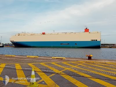
PARADISE ACE
Vehicles Carrier
Current Trip
| Time Travelled | 6 days |
|---|---|
| Remaining Time | 9 h, 30 mins |
| Distance Travelled | 2756.19 nm |
| Remaining Distance | 194.69 nm |
| AVG Speed | 15.7 Knots |
| MAX Speed | 22.3 Knots |
| AVG Wind | 16.5 knots |
| MAX Wind | 38 knots |
| MIN Temp | 3.8°C / 38.84°F |
| MAX Temp | 21.2°C / 70.16°F |
| Draught | 8.9 m |
| Position Received | 5 d ago |
Current Position
| Longitude | -57.84909° |
|---|---|
| Latitude | -39.37173° |
| Status | Under way using engine |
| Speed | 17 Knots |
| Course | 220.5° |
| Area | South Atlantic Ocean |
| Station | T-AIS |
| Position Received | 5 d ago |
Info
Information
The current position of PARADISE ACE is in South Atlantic Ocean with coordinates -39.37173° / -57.84909° as reported on 2024-04-19 22:21 by AIS to our vessel tracker app. The vessel's current speed is 17 Knots and is heading at the port of SAN ANTONIO. The estimated time of arrival as calculated by MyShipTracking vessel tracking app is 2024-04-25 20:42 LT
The vessel PARADISE ACE (IMO: 9293648, MMSI: 352142000) is a Vehicles Carrier that was built in 2004 ( 20 years old ). It's sailing under the flag of [PA] Panama.
In this page you can find informations about the vessels current position, last detected port calls, and current voyage information. If the vessels is not in coverage by AIS you will find the latest position.
The current position of PARADISE ACE is detected by our AIS receivers and we are not responsible for the reliability of the data. The last position was recorded while the vessel was in Coverage by the Ais receivers of our vessel tracking app.
The current draught of PARADISE ACE as reported by AIS is 8.9 meters
Weather
| Temperature | 12.8°C / 55.04°F |
|---|---|
| Wind Speed | 10 knots |
| Direction | 13° NNE |
| Pressure | 1016.8 hPa |
| Humidity | 93 % |
| Cloud Coverage | 90 % |
Featured Company
Last Port Calls
| Port | Arrival | Departure | Time In Port |
|---|---|---|---|
| 2024-04-16 09:44 | 2024-04-18 12:18 | 2 d | |
| 2024-04-12 10:48 | 2024-04-13 09:39 | 22 h | |
| 2024-03-31 15:36 | 2024-04-01 15:30 | 23 h | |
| 2024-03-27 23:42 | 2024-03-28 15:06 | 15 h | |
| 2024-03-22 05:30 | 2024-03-23 05:31 | 1 d | |
| 2024-03-20 15:28 | 2024-03-21 16:37 | 1 d | |
| 2024-03-20 14:21 | 2024-03-20 15:21 | 1 h | |
| 2024-03-17 22:48 | 2024-03-19 05:00 | 1 d | |
| 2024-02-20 05:43 | 2024-02-20 09:50 | 4 h | |
| 2024-02-12 21:38 | 2024-02-13 06:59 | 9 h |
Most Visited Ports (Last year)
| Port | Arrivals | |
|---|---|---|
| 5 | ||
| 5 | ||
| 4 | ||
| 4 | ||
| 4 | ||
| 3 |
Last Trips
| Origin | Departure | Destination | Arrival | Distance | |
|---|---|---|---|---|---|
| 2024-04-13 06:39 | 2024-04-16 06:44 | 1056.43 nm | |||
| 2024-04-01 16:30 | 2024-04-12 07:48 | 4485.09 nm | |||
| 2024-03-28 16:06 | 2024-03-31 16:36 | 850.75 nm | |||
| 2024-03-23 06:31 | 2024-03-28 00:42 | 1954.30 nm | |||
| 2024-03-21 17:37 | 2024-03-22 06:30 | 122.33 nm | |||
| 2024-03-20 16:21 | 2024-03-20 16:28 | 0.24 nm | |||
| 2024-03-19 06:00 | 2024-03-20 15:21 | 119.48 nm | |||
| 2024-02-20 17:50 | 2024-03-17 23:48 | 11865.25 nm | |||
| 2024-02-13 15:59 | 2024-02-20 13:43 | 3007.70 nm | |||
| 2024-02-11 17:03 | 2024-02-13 06:38 | 638.36 nm |
Events
| Time | Event | Details | Position / Dest | Info |
|---|---|---|---|---|
| 2024-04-19 22:24 | Status Changed | Default Under way using engine |
-39.38500 / -57.86333
CL SAI
|
Speed: 17 kn Course: 220.5° |
| 2024-04-19 22:21 | OUT of Coverage |
-39.37173 / -57.84909
South Atlantic Ocean
CL SAI
|
Speed: 17 kn Course: 220.5° |
|
| 2024-04-19 17:55 | ETA Changed | 2024/04/26 08:00 2024/04/25 11:00 |
-38.35999 / -56.86983
CL SAI
|
Speed: 17.7 kn Course: 211.1° |
| 2024-04-19 16:43 | Change Sea Area | Argentinean part of the South Atlantic Ocean Argentinean part of the Rio de La Plata |
-38.06397 / -56.63073
South Atlantic Ocean
CL SAI
|
Speed: 18.4 kn Course: 213.8° |
| 2024-04-19 16:43 | Status Changed | Under way using engine Default |
-38.06397 / -56.63073
CL SAI
|
Speed: 17 kn Course: 215° |
| 2024-04-19 16:27 | IN Coverage |
-38.06397 / -56.63073
South Atlantic Ocean
CL SAI
|
Speed: 18.4 kn Course: 213.8° |
|
| 2024-04-18 17:36 | Status Changed | Default Under way using engine |
-34.61500 / -58.21167
CL SAI
|
Speed: 10.4 kn Course: 112° |
| 2024-04-18 17:30 | OUT of Coverage |
-34.61263 / -58.23432
Rio de La Plata
CL SAI
|
Speed: 10.4 kn Course: 112° |
|
| 2024-04-18 14:14 | Status Changed | Under way using engine Default |
-34.24161 / -58.74793
CL SAI
|
Speed: 8.7 kn Course: 104° |
| 2024-04-18 13:27 | Status Changed | Default Under way using engine |
-34.18014 / -58.88284
CL SAI
|
Speed: 9 kn Course: 158.2° |