
PANORAMA
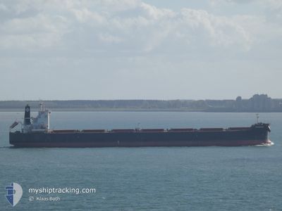
Bulk Carrier
Current Trip
| Time Travelled | 33 days |
|---|---|
| Remaining Time | 5 days |
| Distance Travelled | 9576.69 nm |
| Remaining Distance | 1559.97 nm |
| AVG Speed | 11.9 Knots |
| MAX Speed | 15.4 Knots |
| AVG Wind | 13.6 knots |
| MAX Wind | 31.8 knots |
| MIN Temp | 16.6°C / 61.88°F |
| MAX Temp | 30.1°C / 86.18°F |
| Draught | 7.2 m |
| Position Received | 8 d ago |
Current Position
| Longitude | 17.60846° |
|---|---|
| Latitude | -34.62879° |
| Status | Under way using engine |
| Speed | 12.7 Knots |
| Course | 279.3° |
| Area | South Atlantic Ocean |
| Station | T-AIS |
| Position Received | 8 d ago |
Info
Information
The current position of PANORAMA is in South Atlantic Ocean with coordinates -34.62879° / 17.60846° as reported on 2024-04-11 19:52 by AIS to our vessel tracker app. The vessel's current speed is 12.7 Knots and is heading at the port of SANTOS. The estimated time of arrival as calculated by MyShipTracking vessel tracking app is 2024-04-25 16:59 LT
The vessel PANORAMA (IMO: 9597771, MMSI: 538004139) is a Bulk Carrier that was built in 2012 ( 12 years old ). It's sailing under the flag of [MH] Marshall Is.
In this page you can find informations about the vessels current position, last detected port calls, and current voyage information. If the vessels is not in coverage by AIS you will find the latest position.
The current position of PANORAMA is detected by our AIS receivers and we are not responsible for the reliability of the data. The last position was recorded while the vessel was in Coverage by the Ais receivers of our vessel tracking app.
The current draught of PANORAMA as reported by AIS is 7.2 meters
Weather
| Temperature | 27.8°C / 82.04°F |
|---|---|
| Wind Speed | 12 knots |
| Direction | 100° E |
| Pressure | 1014.1 hPa |
| Humidity | 75.2 % |
| Cloud Coverage | 100 % |
Featured Company
Most Visited Ports (Last year)
| Port | Arrivals | |
|---|---|---|
| 2 | ||
| 2 | ||
| 2 | ||
| 1 | ||
| 1 | ||
| 1 |
Events
| Time | Event | Details | Position / Dest | Info |
|---|---|---|---|---|
| 2024-04-11 19:56 | Status Changed | Default Under way using engine |
-34.62709 / 17.59049
SANTOS
|
Speed: 12.7 kn Course: 279.3° |
| 2024-04-11 19:52 | OUT of Coverage |
-34.62879 / 17.60846
South Atlantic Ocean
SANTOS
|
Speed: 12.7 kn Course: 279.3° |
|
| 2024-04-11 19:44 | Status Changed | Under way using engine Default |
-34.63233 / 17.64266
SANTOS
|
Speed: 12.8 kn Course: 278° |
| 2024-04-11 19:38 | Status Changed | Default Under way using engine |
-34.63486 / 17.66817
SANTOS
|
Speed: 13 kn Course: 276.6° |
| 2024-04-11 18:52 | Status Changed | Under way using engine Default |
-34.64538 / 17.86753
SANTOS
|
Speed: 13.5 kn Course: 275° |
| 2024-04-11 18:43 | Status Changed | Default Under way using engine |
-34.64955 / 17.91089
SANTOS
|
Speed: 13.5 kn Course: 277.9° |
| 2024-04-11 16:02 | Status Changed | Under way using engine Default |
-34.76047 / 18.63384
SANTOS
|
Speed: 14.7 kn Course: 273° |
| 2024-04-11 15:59 | Status Changed | Default Under way using engine |
-34.76268 / 18.64736
SANTOS
|
Speed: 14.7 kn Course: 289.9° |
| 2024-04-11 15:42 | Status Changed | Under way using engine Default |
-34.77515 / 18.72932
SANTOS
|
Speed: 14.5 kn Course: 277° |
| 2024-04-11 15:36 | Status Changed | Default Under way using engine |
-34.77886 / 18.75459
SANTOS
|
Speed: 13.9 kn Course: 284.1° |