
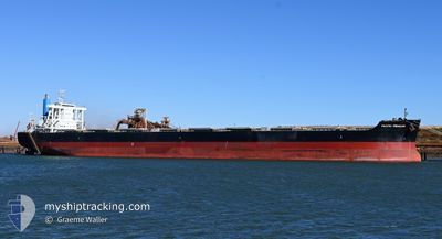
PACIFIC TREASURE
Cargo
Current Trip
| Time Travelled | 20 h, 15 mins |
|---|---|
| Remaining Time | 13 h, 12 mins |
| Distance Travelled | 271.93 nm |
| Remaining Distance | 196.29 nm |
| AVG Speed | 13.6 Knots |
| MAX Speed | 15.5 Knots |
| AVG Wind | 13.9 knots |
| MAX Wind | 18.1 knots |
| MIN Temp | 11.2°C / 52.16°F |
| MAX Temp | 14°C / 57.2°F |
| Draught | 18.2 m |
| Position Received | 16 h, 34 m ago |
Current Position
| Longitude | 118.79640° |
|---|---|
| Latitude | 38.77628° |
| Status | Under way using engine |
| Speed | 13.1 Knots |
| Course | 102.2° |
| Area | Yellow Sea |
| Station | T-AIS |
| Position Received | 16 h, 34 m ago |
Info
Information
The current position of PACIFIC TREASURE is in Yellow Sea with coordinates 38.77628° / 118.79640° as reported on 2024-04-25 04:08 by AIS to our vessel tracker app. The vessel's current speed is 13.1 Knots and is heading at the port of QINGDAO. The estimated time of arrival as calculated by MyShipTracking vessel tracking app is 2024-04-26 09:55 LT
The vessel PACIFIC TREASURE (IMO: 9604988, MMSI: 357952000) is a Cargo It's sailing under the flag of [PA] Panama.
In this page you can find informations about the vessels current position, last detected port calls, and current voyage information. If the vessels is not in coverage by AIS you will find the latest position.
The current position of PACIFIC TREASURE is detected by our AIS receivers and we are not responsible for the reliability of the data. The last position was recorded while the vessel was in Coverage by the Ais receivers of our vessel tracking app.
The current draught of PACIFIC TREASURE as reported by AIS is 18.2 meters
Weather
| Temperature | 11.4°C / 52.52°F |
|---|---|
| Wind Speed | 11 knots |
| Direction | 181° S |
| Pressure | 1008.8 hPa |
| Humidity | 88.5 % |
| Cloud Coverage | 12 % |
Featured Company
Last Port Calls
| Port | Arrival | Departure | Time In Port |
|---|---|---|---|
| 2024-04-22 09:28 | 2024-04-25 00:28 | 2 d | |
| 2024-04-06 11:00 | 2024-04-08 00:48 | 1 d | |
| 2024-03-08 18:58 | 2024-03-10 13:07 | 1 d | |
| 2024-02-16 11:23 | 2024-02-18 19:07 | 2 d |
Most Visited Ports (Last year)
| Port | Arrivals | |
|---|---|---|
| 10 | ||
| 2 | ||
| 1 | ||
| 1 | ||
| 1 | ||
| 1 |
Last Trips
| Origin | Departure | Destination | Arrival | Distance | |
|---|---|---|---|---|---|
| 2024-04-08 08:48 | 2024-04-22 17:28 | 3960.81 nm | |||
| 2024-03-10 21:07 | 2024-04-06 19:00 | 5799.87 nm | |||
| 2024-02-19 03:07 | 2024-03-09 02:58 | 4161.43 nm | |||
| 2024-01-31 11:57 | 2024-02-16 19:23 | 3932.91 nm |
Events
| Time | Event | Details | Position / Dest | Info |
|---|---|---|---|---|
| 2024-04-25 04:16 | Status Changed | Default Under way using engine |
38.77073 / 118.83172
CN QDG
|
Speed: 13.1 kn Course: 102.2° |
| 2024-04-25 04:08 | OUT of Coverage |
38.77628 / 118.79640
Yellow Sea
|
Speed: 13.1 kn Course: 102.2° |
|
| 2024-04-25 03:35 | Change Sea Area | Chinese part of the Yellow Sea Australian part of the Indian Ocean |
38.79845 / 118.64296
Yellow Sea
|
Speed: 13.2 kn Course: 99° |
| 2024-04-25 03:34 | Status Changed | Under way using engine Default |
38.79879 / 118.64031
CN QDG
|
Speed: 13.4 kn Course: 102° |
| 2024-04-25 03:28 | IN Coverage |
38.79845 / 118.64296
Yellow Sea
|
Speed: 13.2 kn Course: 99° |
|
| 2024-04-25 00:28 | PORT DEPARTURE |
|
38.95772 / 117.87897
CN QDG
|
Speed: 7.5 kn Course: 103° |
| 2024-04-25 00:00 | START Moving |
38.96870 / 117.80141
[CN] TIANJIN
|
Speed: 3.4 kn Course: 102° |
|
| 2024-04-22 09:28 | STOP Moving |
38.96598 / 117.79843
[CN] TIANJIN
|
Speed: 0.3 kn Course: 281° |
|
| 2024-04-22 09:28 | PORT ARRIVAL |
|
38.96598 / 117.79843
[CN] TIANJIN
|
Speed: 0.7 kn Course: 276° |