
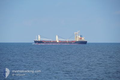
PACIFIC HORSE
Cargo
Current Trip
| Trip Time | 13 days |
|---|---|
| Trip Distance | 785.87 nm |
| AVG Speed | 5.6 Knots |
| MAX Speed | 5.6 Knots |
| Draught | 3.5 m |
| AVG Wind | 11.9 knots |
| MAX Wind | 33.8 knots |
| MIN Temp | 9.5°C / 49.1°F |
| MAX Temp | 20.5°C / 68.9°F |
| Position Received | 7 h, 25 m ago |
Current Position
| Longitude | 136.85506° |
|---|---|
| Latitude | 35.03432° |
| Status | Under way using engine |
| Speed | 7.6 Knots |
| Course | 31° |
| Area | Philippine Sea |
| Station | T-AIS |
| Position Received | 7 h, 25 m ago |
Info
Information
The current position of PACIFIC HORSE is in Philippine Sea with coordinates 35.03432° / 136.85506° as reported on 2024-04-24 04:03 by AIS to our vessel tracker app. The vessel's current speed is 7.6 Knots and is currently inside the port of NAGOYA.
The vessel PACIFIC HORSE (IMO: 9694878, MMSI: 371054000) is a Cargo It's sailing under the flag of [PA] Panama.
In this page you can find informations about the vessels current position, last detected port calls, and current voyage information. If the vessels is not in coverage by AIS you will find the latest position.
The current position of PACIFIC HORSE is detected by our AIS receivers and we are not responsible for the reliability of the data. The last position was recorded while the vessel was in Coverage by the Ais receivers of our vessel tracking app.
The current draught of PACIFIC HORSE as reported by AIS is 3.5 meters
Weather
| Temperature | 16.3°C / 61.34°F |
|---|---|
| Wind Speed | 5 knots |
| Direction | 317° NW |
| Pressure | 1007.7 hPa |
| Humidity | 91.3 % |
| Cloud Coverage | 100 % |
Featured Company
Last Trips
| Origin | Departure | Destination | Arrival | Distance | |
|---|---|---|---|---|---|
| 2024-04-10 14:25 | 2024-04-24 12:47 | 785.87 nm | |||
| 2024-02-25 20:31 | 2024-04-05 07:29 | 4500.07 nm | |||
| 2024-02-24 01:19 | 2024-02-24 02:22 | 5.30 nm | |||
| 2024-02-16 11:39 | 2024-02-23 18:42 | 1325.95 nm | |||
| 2024-01-15 13:39 | 2024-02-14 14:10 | 488.87 nm |
Events
| Time | Event | Details | Position / Dest | Info |
|---|---|---|---|---|
| 2024-04-24 04:43 | STOP Moving |
35.04237 / 136.88060
[JP] NAGOYA
|
Speed: 0.1 kn Course: 87° |
|
| 2024-04-24 04:08 | Status Changed | Default Under way using engine |
35.04219 / 136.86220
[JP] NAGOYA
|
Speed: 7.6 kn Course: 31° |
| 2024-04-24 04:03 | OUT of Coverage |
35.03432 / 136.85506
Philippine Sea
[JP] NAGOYA
|
Speed: 7.6 kn Course: 33.2° |
|
| 2024-04-24 03:47 | PORT ARRIVAL |
|
35.00494 / 136.83014
[JP] NAGOYA
|
Speed: 9.5 kn Course: 28° |
| 2024-04-24 03:40 | Status Changed | Under way using engine Default |
34.98747 / 136.81768
JP NGO
|
Speed: 9.3 kn Course: 29° |
| 2024-04-24 03:36 | Status Changed | Default Under way using engine |
34.97960 / 136.81239
JP NGO
|
Speed: 9.1 kn Course: 48.5° |
| 2024-04-24 03:26 | Status Changed | Under way using engine Default |
34.96377 / 136.78815
JP NGO
|
Speed: 9.8 kn Course: 89° |
| 2024-04-24 03:24 | IN Coverage |
34.96512 / 136.79549
Philippine Sea
|
Speed: 9.4 kn Course: 69.7° |
|
| 2024-04-24 03:12 | START Moving | 3.55 nm, East of YOKKAICHI |
34.96283 / 136.74525
JP NGO
|
Speed: 7.1 kn Course: 88° |
| 2024-04-22 16:02 | OUT of Coverage |
34.96527 / 136.74212
Philippine Sea
|
Speed: 0.1 kn Course: 252.6° |