
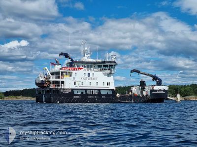
OV RYVINGEN
Anti-pollution equipment
Current Trip
| Trip Time | 10 h, 29 mins |
|---|---|
| Trip Distance | 10.31 nm |
| AVG Speed | 6.2 Knots |
| MAX Speed | 9.9 Knots |
| Draught | 4 m |
| AVG Wind | 7.6 knots |
| MAX Wind | 8.9 knots |
| MIN Temp | 3.3°C / 37.94°F |
| MAX Temp | 7.3°C / 45.14°F |
| Position Received | 1 m ago |
Current Position
| Longitude | 7.97177° |
|---|---|
| Latitude | 58.11458° |
| Status | Moored |
| Speed | |
| Course | 152° |
| Area | Skaggerak |
| Station | T-AIS |
| Position Received | 1 m ago |
Info
Information
The current position of OV RYVINGEN is in Skaggerak with coordinates 58.11458° / 7.97177° as reported on 2024-04-25 18:50 by AIS to our vessel tracker app. The vessel's current speed is 0 Knots and is currently inside the port of KRISTIANSAND.
The vessel OV RYVINGEN (IMO: 9824344, MMSI: 257056880) is a Anti-pollution equipment It's sailing under the flag of [NO] Norway.
In this page you can find informations about the vessels current position, last detected port calls, and current voyage information. If the vessels is not in coverage by AIS you will find the latest position.
The current position of OV RYVINGEN is detected by our AIS receivers and we are not responsible for the reliability of the data. The last position was recorded while the vessel was in Coverage by the Ais receivers of our vessel tracking app.
The current draught of OV RYVINGEN as reported by AIS is 4 meters
Weather
| Temperature | 6.9°C / 44.42°F |
|---|---|
| Wind Speed | 13 knots |
| Direction | 70° ENE |
| Pressure | 1004.6 hPa |
| Humidity | 67.4 % |
| Cloud Coverage | 57 % |
Featured Company
Last Port Calls
| Port | Arrival | Departure | Time In Port |
|---|---|---|---|
| 2024-04-25 18:25 | |||
| 2024-04-24 18:31 | 2024-04-25 07:56 | 13 h | |
| 2024-04-02 17:48 | 2024-04-24 07:24 | 21 d |
Most Visited Ports (Last year)
| Port | Arrivals | |
|---|---|---|
| 2 |
Last Trips
| Origin | Departure | Destination | Arrival | Distance | |
|---|---|---|---|---|---|
| 2024-04-25 09:56 | 2024-04-25 20:25 | 10.31 nm | |||
| 2024-04-24 09:24 | 2024-04-24 20:31 | 38.70 nm |
Events
| Time | Event | Details | Position / Dest | Info |
|---|---|---|---|---|
| 2024-04-25 18:50 | Status Changed | Moored Under way using engine |
58.11457 / 7.97180
[NO] KRISTIANSAND
|
Speed: Course: 152° |
| 2024-04-25 18:45 | STOP Moving |
58.11464 / 7.97180
[NO] KRISTIANSAND
|
Speed: 0.3 kn Course: 154° |
|
| 2024-04-25 18:25 | PORT ARRIVAL |
|
58.13331 / 8.02250
[NO] KRISTIANSAND
|
Speed: 9.9 kn Course: 218° |
| 2024-04-25 18:04 | START Moving | 3.5 nm, North East of KRISTIANSAND |
58.18069 / 8.05550
SEA TRIALS 90760476
|
Speed: 3.3 kn Course: 150° |
| 2024-04-25 13:44 | STOP Moving | 3.87 nm, North East of KRISTIANSAND |
58.18360 / 8.06655
SEA TRIALS 90760476
|
Speed: 0.3 kn Course: 52° |
| 2024-04-25 13:38 | START Moving | 3.6 nm, North East of KRISTIANSAND |
58.18245 / 8.05595
SEA TRIALS 90760476
|
Speed: 4.3 kn Course: 84° |
| 2024-04-25 09:26 | STOP Moving | 3.62 nm, North East of KRISTIANSAND |
58.17970 / 8.06308
SEA TRIALS 90760476
|
Speed: 0.1 kn Course: 318° |
| 2024-04-25 09:24 | START Moving | 3.62 nm, North East of KRISTIANSAND |
58.18017 / 8.06223
SEA TRIALS 90760476
|
Speed: 3.3 kn Course: 316° |
| 2024-04-25 08:25 | STOP Moving | 3.83 nm, North East of KRISTIANSAND |
58.18330 / 8.06572
SEA TRIALS 90760476
|
Speed: 0.2 kn Course: 295° |
| 2024-04-25 07:56 | PORT DEPARTURE |
|
58.12950 / 8.02210
SEA TRIALS 90760476
|
Speed: 8.3 kn Course: 36° |