
BSG BARBADOS
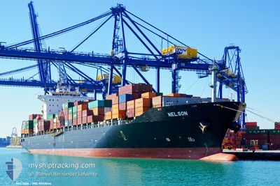
Container Ship
Current Trip
| Time Travelled | 7 days |
|---|---|
| Remaining Time | --- |
| Distance Travelled | 161.42 nm |
| Remaining Distance | --- |
| AVG Speed | 9.5 Knots |
| MAX Speed | 15.4 Knots |
| AVG Wind | 8 knots |
| MAX Wind | 16 knots |
| MIN Temp | 10.7°C / 51.26°F |
| MAX Temp | 17.9°C / 64.22°F |
| Draught | 7.8 m |
| Position Received | 13 d ago |
Current Position
| Longitude | 118.49933° |
|---|---|
| Latitude | 23.92213° |
| Status | Under way using engine |
| Speed | 20.7 Knots |
| Course | 49° |
| Area | South China Sea |
| Station | T-AIS |
| Position Received | 13 d ago |
Info
Information
The current position of BSG BARBADOS is in South China Sea with coordinates 23.92213° / 118.49933° as reported on 2024-04-11 01:26 by AIS to our vessel tracker app. The vessel's current speed is 20.7 Knots and is heading at the port of NINGBO. The estimated time of arrival as calculated by MyShipTracking vessel tracking app is 2024-04-12 04:00 LT
The vessel BSG BARBADOS (IMO: 9333046, MMSI: 636091308) is a Container Ship that was built in 2007 ( 17 years old ). It's sailing under the flag of [LR] Liberia.
In this page you can find informations about the vessels current position, last detected port calls, and current voyage information. If the vessels is not in coverage by AIS you will find the latest position.
The current position of BSG BARBADOS is detected by our AIS receivers and we are not responsible for the reliability of the data. The last position was recorded while the vessel was in Coverage by the Ais receivers of our vessel tracking app.
The current draught of BSG BARBADOS as reported by AIS is 7.8 meters
Weather
| Temperature | 18°C / 64.4°F |
|---|---|
| Wind Speed | 4 knots |
| Direction | 326° NW |
| Pressure | 1013.6 hPa |
| Humidity | 62.3 % |
| Cloud Coverage | 28 % |
Featured Company
Last Port Calls
| Port | Arrival | Departure | Time In Port |
|---|---|---|---|
| 2024-04-16 01:21 | 2024-04-16 10:07 | 8 h | |
| 2024-04-09 11:58 | 2024-04-10 10:49 | 22 h | |
| 2024-03-31 18:46 | 2024-04-01 20:51 | 1 d | |
| 2024-03-27 11:43 | 2024-03-29 03:52 | 1 d | |
| 2024-03-23 20:29 | 2024-03-25 03:27 | 1 d | |
| 2024-03-20 02:44 | 2024-03-21 13:57 | 1 d | |
| 2024-03-16 11:44 | 2024-03-17 13:19 | 1 d | |
| 2024-03-12 16:15 | 2024-03-14 03:36 | 1 d | |
| 2024-03-09 05:16 | 2024-03-10 12:47 | 1 d | |
| 2024-03-07 01:48 |
Most Visited Ports (Last year)
| Port | Arrivals | |
|---|---|---|
| 16 | ||
| 13 | ||
| 10 | ||
| 8 | ||
| 8 | ||
| 8 |
Last Trips
| Origin | Departure | Destination | Arrival | Distance | |
|---|---|---|---|---|---|
| 2024-04-10 18:49 | 2024-04-16 09:21 | 1070.88 nm | |||
| 2024-04-02 04:51 | 2024-04-09 19:58 | 1942.25 nm | |||
| 2024-03-29 10:52 | 2024-04-01 02:46 | 825.76 nm | |||
| 2024-03-25 11:27 | 2024-03-27 18:43 | 830.28 nm | |||
| 2024-03-21 20:57 | 2024-03-24 04:29 | 825.20 nm | |||
| 2024-03-17 21:19 | 2024-03-20 09:44 | 806.48 nm | |||
| 2024-03-14 10:36 | 2024-03-16 19:44 | 831.40 nm | |||
| 2024-03-10 20:47 | 2024-03-12 23:15 | 821.60 nm | |||
| 2024-03-07 08:48 | 2024-03-09 13:16 | 813.42 nm | |||
| 2024-02-29 20:53 | 2024-03-02 19:32 | 815.58 nm |
Events
| Time | Event | Details | Position / Dest | Info |
|---|---|---|---|---|
| 2024-04-17 04:07 | STOP Moving | 14.07 nm, East of TAICANG |
31.59007 / 121.45648
CNNBG
|
Speed: 0.3 kn Course: 294° |
| 2024-04-16 18:27 | START Moving | 16.98 nm, North East of SHENGSI |
30.99410 / 122.56969
CNNBG
|
Speed: 8.4 kn Course: 269° |
| 2024-04-16 17:28 | STOP Moving | 17.56 nm, North East of SHENGSI |
30.99805 / 122.58510
CNNBG
|
Speed: Course: 61° |
| 2024-04-16 10:07 | START Moving | 1.28 nm, North West of SHANGHAI |
31.37945 / 121.58628
CNNBG
|
Speed: 8.2 kn Course: 88° |
| 2024-04-16 10:07 | PORT DEPARTURE |
|
31.37945 / 121.58628
CNNBG
|
Speed: 0.1 kn Course: 184° |
| 2024-04-16 01:21 | STOP Moving |
31.37738 / 121.57460
[CN] SHANGHAI
|
Speed: Course: 294° |
|
| 2024-04-16 01:21 | PORT ARRIVAL |
|
31.37738 / 121.57460
[CN] SHANGHAI
|
Speed: 4.3 kn Course: 288° |
| 2024-04-15 20:14 | START Moving |
31.17788 / 122.44360
CNNBG
|
Speed: 7 kn Course: 125° |
|
| 2024-04-15 15:34 | STOP Moving |
31.17615 / 122.43590
CNNBG
|
Speed: 0.3 kn Course: 30° |
|
| 2024-04-15 11:42 | START Moving |
31.14170 / 123.14702
CNNBG
|
Speed: 4.3 kn Course: 290° |