
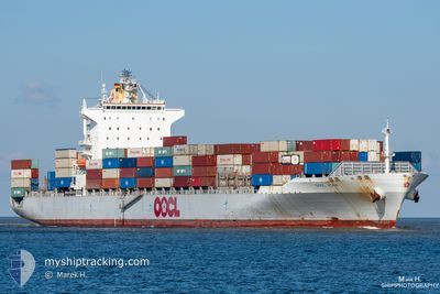
OOCL KOBE
Container Ship
Current Trip
| Time Travelled | 20 h, 38 mins |
|---|---|
| Remaining Time | 7 mins |
| Distance Travelled | 300.15 nm |
| Remaining Distance | 4.07 nm |
| AVG Speed | 13.5 Knots |
| MAX Speed | 18.5 Knots |
| AVG Wind | 17 knots |
| MAX Wind | 26 knots |
| MIN Temp | 0.6°C / 33.08°F |
| MAX Temp | 8°C / 46.4°F |
| Draught | 11.1 m |
| Position Received | 1 m ago |
Current Position
| Longitude | 9.80978° |
|---|---|
| Latitude | 53.55290° |
| Status | Under way using engine |
| Speed | 9.7 Knots |
| Course | 106° |
| Area | North Sea |
| Station | T-AIS |
| Position Received | 1 m ago |
Info
Information
The current position of OOCL KOBE is in North Sea with coordinates 53.55290° / 9.80978° as reported on 2024-04-25 02:18 by AIS to our vessel tracker app. The vessel's current speed is 9.7 Knots and is heading at the port of HAMBURG. The estimated time of arrival as calculated by MyShipTracking vessel tracking app is 2024-04-25 02:26 LT
The vessel OOCL KOBE (IMO: 9329526, MMSI: 477883300) is a Container Ship that was built in 2007 ( 17 years old ). It's sailing under the flag of [HK] Hong Kong.
In this page you can find informations about the vessels current position, last detected port calls, and current voyage information. If the vessels is not in coverage by AIS you will find the latest position.
The current position of OOCL KOBE is detected by our AIS receivers and we are not responsible for the reliability of the data. The last position was recorded while the vessel was in Coverage by the Ais receivers of our vessel tracking app.
The current draught of OOCL KOBE as reported by AIS is 11.1 meters
Weather
| Temperature | 2.6°C / 36.68°F |
|---|---|
| Wind Speed | 1 knots |
| Direction | 43° NE |
| Pressure | 1003.2 hPa |
| Humidity | 94.5 % |
| Cloud Coverage | 91 % |
Featured Company
Last Port Calls
| Port | Arrival | Departure | Time In Port |
|---|---|---|---|
| 2024-04-23 06:25 | 2024-04-24 05:41 | 23 h | |
| 2024-04-20 03:06 | 2024-04-21 00:47 | 21 h | |
| 2024-04-08 06:22 | 2024-04-08 17:26 | 11 h | |
| 2024-04-05 12:39 | 2024-04-06 04:04 | 15 h | |
| 2024-04-02 14:09 | 2024-04-04 00:15 | 1 d | |
| 2024-03-30 14:38 | 2024-03-31 17:45 | 1 d | |
| 2024-03-28 08:08 | 2024-03-28 23:55 | 15 h | |
| 2024-03-23 15:19 | 2024-03-24 12:48 | 21 h | |
| 2024-03-23 15:16 | |||
| 2024-03-14 16:16 | 2024-03-15 13:28 | 21 h |
Most Visited Ports (Last year)
| Port | Arrivals | |
|---|---|---|
| 18 | ||
| 9 | ||
| 9 | ||
| 9 | ||
| 9 | ||
| 8 |
Last Trips
| Origin | Departure | Destination | Arrival | Distance | |
|---|---|---|---|---|---|
| 2024-04-21 01:47 | 2024-04-23 08:25 | 120.94 nm | |||
| 2024-04-08 19:26 | 2024-04-20 04:06 | 2400.01 nm | |||
| 2024-04-06 07:04 | 2024-04-08 08:22 | 658.87 nm | |||
| 2024-04-04 02:15 | 2024-04-05 15:39 | 521.95 nm | |||
| 2024-03-31 20:45 | 2024-04-02 16:09 | 437.07 nm | |||
| 2024-03-29 02:55 | 2024-03-30 17:38 | 104.45 nm | |||
| 2024-03-24 14:48 | 2024-03-28 11:08 | 795.86 nm | |||
| 2024-03-15 14:28 | 2024-03-23 17:19 | 2940.26 nm | |||
| 2024-03-15 14:28 | 2024-03-23 17:16 | 2940.21 nm | |||
| 2024-03-14 09:07 | 2024-03-14 17:16 | 127.57 nm |
Events
| Time | Event | Details | Position / Dest | Info |
|---|---|---|---|---|
| 2024-04-24 19:12 | ETA Changed | 2024/04/24 21:15 2024/04/24 21:00 |
53.92505 / 7.64605
NLRTM=>DEHAM
|
Speed: 15.4 kn Course: 72° |
| 2024-04-24 18:21 | Status Changed | Under way using engine Default |
53.87997 / 7.22682
NLRTM=>DEHAM
|
Speed: 17.8 kn Course: 77° |
| 2024-04-24 18:15 | Status Changed | Default Under way using engine |
53.87403 / 7.18033
NLRTM=>DEHAM
|
Speed: 17.9 kn Course: 77° |
| 2024-04-24 17:20 | Change Sea Area | German part of the North Sea Dutch part of the North Sea |
53.81543 / 6.73802
North Sea
NLRTM=>DEHAM
|
Speed: 16.9 kn Course: 76° |
| 2024-04-24 17:20 | Status Changed | Under way using engine Default |
53.81543 / 6.73802
NLRTM=>DEHAM
|
Speed: 17 kn Course: 76° |
| 2024-04-24 17:00 | IN Coverage |
53.81543 / 6.73802
North Sea
NLRTM=>DEHAM
|
Speed: 16.9 kn Course: 76° |
|
| 2024-04-24 15:36 | Status Changed | Default Under way using engine |
53.67812 / 5.95588
NLRTM=>DEHAM
|
Speed: 16.5 kn Course: 71° |
| 2024-04-24 15:35 | Status Changed | Under way using engine Default |
53.67693 / 5.94990
NLRTM=>DEHAM
|
Speed: 16.5 kn Course: 71° |
| 2024-04-24 15:35 | OUT of Coverage |
53.67693 / 5.94990
North Sea
NLRTM=>DEHAM
|
Speed: 16.5 kn Course: 71° |
|
| 2024-04-24 15:26 | Status Changed | Default Under way using engine |
53.66362 / 5.88018
NLRTM=>DEHAM
|
Speed: 16.5 kn Course: 73° |