
ONUR G A
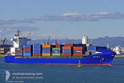
Container Ship
Current Trip
| Time Travelled | 12 h, 26 mins |
|---|---|
| Remaining Time | 1 day |
| Distance Travelled | 143.96 nm |
| Remaining Distance | 524.99 nm |
| AVG Speed | 11.4 Knots |
| MAX Speed | 12.1 Knots |
| AVG Wind | 18 knots |
| MAX Wind | 23 knots |
| MIN Temp | 12.3°C / 54.14°F |
| MAX Temp | 15.9°C / 60.62°F |
| Draught | 8.6 m |
| Position Received | 10 h, 17 m ago |
Current Position
| Longitude | --- |
|---|---|
| Latitude | --- |
| Status | Under way using engine |
| Speed | 11.1 Knots |
| Course | 155.7° |
| Area | Mediterranean Sea - Western Basin |
| Station | T-AIS |
| Position Received | 10 h, 17 m ago |
Info
Information
The current position of ONUR G A is in Mediterranean Sea - Western Basin with coordinates 43.02056° / 5.26662° as reported on 2025-12-06 17:39 by AIS to our vessel tracker app. The vessel's current speed is 11.1 Knots and is heading at the port of MARSAXLOKK. The estimated time of arrival as calculated by MyShipTracking vessel tracking app is 2025-12-09 02:20 LT
The vessel ONUR G A (IMO: 9238076, MMSI: 215424000) is a Container Ship that was built in 2001 ( 24 years old ). It's sailing under the flag of [MT] Malta.
In this page you can find informations about the vessels current position, last detected port calls, and current voyage information. If the vessels is not in coverage by AIS you will find the latest position.
The current position of ONUR G A is detected by our AIS receivers and we are not responsible for the reliability of the data. The last position was recorded while the vessel was in Coverage by the Ais receivers of our vessel tracking app.
The current draught of ONUR G A as reported by AIS is 8.6 meters
Weather
| Temperature | 15.9°C / 60.62°F |
|---|---|
| Wind Speed | 21 knots |
| Direction | 297° WNW |
| Pressure | 1017.1 hPa |
| Humidity | 80.3 % |
| Cloud Coverage | 99 % |
Featured Company
Last Port Calls
| Port | Arrival | Departure | Time In Port |
|---|---|---|---|
| 2025-12-05 23:52 | 2025-12-06 16:30 | 16 h | |
| 2025-12-03 23:01 | 2025-12-04 17:41 | 18 h | |
| 2025-12-03 05:11 | 2025-12-03 16:51 | 11 h | |
| 2025-11-29 07:37 | 2025-12-01 18:05 | 2 d | |
| 2025-11-27 06:28 | 2025-11-28 02:19 | 19 h | |
| 2025-11-24 13:37 | 2025-11-25 01:01 | 11 h | |
| 2025-11-20 18:21 | 2025-11-21 22:32 | 1 d | |
| 2025-11-17 12:44 | 2025-11-17 20:43 | 7 h | |
| 2025-11-16 04:09 | 2025-11-16 19:07 | 14 h | |
| 2025-11-14 17:30 | 2025-11-15 04:56 | 11 h |
Last Trips
| Origin | Departure | Destination | Arrival | Distance | |
|---|---|---|---|---|---|
| 2025-12-04 17:41 | 2025-12-05 23:52 | 285.04 nm | |||
| 2025-12-03 16:51 | 2025-12-03 23:01 | 69.48 nm | |||
| 2025-12-01 18:05 | 2025-12-03 05:11 | 159.03 nm | |||
| 2025-11-28 02:19 | 2025-11-29 07:37 | 320.82 nm | |||
| 2025-11-25 01:01 | 2025-11-27 06:28 | 105.50 nm | |||
| 2025-11-21 22:32 | 2025-11-24 13:37 | 331.35 nm | |||
| 2025-11-17 20:43 | 2025-11-20 18:21 | 822.27 nm | |||
| 2025-11-16 19:07 | 2025-11-17 12:44 | 62.98 nm | |||
| 2025-11-15 04:56 | 2025-11-16 04:09 | 77.64 nm | |||
| 2025-11-13 15:08 | 2025-11-14 17:30 | 253.83 nm |
Events
| Time | Event | Details | Position / Dest | Info |
|---|---|---|---|---|
| 2025-12-06 17:47 | Status Changed | Default Under way using engine |
42.99667 / 5.28167
MTMAR
|
Speed: 11.1 kn Course: 155.7° |
| 2025-12-06 17:39 | Status Changed | Under way using engine Default |
43.02056 / 5.26662
MTMAR
|
Speed: 11.2 kn Course: 156° |
| 2025-12-06 17:39 | OUT of Coverage |
43.02056 / 5.26662
Mediterranean Sea - Western Basin
MTMAR
|
Speed: 11.1 kn Course: 155.7° |
|
| 2025-12-06 17:11 | Status Changed | Default Under way using engine |
43.09667 / 5.21500
MTMAR
|
Speed: 11.5 kn Course: 154.7° |
| 2025-12-06 17:02 | Status Changed | Under way using engine Default |
43.12416 / 5.19738
MTMAR
|
Speed: 11.5 kn Course: 153° |
| 2025-12-06 16:53 | Status Changed | Default Under way using engine |
43.15015 / 5.17863
MTMAR
|
Speed: 11.5 kn Course: 151.7° |
| 2025-12-06 16:42 | Status Changed | Under way using engine Default |
43.18137 / 5.15759
MTMAR
|
Speed: 11.3 kn Course: 181° |
| 2025-12-06 16:29 | Status Changed | Default Under way using engine |
43.22297 / 5.15921
MTMAR
|
Speed: 11.5 kn Course: 180° |
| 2025-12-06 16:24 | Status Changed | Under way using engine Default |
43.23995 / 5.15962
MTMAR
|
Speed: 11.3 kn Course: 181° |
| 2025-12-06 16:21 | Status Changed | Default Under way using engine |
43.24832 / 5.15980
MTMAR
|
Speed: 10.8 kn Course: 209.1° |