
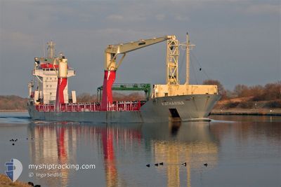
ONEGO ELBE
General Cargo
Current Trip
| Trip Time | 19 days |
|---|---|
| Trip Distance | 5827.41 nm |
| AVG Speed | 11.4 Knots |
| MAX Speed | 15.5 Knots |
| Draught | 7.2 m |
| AVG Wind | 15 knots |
| MAX Wind | 30.7 knots |
| MIN Temp | -5.6°C / 21.92°F |
| MAX Temp | 30°C / 86°F |
| Position Received | 3 d ago |
Current Position
| Longitude | 21.24460° |
|---|---|
| Latitude | 63.62020° |
| Status | Under way using engine |
| Speed | 12 Knots |
| Course | 63.6° |
| Area | Gulf of Bothnia |
| Station | T-AIS |
| Position Received | 3 d ago |
Info
Information
The current position of ONEGO ELBE is in Gulf of Bothnia with coordinates 63.62020° / 21.24460° as reported on 2024-04-21 23:51 by AIS to our vessel tracker app. The vessel's current speed is 12 Knots and is currently inside the port of ROYTTA.
The vessel ONEGO ELBE (IMO: 9438573, MMSI: 305305000) is a General Cargo that was built in 2008 ( 16 years old ). It's sailing under the flag of [AG] Antigua Barbuda.
In this page you can find informations about the vessels current position, last detected port calls, and current voyage information. If the vessels is not in coverage by AIS you will find the latest position.
The current position of ONEGO ELBE is detected by our AIS receivers and we are not responsible for the reliability of the data. The last position was recorded while the vessel was in Coverage by the Ais receivers of our vessel tracking app.
The current draught of ONEGO ELBE as reported by AIS is 7.2 meters
Weather
| Temperature | -4.5°C / 23.9°F |
|---|---|
| Wind Speed | 5 knots |
| Direction | 140° SE |
| Pressure | 1014 hPa |
| Humidity | 99.1 % |
| Cloud Coverage | 75 % |
Featured Company
Last Port Calls
| Port | Arrival | Departure | Time In Port |
|---|---|---|---|
| 2024-04-22 16:16 | |||
| 2024-03-31 21:15 | 2024-04-02 20:37 | 1 d | |
| 2024-03-18 02:48 | 2024-03-25 13:41 | 7 d | |
| 2024-02-18 12:31 | 2024-02-22 17:39 | 4 d | |
| 2024-02-09 08:54 | 2024-02-18 07:35 | 8 d | |
| 2024-02-02 22:51 | 2024-02-05 12:27 | 2 d |
Most Visited Ports (Last year)
| Port | Arrivals | |
|---|---|---|
| 3 | ||
| 2 | ||
| 2 | ||
| 2 | ||
| 2 | ||
| 1 |
Last Trips
| Origin | Departure | Destination | Arrival | Distance | |
|---|---|---|---|---|---|
| 2024-04-02 15:37 | 2024-04-22 19:16 | 5827.41 nm | |||
| 2024-03-25 08:41 | 2024-03-31 16:15 | 1588.41 nm | |||
| 2024-02-22 19:39 | 2024-03-17 21:48 | 6689.84 nm | |||
| 2024-02-18 09:35 | 2024-02-18 14:31 | 63.44 nm | |||
| 2024-02-05 13:27 | 2024-02-09 10:54 | 946.68 nm | |||
| 2024-01-13 14:04 | 2024-02-02 23:51 | 6006.41 nm |
Events
| Time | Event | Details | Position / Dest | Info |
|---|---|---|---|---|
| 2024-04-22 16:33 | STOP Moving |
65.75363 / 24.15514
[FI] ROYTTA
|
Speed: Course: 149° |
|
| 2024-04-22 16:16 | PORT ARRIVAL |
|
65.75377 / 24.15117
[FI] ROYTTA
|
Speed: 1 kn Course: 8° |
| 2024-04-22 15:04 | START Moving | 3.99 nm, South West of AJOS |
65.62968 / 24.36854
FITOR
|
Speed: 6 kn Course: 300° |
| 2024-04-22 14:56 | STOP Moving | 3.89 nm, South West of AJOS |
65.62804 / 24.37510
FITOR
|
Speed: Course: 302° |
| 2024-04-22 14:40 | START Moving | 3.62 nm, South West of AJOS |
65.61877 / 24.40599
FITOR
|
Speed: 5.9 kn Course: 309° |
| 2024-04-22 13:28 | STOP Moving | 3.6 nm, South West of AJOS |
65.61636 / 24.41328
FITOR
|
Speed: Course: 311° |
| 2024-04-22 12:48 | START Moving | 6.52 nm, South of AJOS |
65.55578 / 24.44494
FITOR
|
Speed: 5.6 kn Course: 21° |
| 2024-04-22 12:36 | STOP Moving | 6.7 nm, South of AJOS |
65.55290 / 24.44245
FITOR
|
Speed: Course: 20° |
| 2024-04-22 11:36 | START Moving | 15.23 nm, South West of AJOS |
65.43848 / 24.21805
FITOR
|
Speed: 8.8 kn Course: 41° |
| 2024-04-22 11:16 | STOP Moving | 15.5 nm, South West of AJOS |
65.43501 / 24.21100
FITOR
|
Speed: Course: 40° |