
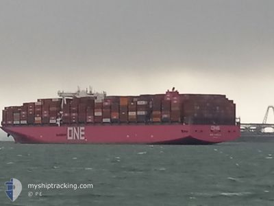
ONE AQUILA
Cargo
Current Trip
| Time Travelled | 15 h, 38 mins |
|---|---|
| Remaining Time | 1 day |
| Distance Travelled | 172.39 nm |
| Remaining Distance | 638.41 nm |
| AVG Speed | 12 Knots |
| MAX Speed | 15 Knots |
| AVG Wind | 5.1 knots |
| MAX Wind | 6.4 knots |
| MIN Temp | 28.5°C / 83.3°F |
| MAX Temp | 30.5°C / 86.9°F |
| Draught | 11.9 m |
| Position Received | 11 h, 50 m ago |
Current Position
| Longitude | 104.42673° |
|---|---|
| Latitude | 1.37403° |
| Status | Under way using engine |
| Speed | 14 Knots |
| Course | 48.8° |
| Area | South China Sea |
| Station | T-AIS |
| Position Received | 11 h, 50 m ago |
Info
Information
The current position of ONE AQUILA is in South China Sea with coordinates 1.37403° / 104.42673° as reported on 2024-04-19 13:47 by AIS to our vessel tracker app. The vessel's current speed is 14 Knots and is heading at the port of LAEM CHABANG. The estimated time of arrival as calculated by MyShipTracking vessel tracking app is 2024-04-21 17:42 LT
The vessel ONE AQUILA (IMO: 9806043, MMSI: 374858000) is a Cargo It's sailing under the flag of [PA] Panama.
In this page you can find informations about the vessels current position, last detected port calls, and current voyage information. If the vessels is not in coverage by AIS you will find the latest position.
The current position of ONE AQUILA is detected by our AIS receivers and we are not responsible for the reliability of the data. The last position was recorded while the vessel was in Coverage by the Ais receivers of our vessel tracking app.
The current draught of ONE AQUILA as reported by AIS is 11.9 meters
Weather
| Temperature | 28.8°C / 83.84°F |
|---|---|
| Wind Speed | 5 knots |
| Direction | 34° NE |
| Pressure | 1009 hPa |
| Humidity | 74.6 % |
| Cloud Coverage | 67 % |
Featured Company
Last Port Calls
| Port | Arrival | Departure | Time In Port |
|---|---|---|---|
| 2024-04-18 02:35 | 2024-04-19 10:00 | 1 d | |
| 2024-04-10 22:41 | 2024-04-11 16:34 | 17 h | |
| 2024-03-18 14:57 | 2024-03-21 05:24 | 2 d | |
| 2024-03-09 23:03 | 2024-03-17 02:16 | 7 d | |
| 2024-02-22 11:47 | 2024-02-23 20:02 | 1 d | |
| 2024-02-17 15:46 | 2024-02-19 00:10 | 1 d | |
| 2024-02-16 18:15 | 2024-02-17 10:35 | 16 h | |
| 2024-02-12 17:23 | 2024-02-14 06:26 | 1 d | |
| 2024-02-07 03:06 | 2024-02-09 22:55 | 2 d | |
| 2024-02-03 14:37 | 2024-02-04 20:05 | 1 d |
Last Trips
| Origin | Departure | Destination | Arrival | Distance | |
|---|---|---|---|---|---|
| 2024-04-12 00:34 | 2024-04-18 10:35 | 1534.94 nm | |||
| 2024-03-20 22:24 | 2024-04-11 06:41 | 6551.06 nm | |||
| 2024-03-16 19:16 | 2024-03-18 07:57 | 386.27 nm | |||
| 2024-02-24 05:02 | 2024-03-09 15:03 | 6073.83 nm | |||
| 2024-02-19 08:10 | 2024-02-22 20:47 | 1155.88 nm | |||
| 2024-02-17 18:35 | 2024-02-17 23:46 | 59.58 nm | |||
| 2024-02-14 13:26 | 2024-02-17 02:15 | 935.63 nm | |||
| 2024-02-10 05:55 | 2024-02-13 00:23 | 694.42 nm | |||
| 2024-02-05 04:05 | 2024-02-07 10:06 | 806.74 nm | |||
| 2024-01-29 20:51 | 2024-02-03 22:37 | 1456.38 nm |
Events
| Time | Event | Details | Position / Dest | Info |
|---|---|---|---|---|
| 2024-04-19 13:47 | OUT of Coverage |
1.37403 / 104.42673
South China Sea
TH LCH
|
Speed: 14 kn Course: 48.8° |
|
| 2024-04-19 13:22 | Change Sea Area | Malaysian part of the South China Sea Malaysian part of the Singapore Strait |
1.31235 / 104.35478
South China Sea
TH LCH
|
Speed: 13.2 kn Course: 49.9° |
| 2024-04-19 12:23 | Change Sea Area | Malaysian part of the Singapore Strait Indonesian part of the Singapore Strait |
1.26064 / 104.14308
Singapore Strait
TH LCH
|
Speed: 14.2 kn Course: 81° |
| 2024-04-19 11:01 | Change Sea Area | Indonesian part of the Singapore Strait Singaporean part of the Singapore Strait |
1.19585 / 103.86080
Singapore Strait
TH LCH
|
Speed: 9.8 kn Course: 73.6° |
| 2024-04-19 10:00 | PORT DEPARTURE |
|
1.28031 / 103.74593
TH LCH
|
Speed: 6.3 kn Course: 198.4° |
| 2024-04-19 09:50 | START Moving |
1.28764 / 103.75687
[SG] SINGAPORE
|
Speed: 3.2 kn Course: 260.1° |
|
| 2024-04-19 09:26 | Status Changed | Under way using engine Moored |
1.28370 / 103.76080
[SG] SINGAPORE
|
Speed: Course: 511° |
| 2024-04-19 07:55 | Draught Changed | 11.9 13.8 |
1.28369 / 103.76075
[SG] SINGAPORE
|
Speed: Course: 511° |
| 2024-04-19 07:55 | Destination Changed | TH LCH SG SIN PEBGA |
1.28369 / 103.76075
[SG] SINGAPORE
|
Speed: Course: 511° |
| 2024-04-19 07:55 | ETA Changed | 2024/04/21 21:00 2024/04/18 00:15 |
1.28369 / 103.76075
[SG] SINGAPORE
|
Speed: Course: 511° |