
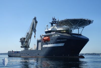
OLYMPIC CHALLENGER
Offshore Supply Ship
Current Trip
| Trip Time | --- |
|---|---|
| Trip Distance | --- |
| AVG Speed | --- |
| MAX Speed | --- |
| Draught | --- |
| AVG Wind | --- |
| MAX Wind | --- |
| MIN Temp | --- |
| MAX Temp | --- |
| Position Received | 14 m ago |
Current Position
| Longitude | -88.09874° |
|---|---|
| Latitude | 30.52549° |
| Status | Moored |
| Speed | |
| Course | 124° |
| Area | Gulf of Mexico |
| Station | T-AIS |
| Position Received | 14 m ago |
Info
Information
The current position of OLYMPIC CHALLENGER is in Gulf of Mexico with coordinates 30.52549° / -88.09874° as reported on 2024-04-25 09:06 by AIS to our vessel tracker app. The vessel's current speed is 0 Knots and is currently inside the port of DEER RIVER.
The vessel OLYMPIC CHALLENGER (IMO: 9398292, MMSI: 257089810) is a Offshore Supply Ship that was built in 2008 ( 16 years old ). It's sailing under the flag of [NO] Norway.
In this page you can find informations about the vessels current position, last detected port calls, and current voyage information. If the vessels is not in coverage by AIS you will find the latest position.
The current position of OLYMPIC CHALLENGER is detected by our AIS receivers and we are not responsible for the reliability of the data. The last position was recorded while the vessel was in Coverage by the Ais receivers of our vessel tracking app.
The current draught of OLYMPIC CHALLENGER as reported by AIS is 6.3 meters
Weather
| Temperature | 19.4°C / 66.92°F |
|---|---|
| Wind Speed | 4 knots |
| Direction | 304° NW |
| Pressure | 1019.8 hPa |
| Humidity | 88.8 % |
| Cloud Coverage | 3 % |
Featured Company
Last Port Calls
| Port | Arrival | Departure | Time In Port |
|---|---|---|---|
| 2024-03-06 02:42 | 2024-03-09 18:07 | 3 d |
Most Visited Ports (Last year)
| Port | Arrivals | |
|---|---|---|
| 3 | ||
| 1 |
Last Trips
| Origin | Departure | Destination | Arrival | Distance | |
|---|---|---|---|---|---|
| 2024-01-05 20:32 | 2024-03-05 20:42 | 256.88 nm |
Events
| Time | Event | Details | Position / Dest | Info |
|---|---|---|---|---|
| 2024-04-25 09:06 | IN Coverage |
30.52549 / -88.09874
Gulf of Mexico
[US] DEER RIVER
|
Speed: Course: 295.5° |
|
| 2024-04-20 21:43 | OUT of Coverage |
27.37110 / -90.19471
Gulf of Mexico
WARRIOR
|
Speed: Course: 84.4° |
|
| 2024-04-20 06:49 | Destination Changed | WARRIOR WINTERFELL |
27.37163 / -90.19359
WARRIOR
|
Speed: 0.1 kn Course: 219° |
| 2024-04-20 06:49 | ETA Changed | 2024/04/21 21:15 2025/03/21 12:34 |
27.37163 / -90.19359
WARRIOR
|
Speed: 0.1 kn Course: 219° |
| 2024-04-20 06:16 | IN Coverage |
27.37161 / -90.19361
Gulf of Mexico
|
Speed: 0.1 kn Course: 211.8° |
|
| 2024-04-17 14:52 | OUT of Coverage |
27.11541 / -90.80283
Gulf of Mexico
|
Speed: 0.2 kn Course: 165.5° |
|
| 2024-04-17 10:58 | IN Coverage |
27.11538 / -90.80283
Gulf of Mexico
|
Speed: 0.2 kn Course: 39.8° |
|
| 2024-04-17 09:34 | OUT of Coverage |
27.11541 / -90.80279
Gulf of Mexico
|
Speed: 0.2 kn Course: 274.1° |
|
| 2024-04-17 04:19 | IN Coverage |
27.11562 / -90.80388
Gulf of Mexico
|
Speed: 0.1 kn Course: 44.1° |
|
| 2024-04-16 16:19 | OUT of Coverage |
27.11635 / -90.80487
Gulf of Mexico
|
Speed: 0.2 kn Course: 226.4° |