
BRAVEHEART I
Bulk Carrier
Current Trip
ID BAH
| Time Travelled | 29 days |
|---|---|
| Remaining Time | --- |
| Distance Travelled | 5890.81 nm |
| Remaining Distance | --- |
| AVG Speed | 11.6 Knots |
| MAX Speed | 11.6 Knots |
| AVG Wind | 13.1 knots |
| MAX Wind | 38.5 knots |
| MIN Temp | -2.8°C / 26.96°F |
| MAX Temp | 20°C / 68°F |
| Draught | 14.8 m |
| Position Received | 11 h, 46 m ago |
Current Position
| Longitude | 5.45959° |
|---|---|
| Latitude | 55.25209° |
| Status | Constrained by her draught |
| Speed | 11.2 Knots |
| Course | 196.6° |
| Area | North Sea |
| Station | T-AIS |
| Position Received | 11 h, 46 m ago |
Info
Information
The current position of BRAVEHEART I is in North Sea with coordinates 55.25209° / 5.45959° as reported on 2024-04-25 08:37 by AIS to our vessel tracker app. The vessel's current speed is 11.2 Knots
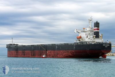
The vessel BRAVEHEART I (IMO: 9392444, MMSI: 636018158) is a Bulk Carrier that was built in 2007 ( 17 years old ). It's sailing under the flag of [LR] Liberia.
In this page you can find informations about the vessels current position, last detected port calls, and current voyage information. If the vessels is not in coverage by AIS you will find the latest position.
The current position of BRAVEHEART I is detected by our AIS receivers and we are not responsible for the reliability of the data. The last position was recorded while the vessel was in Coverage by the Ais receivers of our vessel tracking app.
The current draught of BRAVEHEART I as reported by AIS is 14.8 meters
Weather
| Temperature | 6.9°C / 44.42°F |
|---|---|
| Wind Speed | 14 knots |
| Direction | 262° W |
| Pressure | 999.5 hPa |
| Humidity | 69.7 % |
| Cloud Coverage | 76 % |
Featured Company
Last Trips
Events
| Time | Event | Details | Position / Dest | Info |
|---|---|---|---|---|
| 2024-04-25 08:38 | Status Changed | Default Constrained by her draught |
55.25007 / 5.45856
ID BAH
|
Speed: 11.2 kn Course: 196.6° |
| 2024-04-25 08:37 | OUT of Coverage |
55.25209 / 5.45959
North Sea
|
Speed: 11.2 kn Course: 196.6° |
|
| 2024-04-25 08:05 | Change Sea Area | German part of the North Sea Danish part of the North Sea |
55.34245 / 5.52689
North Sea
|
Speed: 11.2 kn Course: 207.7° |
| 2024-04-25 07:17 | Status Changed | Constrained by her draught Default |
55.48458 / 5.59928
ID BAH
|
Speed: 11 kn Course: 189° |
| 2024-04-25 07:15 | Status Changed | Default Constrained by her draught |
55.49166 / 5.60167
ID BAH
|
Speed: 11.2 kn Course: 188.8° |
| 2024-04-25 05:27 | Status Changed | Constrained by her draught Default |
55.82623 / 5.69181
ID BAH
|
Speed: 11 kn Course: 189° |
| 2024-04-25 05:24 | IN Coverage |
55.81909 / 5.68978
North Sea
|
Speed: 11.2 kn Course: 188.9° |
|
| 2024-04-25 03:42 | Status Changed | Default Constrained by her draught |
56.14834 / 5.79833
ID BAH
|
Speed: 11.2 kn Course: 190.5° |
| 2024-04-25 03:39 | Status Changed | Constrained by her draught Default |
56.15690 / 5.80180
ID BAH
|
Speed: 11.2 kn Course: 191° |
| 2024-04-25 03:39 | OUT of Coverage |
56.15690 / 5.80180
North Sea
|
Speed: 11.2 kn Course: 190.5° |