
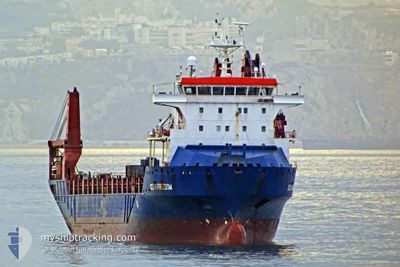
OCEAN FREEDOM
General Cargo
Current Trip
| Trip Time | --- |
|---|---|
| Trip Distance | --- |
| AVG Speed | --- |
| MAX Speed | --- |
| Draught | --- |
| AVG Wind | --- |
| MAX Wind | --- |
| MIN Temp | --- |
| MAX Temp | --- |
| Position Received | 2 d ago |
Current Position
| Longitude | 0.42509° |
|---|---|
| Latitude | 36.59230° |
| Status | Under way using engine |
| Speed | 14.9 Knots |
| Course | 77.5° |
| Area | Mediterranean Sea - Western Basin |
| Station | T-AIS |
| Position Received | 2 d ago |
Info
Information
The current position of OCEAN FREEDOM is in Mediterranean Sea - Western Basin with coordinates 36.59230° / 0.42509° as reported on 2024-04-17 13:28 by AIS to our vessel tracker app. The vessel's current speed is 14.9 Knots and is currently inside the port of BIZERTE.
The vessel OCEAN FREEDOM (IMO: 9506722, MMSI: 367503980) is a General Cargo that was built in 2010 ( 14 years old ). It's sailing under the flag of [US] USA.
In this page you can find informations about the vessels current position, last detected port calls, and current voyage information. If the vessels is not in coverage by AIS you will find the latest position.
The current position of OCEAN FREEDOM is detected by our AIS receivers and we are not responsible for the reliability of the data. The last position was recorded while the vessel was in Coverage by the Ais receivers of our vessel tracking app.
The current draught of OCEAN FREEDOM as reported by AIS is 6.3 meters
Weather
| Temperature | 13.4°C / 56.12°F |
|---|---|
| Wind Speed | 15 knots |
| Direction | 298° WNW |
| Pressure | 1019.6 hPa |
| Humidity | 65.2 % |
| Cloud Coverage | --- |
Featured Company
Last Port Calls
| Port | Arrival | Departure | Time In Port |
|---|---|---|---|
| 2024-04-04 19:23 | 2024-04-06 10:32 | 1 d | |
| 2024-03-16 18:54 | 2024-03-17 19:45 | 1 d | |
| 2024-03-08 15:12 | 2024-03-09 02:23 | 11 h | |
| 2024-03-02 17:23 | 2024-03-08 03:11 | 5 d |
Most Visited Ports (Last year)
| Port | Arrivals | |
|---|---|---|
| 3 | ||
| 2 | ||
| 2 | ||
| 2 | ||
| 2 | ||
| 1 |
Last Trips
| Origin | Departure | Destination | Arrival | Distance | |
|---|---|---|---|---|---|
| 2024-03-17 12:45 | 2024-04-04 15:23 | 6669.01 nm | |||
| 2024-03-08 18:23 | 2024-03-16 11:54 | 2257.98 nm | |||
| 2024-03-07 19:11 | 2024-03-08 07:12 | 96.98 nm | |||
| 2024-01-24 10:12 | 2024-03-02 09:23 | 10823.96 nm |
Events
| Time | Event | Details | Position / Dest | Info |
|---|---|---|---|---|
| 2024-04-17 13:46 | Status Changed | Default Under way using engine |
36.61500 / .54833
TNBIZ
|
Speed: 14.9 kn Course: 77.5° |
| 2024-04-17 13:28 | Status Changed | Under way using engine Default |
36.59230 / .42509
TNBIZ
|
Speed: 15 kn Course: 77° |
| 2024-04-17 13:28 | OUT of Coverage |
36.59230 / .42509
Mediterranean Sea - Western Basin
TNBIZ
|
Speed: 14.9 kn Course: 77.5° |
|
| 2024-04-17 13:16 | Status Changed | Default Under way using engine |
36.58667 / .39833
TNBIZ
|
Speed: 15 kn Course: 78.1° |
| 2024-04-17 12:48 | Status Changed | Under way using engine Default |
36.56382 / .25369
TNBIZ
|
Speed: 15 kn Course: 79° |
| 2024-04-17 12:43 | Status Changed | Default Under way using engine |
36.55833 / .22667
TNBIZ
|
Speed: 15.6 kn Course: 81.9° |
| 2024-04-17 12:36 | Status Changed | Under way using engine Default |
36.55387 / .18698
TNBIZ
|
Speed: 15 kn Course: 81° |
| 2024-04-17 12:22 | Status Changed | Default Under way using engine |
36.54500 / .11333
TNBIZ
|
Speed: 16.1 kn Course: 81.5° |
| 2024-04-17 12:04 | Status Changed | Under way using engine Default |
36.53101 / -.00559
TNBIZ
|
Speed: 16 kn Course: 80° |
| 2024-04-17 11:54 | Status Changed | Default Under way using engine |
36.52667 / -.03333
TNBIZ
|
Speed: 16.1 kn Course: 80.9° |