
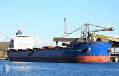
OCEAN ALIGNMENT
Bulk Carrier
Current Trip
| Time Travelled | 7 days |
|---|---|
| Remaining Time | 8 days |
| Distance Travelled | 2135.74 nm |
| Remaining Distance | 2430.41 nm |
| AVG Speed | 11.8 Knots |
| MAX Speed | 14.8 Knots |
| AVG Wind | 20.2 knots |
| MAX Wind | 30.9 knots |
| MIN Temp | 2.3°C / 36.14°F |
| MAX Temp | 19.3°C / 66.74°F |
| Draught | 7.8 m |
| Position Received | 7 d ago |
Current Position
| Longitude | 137.55456° |
|---|---|
| Latitude | 34.23911° |
| Status | Under way using engine |
| Speed | 12.7 Knots |
| Course | 123.5° |
| Area | Philippine Sea |
| Station | T-AIS |
| Position Received | 7 d ago |
Info
Information
The current position of OCEAN ALIGNMENT is in Philippine Sea with coordinates 34.23911° / 137.55456° as reported on 2024-04-16 05:58 by AIS to our vessel tracker app. The vessel's current speed is 12.7 Knots and is heading at the port of VANCOUVER. The estimated time of arrival as calculated by MyShipTracking vessel tracking app is 2024-05-01 23:46 LT
The vessel OCEAN ALIGNMENT (IMO: 9631254, MMSI: 477817200) is a Bulk Carrier that was built in 2012 ( 12 years old ). It's sailing under the flag of [HK] Hong Kong.
In this page you can find informations about the vessels current position, last detected port calls, and current voyage information. If the vessels is not in coverage by AIS you will find the latest position.
The current position of OCEAN ALIGNMENT is detected by our AIS receivers and we are not responsible for the reliability of the data. The last position was recorded while the vessel was in Coverage by the Ais receivers of our vessel tracking app.
The current draught of OCEAN ALIGNMENT as reported by AIS is 7.8 meters
Weather
| Temperature | 3.6°C / 38.48°F |
|---|---|
| Wind Speed | 27 knots |
| Direction | 260° W |
| Pressure | 1002.8 hPa |
| Humidity | 76.7 % |
| Cloud Coverage | 100 % |
Featured Company
Last Trips
| Origin | Departure | Destination | Arrival | Distance |
|---|
Events
| Time | Event | Details | Position / Dest | Info |
|---|---|---|---|---|
| 2024-04-16 06:01 | Status Changed | Default Under way using engine |
34.23267 / 137.56645
CA VAN
|
Speed: 12.7 kn Course: 123.5° |
| 2024-04-16 05:58 | OUT of Coverage |
34.23911 / 137.55456
Philippine Sea
CA VAN
|
Speed: 12.7 kn Course: 123.5° |
|
| 2024-04-16 05:32 | Status Changed | Under way using engine Default |
34.28540 / 137.46107
CA VAN
|
Speed: 13.3 kn Course: 120° |
| 2024-04-16 05:03 | Status Changed | Default Under way using engine |
34.33864 / 137.34891
CA VAN
|
Speed: 13.1 kn Course: 121.2° |
| 2024-04-16 04:18 | Status Changed | Under way using engine Default |
34.41867 / 137.18054
CA VAN
|
Speed: 12.6 kn Course: 121° |
| 2024-04-16 04:10 | Status Changed | Default Under way using engine |
34.43198 / 137.15328
CA VAN
|
Speed: 12.7 kn Course: 120.4° |
| 2024-04-16 04:03 | Status Changed | Under way using engine Default |
34.44458 / 137.12732
CA VAN
|
Speed: 12.9 kn Course: 121° |
| 2024-04-16 03:50 | Status Changed | Default Under way using engine |
34.46992 / 137.07838
CA VAN
|
Speed: 12.8 kn Course: 130.2° |
| 2024-04-16 03:47 | Status Changed | Under way using engine Default |
34.47566 / 137.06921
CA VAN
|
Speed: 12.3 kn Course: 138° |
| 2024-04-16 03:06 | Status Changed | Default Under way using engine |
34.57673 / 136.97974
CA VAN
|
Speed: 12.7 kn Course: 130.7° |