
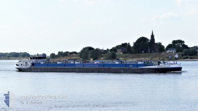
OBSEDIAAN
Tanker
Current Trip
ADENHAVEN
| Time Travelled | 1 day |
|---|---|
| Remaining Time | --- |
| Distance Travelled | 83.39 nm |
| Remaining Distance | --- |
| AVG Speed | 8.6 Knots |
| MAX Speed | 11.2 Knots |
| AVG Wind | 9.4 knots |
| MAX Wind | 12.7 knots |
| MIN Temp | 3.1°C / 37.58°F |
| MAX Temp | 8.8°C / 47.84°F |
| Draught | 1.5 m |
| Position Received | 13 m ago |
Current Position
| Longitude | 8.11247° |
|---|---|
| Latitude | 48.83043° |
| Status | Under way using engine |
| Speed | 2 Knots |
| Course | --- |
| Area | North Sea |
| Station | T-AIS |
| Position Received | 13 m ago |
Info
Information
The current position of OBSEDIAAN is in North Sea with coordinates 48.83043° / 8.11247° as reported on 2024-04-24 11:33 by AIS to our vessel tracker app. The vessel's current speed is 2 Knots
The vessel OBSEDIAAN (MMSI: 244890116) is a Tanker It's sailing under the flag of [NL] Netherlands.
In this page you can find informations about the vessels current position, last detected port calls, and current voyage information. If the vessels is not in coverage by AIS you will find the latest position.
The current position of OBSEDIAAN is detected by our AIS receivers and we are not responsible for the reliability of the data. The last position was recorded while the vessel was in Coverage by the Ais receivers of our vessel tracking app.
The current draught of OBSEDIAAN as reported by AIS is 1.5 meters
Weather
| Temperature | 3.6°C / 38.48°F |
|---|---|
| Wind Speed | 5 knots |
| Direction | 224° SW |
| Pressure | 1011.8 hPa |
| Humidity | 97.2 % |
| Cloud Coverage | 100 % |
Featured Company
Last Port Calls
| Port | Arrival | Departure | Time In Port |
|---|---|---|---|
| 2024-04-23 09:39 | 2024-04-23 09:55 | 16 m | |
| 2024-04-22 04:28 | 2024-04-23 09:12 | 1 d | |
| 2024-04-21 15:50 | 2024-04-22 03:41 | 11 h | |
| 2024-04-17 21:38 | 2024-04-18 04:19 | 6 h | |
| 2024-04-16 14:11 | 2024-04-17 01:39 | 11 h | |
| 2024-04-15 08:33 | 2024-04-16 14:05 | 1 d | |
| 2024-04-14 15:38 | 2024-04-14 16:03 | 24 m | |
| 2024-04-12 14:12 | 2024-04-13 06:06 | 15 h | |
| 2024-04-11 07:41 | 2024-04-12 13:49 | 1 d | |
| 2024-04-10 20:31 | 2024-04-11 06:55 | 10 h |
Most Visited Ports (Last year)
| Port | Arrivals | |
|---|---|---|
| 53 | ||
| 51 | ||
| 38 | ||
| 24 | ||
| 18 | ||
| 16 |
Last Trips
| Origin | Departure | Destination | Arrival | Distance | |
|---|---|---|---|---|---|
| 2024-04-23 11:12 | 2024-04-23 11:39 | 1.06 nm | |||
| 2024-04-22 05:41 | 2024-04-22 06:28 | 0.86 nm | |||
| 2024-04-18 06:19 | 2024-04-21 17:50 | 308.08 nm | |||
| 2024-04-17 03:39 | 2024-04-17 23:38 | 103.58 nm | |||
| 2024-04-16 16:05 | 2024-04-16 16:11 | 0.82 nm | |||
| 2024-04-14 18:03 | 2024-04-15 10:33 | 154.26 nm | |||
| 2024-04-13 08:06 | 2024-04-14 17:38 | 259.95 nm | |||
| 2024-04-12 15:49 | 2024-04-12 16:12 | 1.06 nm | |||
| 2024-04-11 08:55 | 2024-04-11 09:41 | 0.88 nm | |||
| 2024-04-08 13:11 | 2024-04-10 22:31 | 169.48 nm |
Events
| Time | Event | Details | Position / Dest | Info |
|---|---|---|---|---|
| 2024-04-24 10:38 | IN Coverage |
48.76004 / 7.97689
North Sea
ADENHAVEN
|
Speed: 9.8 kn Course: 65° |
|
| 2024-04-23 13:05 | OUT of Coverage |
47.79925 / 7.53323
North Sea
ADENHAVEN
|
Speed: 8.8 kn Course: 24.6° |
|
| 2024-04-23 12:58 | START Moving | 11.21 nm, North of HUNINGUE |
47.78122 / 7.52500
ADENHAVEN
|
Speed: 9.7 kn Course: 4.7° |
| 2024-04-23 12:32 | STOP Moving | 10.45 nm, North of HUNINGUE |
47.76832 / 7.52623
ADENHAVEN
|
Speed: Course: 511° |
| 2024-04-23 12:27 | START Moving | 10.24 nm, North of HUNINGUE |
47.76478 / 7.52708
ADENHAVEN
|
Speed: 5 kn Course: 343.8° |
| 2024-04-23 11:53 | STOP Moving | 10.1 nm, North of HUNINGUE |
47.76271 / 7.52826
ADENHAVEN
|
Speed: 0.2 kn Course: 511° |
| 2024-04-23 11:06 | START Moving | 4.21 nm, North West of HUNINGUE |
47.65339 / 7.52475
ADENHAVEN
|
Speed: 8.7 kn Course: 320° |
| 2024-04-23 11:05 | Status Changed | Under way using engine Moored |
47.65221 / 7.52599
ADENHAVEN
|
Speed: Course: 511° |
| 2024-04-23 10:47 | Status Changed | Moored Under way using engine |
47.65208 / 7.52639
ADENHAVEN
|
Speed: 0.2 kn Course: 511° |
| 2024-04-23 10:44 | STOP Moving | 4.1 nm, North West of HUNINGUE |
47.65196 / 7.52649
ADENHAVEN
|
Speed: 0.2 kn Course: 511° |