
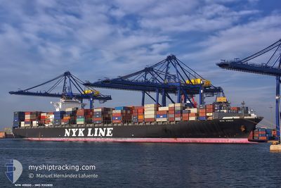
NYK VIRGO
Container Ship
Current Trip
| Trip Time | 30 days |
|---|---|
| Trip Distance | 11889.07 nm |
| AVG Speed | 15.1 Knots |
| MAX Speed | 15.1 Knots |
| Draught | 13.9 m |
| AVG Wind | 14.5 knots |
| MAX Wind | 33.5 knots |
| MIN Temp | 6.7°C / 44.06°F |
| MAX Temp | 30.6°C / 87.08°F |
| Position Received | 1 m ago |
Current Position
| Longitude | 4.04727° |
|---|---|
| Latitude | 51.94740° |
| Status | Moored |
| Speed | 0.1 Knots |
| Course | 258° |
| Area | North Sea |
| Station | T-AIS |
| Position Received | 1 m ago |
Info
Information
The current position of NYK VIRGO is in North Sea with coordinates 51.94740° / 4.04727° as reported on 2024-04-19 13:29 by AIS to our vessel tracker app. The vessel's current speed is 0.1 Knots and is currently inside the port of MAASVLAKTE - ROTTERDAM.
The vessel NYK VIRGO (IMO: 9312810, MMSI: 563025600) is a Container Ship that was built in 2007 ( 17 years old ). It's sailing under the flag of [SG] Singapore.
In this page you can find informations about the vessels current position, last detected port calls, and current voyage information. If the vessels is not in coverage by AIS you will find the latest position.
The current position of NYK VIRGO is detected by our AIS receivers and we are not responsible for the reliability of the data. The last position was recorded while the vessel was in Coverage by the Ais receivers of our vessel tracking app.
The current draught of NYK VIRGO as reported by AIS is 13.9 meters
Weather
| Temperature | 8.7°C / 47.66°F |
|---|---|
| Wind Speed | 27 knots |
| Direction | 333° NNW |
| Pressure | 1011.2 hPa |
| Humidity | 77.8 % |
| Cloud Coverage | 96 % |
Featured Company
Last Port Calls
| Port | Arrival | Departure | Time In Port |
|---|---|---|---|
| 2024-04-19 02:55 | |||
| 2024-03-17 23:48 | 2024-03-19 17:27 | 1 d | |
| 2024-03-10 03:58 | 2024-03-10 20:31 | 16 h | |
| 2024-03-08 09:11 | 2024-03-09 13:33 | 1 d | |
| 2024-03-06 02:28 | 2024-03-07 16:22 | 1 d | |
| 2024-03-04 21:01 | 2024-03-05 07:40 | 10 h | |
| 2024-03-03 09:40 | 2024-03-04 08:02 | 22 h | |
| 2024-02-18 03:09 | 2024-02-19 22:04 | 1 d | |
| 2024-02-11 15:28 | 2024-02-16 17:19 | 5 d |
Last Trips
| Origin | Departure | Destination | Arrival | Distance | |
|---|---|---|---|---|---|
| 2024-03-20 01:27 | 2024-04-19 04:55 | 11889.07 nm | |||
| 2024-03-11 05:31 | 2024-03-18 07:48 | 2933.21 nm | |||
| 2024-03-09 22:33 | 2024-03-10 12:58 | 224.43 nm | |||
| 2024-03-08 01:22 | 2024-03-08 18:11 | 264.06 nm | |||
| 2024-03-05 16:40 | 2024-03-06 11:28 | 254.69 nm | |||
| 2024-03-04 17:02 | 2024-03-05 06:01 | 139.92 nm | |||
| 2024-02-19 14:04 | 2024-03-03 18:40 | 5187.23 nm | |||
| 2024-02-16 09:19 | 2024-02-17 19:09 | 391.56 nm | |||
| 2024-01-30 03:43 | 2024-02-11 07:28 | 5306.33 nm |
Events
| Time | Event | Details | Position / Dest | Info |
|---|---|---|---|---|
| 2024-04-19 03:20 | Status Changed | Moored Under way using engine |
51.94685 / 4.04741
[NL] MAASVLAKTE - ROTTERDAM
|
Speed: 0.1 kn Course: 256° |
| 2024-04-19 03:18 | STOP Moving |
51.94670 / 4.04749
[NL] MAASVLAKTE - ROTTERDAM
|
Speed: 0.2 kn Course: 261° |
|
| 2024-04-19 02:55 | PORT ARRIVAL |
|
51.95046 / 4.07803
[NL] MAASVLAKTE - ROTTERDAM
|
Speed: 4.4 kn Course: 250° |
| 2024-04-19 00:05 | START Moving | 16.77 nm, North West of BROUWERSDAM |
51.90358 / 3.45465
NL RTM
|
Speed: 3.1 kn Course: 307° |
| 2024-04-18 23:58 | Status Changed | Under way using engine At anchor |
51.90228 / 3.45478
NL RTM
|
Speed: 0.4 kn Course: 246° |
| 2024-04-18 14:31 | Status Changed | At anchor Under way using engine |
51.90288 / 3.44949
NL RTM
|
Speed: 0.7 kn Course: 155° |
| 2024-04-18 14:17 | STOP Moving | 16.88 nm, North West of BROUWERSDAM |
51.90317 / 3.45083
NL RTM
|
Speed: 0.3 kn Course: 240° |
| 2024-04-18 11:28 | Change Sea Area | Dutch part of the North Sea Belgian part of the North Sea |
51.77590 / 2.70108
North Sea
NL RTM
|
Speed: 11.1 kn Course: 66.7° |
| 2024-04-18 09:05 | ETA Changed | 2024/04/18 23:00 2024/04/18 14:30 |
51.54324 / 2.28391
NL RTM
|
Speed: 8.4 kn Course: 42.2° |
| 2024-04-18 08:56 | Detected in Sea | Belgian part of the North Sea |
51.52712 / 2.26054
North Sea
NL RTM
|
Speed: 8.5 kn Course: 40.7° |