
NORTH SEA
Tanker
Current Trip
US NYC (FOR ORDERS)
| Time Travelled | 10 days |
|---|---|
| Remaining Time | --- |
| Distance Travelled | 3169.69 nm |
| Remaining Distance | --- |
| AVG Speed | 11.6 Knots |
| MAX Speed | 14.6 Knots |
| AVG Wind | 15.2 knots |
| MAX Wind | 28 knots |
| MIN Temp | 7.5°C / 45.5°F |
| MAX Temp | 17.7°C / 63.86°F |
| Draught | 10.9 m |
| Position Received | 4 m ago |
Current Position
| Longitude | -73.20697° |
|---|---|
| Latitude | 40.12495° |
| Status | Under way using engine |
| Speed | 10 Knots |
| Course | 293.5° |
| Area | North Atlantic Ocean |
| Station | T-AIS |
| Position Received | 4 m ago |
Info
Information
The current position of NORTH SEA is in North Atlantic Ocean with coordinates 40.12495° / -73.20697° as reported on 2024-04-20 01:16 by AIS to our vessel tracker app. The vessel's current speed is 10 Knots
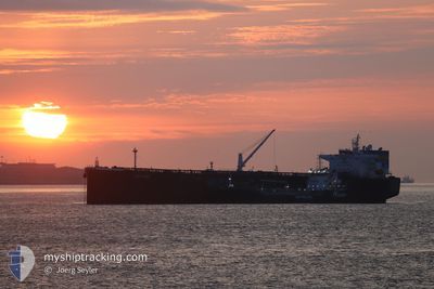
The vessel NORTH SEA (IMO: 9760495, MMSI: 636017501) is a Tanker It's sailing under the flag of [LR] Liberia.
In this page you can find informations about the vessels current position, last detected port calls, and current voyage information. If the vessels is not in coverage by AIS you will find the latest position.
The current position of NORTH SEA is detected by our AIS receivers and we are not responsible for the reliability of the data. The last position was recorded while the vessel was in Coverage by the Ais receivers of our vessel tracking app.
The current draught of NORTH SEA as reported by AIS is 10.9 meters
Weather
| Temperature | 8.6°C / 47.48°F |
|---|---|
| Wind Speed | 7 knots |
| Direction | 125° SE |
| Pressure | 1018 hPa |
| Humidity | 93.7 % |
| Cloud Coverage | 100 % |
Featured Company
Events
| Time | Event | Details | Position / Dest | Info |
|---|---|---|---|---|
| 2024-04-20 00:51 | Status Changed | Under way using engine Default |
40.09593 / -73.11938
US NYC (FOR ORDERS)
|
Speed: 12.5 kn Course: 281° |
| 2024-04-20 00:39 | Status Changed | Default Under way using engine |
40.08682 / -73.06995
US NYC (FOR ORDERS)
|
Speed: 12.7 kn Course: 273.3° |
| 2024-04-20 00:34 | ETA Changed | 2024/04/20 05:00 2024/04/19 23:00 |
40.08381 / -73.04367
US NYC (FOR ORDERS)
|
Speed: 12.7 kn Course: 273.5° |
| 2024-04-20 00:18 | Status Changed | Under way using engine Default |
40.07939 / -72.97535
US NYC (FOR ORDERS)
|
Speed: 12.4 kn Course: 278° |
| 2024-04-20 00:13 | Status Changed | Default Under way using engine |
40.07771 / -72.95074
US NYC (FOR ORDERS)
|
Speed: 12.2 kn Course: 265.9° |
| 2024-04-19 23:37 | Status Changed | Under way using engine Default |
40.08449 / -72.79648
US NYC (FOR ORDERS)
|
Speed: 12.6 kn Course: 281° |
| 2024-04-19 23:29 | Status Changed | Default Under way using engine |
40.07835 / -72.76141
US NYC (FOR ORDERS)
|
Speed: 12.7 kn Course: 275.5° |
| 2024-04-19 23:22 | Status Changed | Under way using engine Default |
40.07577 / -72.72997
US NYC (FOR ORDERS)
|
Speed: 12.9 kn Course: 276° |
| 2024-04-19 22:56 | Status Changed | Default Under way using engine |
40.06678 / -72.61260
US NYC (FOR ORDERS)
|
Speed: 12.5 kn Course: 275.2° |
| 2024-04-19 22:45 | Status Changed | Under way using engine Default |
40.06338 / -72.56061
US NYC (FOR ORDERS)
|
Speed: 12.6 kn Course: 276° |