
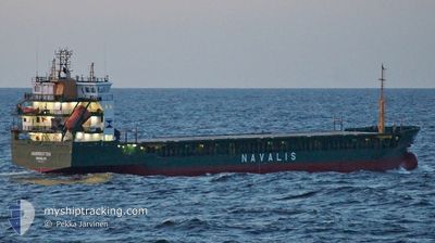
NORRBOTTEN
General Cargo
Current Trip
| Time Travelled | 4 days |
|---|---|
| Remaining Time | --- |
| Distance Travelled | 643.48 nm |
| Remaining Distance | --- |
| AVG Speed | 10.1 Knots |
| MAX Speed | 12.6 Knots |
| AVG Wind | 19.2 knots |
| MAX Wind | 26.9 knots |
| MIN Temp | -1.6°C / 29.12°F |
| MAX Temp | 7.6°C / 45.68°F |
| Draught | 4.2 m |
| Position Received | 12 h, 16 m ago |
Current Position
| Longitude | 23.66494° |
|---|---|
| Latitude | 57.94277° |
| Status | Under way using engine |
| Speed | 11.4 Knots |
| Course | 170.8° |
| Area | Gulf of Riga |
| Station | T-AIS |
| Position Received | 12 h, 16 m ago |
Info
Information
The current position of NORRBOTTEN is in Gulf of Riga with coordinates 57.94277° / 23.66494° as reported on 2024-04-24 10:04 by AIS to our vessel tracker app. The vessel's current speed is 11.4 Knots
The vessel NORRBOTTEN (IMO: 9191931, MMSI: 255624000) is a General Cargo that was built in 2001 ( 23 years old ). It's sailing under the flag of [PT] Portugal.
In this page you can find informations about the vessels current position, last detected port calls, and current voyage information. If the vessels is not in coverage by AIS you will find the latest position.
The current position of NORRBOTTEN is detected by our AIS receivers and we are not responsible for the reliability of the data. The last position was recorded while the vessel was in Coverage by the Ais receivers of our vessel tracking app.
The current draught of NORRBOTTEN as reported by AIS is 4.2 meters
Weather
| Temperature | 5.1°C / 41.18°F |
|---|---|
| Wind Speed | 9 knots |
| Direction | 58° ENE |
| Pressure | 1004 hPa |
| Humidity | 94.3 % |
| Cloud Coverage | 100 % |
Featured Company
Last Port Calls
| Port | Arrival | Departure | Time In Port |
|---|---|---|---|
| 2024-04-20 16:00 | |||
| 2024-04-16 20:25 | 2024-04-18 20:00 | 1 d | |
| 2024-04-15 06:31 | 2024-04-15 18:09 | 11 h | |
| 2024-04-14 04:32 | 2024-04-15 00:10 | 19 h | |
| 2024-03-31 12:59 | 2024-04-01 16:18 | 1 d | |
| 2024-03-27 20:34 | 2024-03-28 13:41 | 17 h | |
| 2024-03-25 11:04 | 2024-03-26 19:06 | 1 d | |
| 2024-03-22 04:40 | 2024-03-22 17:04 | 12 h | |
| 2024-03-19 06:02 | 2024-03-20 05:56 | 23 h | |
| 2024-03-16 18:27 | 2024-03-17 14:48 | 20 h |
Most Visited Ports (Last year)
| Port | Arrivals | |
|---|---|---|
| 8 | ||
| 8 | ||
| 7 | ||
| 6 | ||
| 6 | ||
| 5 |
Last Trips
| Origin | Departure | Destination | Arrival | Distance | |
|---|---|---|---|---|---|
| 2024-04-15 20:09 | 2024-04-16 22:25 | 293.27 nm | |||
| 2024-04-15 02:10 | 2024-04-15 08:31 | 74.55 nm | |||
| 2024-04-01 19:18 | 2024-04-14 06:32 | 800.78 nm | |||
| 2024-03-28 15:41 | 2024-03-31 15:59 | 371.78 nm | |||
| 2024-03-26 20:06 | 2024-03-27 22:34 | 287.79 nm | |||
| 2024-03-22 18:04 | 2024-03-25 12:04 | 404.55 nm | |||
| 2024-03-20 07:56 | 2024-03-22 05:40 | 481.08 nm | |||
| 2024-03-17 16:48 | 2024-03-19 08:02 | 402.77 nm | |||
| 2024-03-09 14:44 | 2024-03-16 20:27 | 1301.62 nm | |||
| 2024-03-03 17:40 | 2024-03-07 19:56 | 401.32 nm |
Events
| Time | Event | Details | Position / Dest | Info |
|---|---|---|---|---|
| 2024-04-24 15:12 | STOP Moving | 5.69 nm, North of RIGA |
57.04219 / 24.07589
LVRIX (VIA MUHU)
|
Speed: 0.2 kn Course: 192° |
| 2024-04-24 10:04 | OUT of Coverage |
57.94277 / 23.66494
Gulf of Riga
|
Speed: 11.4 kn Course: 170.8° |
|
| 2024-04-24 09:04 | Status Changed | Under way using engine Default |
58.13121 / 23.60022
LVRIX (VIA MUHU)
|
Speed: 11 kn Course: 171° |
| 2024-04-24 08:50 | Status Changed | Default Under way using engine |
58.17500 / 23.58667
LVRIX (VIA MUHU)
|
Speed: 12 kn Course: 171.4° |
| 2024-04-24 08:50 | IN Coverage |
58.13121 / 23.60022
Gulf of Riga
|
Speed: 11.5 kn Course: 171.9° |
|
| 2024-04-24 08:02 | OUT of Coverage |
58.33028 / 23.54564
Gulf of Riga
|
Speed: 12 kn Course: 171.4° |
|
| 2024-04-24 06:55 | Change Sea Area | Estonian part of the Gulf of Riga Estonian part of the Baltic Sea |
58.54276 / 23.47068
Gulf of Riga
LVRIX (VIA MUHU)
|
Speed: 11.4 kn Course: 159.7° |
| 2024-04-24 06:54 | Status Changed | Under way using engine Default |
58.54573 / 23.46862
LVRIX (VIA MUHU)
|
Speed: 11 kn Course: 154° |
| 2024-04-24 06:54 | IN Coverage |
58.54276 / 23.47068
Gulf of Riga
LVRIX (VIA MUHU)
|
Speed: 11.4 kn Course: 159.7° |
|
| 2024-04-24 02:08 | OUT of Coverage |
59.27209 / 23.15295
Baltic Sea
LVRIX (VIA MUHU)
|
Speed: 11.3 kn Course: 217.9° |