
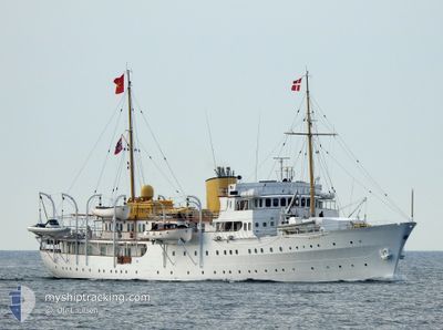
NORGE
Military ops
Current Trip
REDAL
| Time Travelled | 5 days |
|---|---|
| Remaining Time | --- |
| Distance Travelled | 545.26 nm |
| Remaining Distance | --- |
| AVG Speed | 11.4 Knots |
| MAX Speed | 16 Knots |
| AVG Wind | 13 knots |
| MAX Wind | 23 knots |
| MIN Temp | -1°C / 30.2°F |
| MAX Temp | 13.4°C / 56.12°F |
| Draught | 5 m |
| Position Received | 1 h, 43 m ago |
Current Position
| Longitude | 5.47110° |
|---|---|
| Latitude | 61.48862° |
| Status | Under way using engine |
| Speed | 9 Knots |
| Course | 58.6° |
| Area | Norwegian Sea |
| Station | T-AIS |
| Position Received | 1 h, 43 m ago |
Info
Information
The current position of NORGE is in Norwegian Sea with coordinates 61.48862° / 5.47110° as reported on 2024-04-18 04:59 by AIS to our vessel tracker app. The vessel's current speed is 9 Knots
The vessel NORGE (MMSI: 257001000) is a Military ops It's sailing under the flag of [NO] Norway.
In this page you can find informations about the vessels current position, last detected port calls, and current voyage information. If the vessels is not in coverage by AIS you will find the latest position.
The current position of NORGE is detected by our AIS receivers and we are not responsible for the reliability of the data. The last position was recorded while the vessel was in Coverage by the Ais receivers of our vessel tracking app.
The current draught of NORGE as reported by AIS is 5 meters
Weather
| Temperature | -2.1°C / 28.22°F |
|---|---|
| Wind Speed | 4 knots |
| Direction | 109° ESE |
| Pressure | 1014.8 hPa |
| Humidity | 73.8 % |
| Cloud Coverage | 97 % |
Featured Company
Last Port Calls
Most Visited Ports (Last year)
| Port | Arrivals | |
|---|---|---|
| 10 | ||
| 4 | ||
| 3 | ||
| 2 | ||
| 2 | ||
| 1 |
Last Trips
| Origin | Departure | Destination | Arrival | Distance | |
|---|---|---|---|---|---|
| 2024-04-06 09:59 | 2024-04-09 20:48 | 158.06 nm | |||
| 2024-04-05 15:20 | 2024-04-05 18:43 | 43.28 nm | |||
| 2024-04-04 10:23 | 2024-04-05 13:01 | 70.27 nm | |||
| 2024-03-13 11:21 | 2024-03-13 14:49 | 32.16 nm | |||
| 2024-02-14 11:14 | 2024-02-14 13:43 | 30.62 nm |
Events
| Time | Event | Details | Position / Dest | Info |
|---|---|---|---|---|
| 2024-04-18 04:59 | OUT of Coverage |
61.48862 / 5.47110
Norwegian Sea
REDAL
|
Speed: 9 kn Course: 58.6° |
|
| 2024-04-17 22:56 | Change Sea Area | Norwegian part of the Norwegian Sea Norwegian part of the North Sea |
61.00573 / 4.82691
Norwegian Sea
REDAL
|
Speed: 8.7 kn Course: 55.4° |
| 2024-04-17 18:14 | START Moving | 3.21 nm, South East of KNARREVIK |
60.32496 / 5.21503
REDAL
|
Speed: 3.9 kn Course: 274° |
| 2024-04-17 16:59 | STOP Moving | 3.38 nm, South East of KNARREVIK |
60.32471 / 5.22536
REDAL
|
Speed: 0.3 kn Course: 152° |
| 2024-04-17 15:47 | START Moving | 3.24 nm, East of HUFTHAMER |
60.13932 / 5.30378
REDAL
|
Speed: 3.3 kn Course: 298° |
| 2024-04-17 15:28 | Destination Changed | REDAL BJOERNAFJORDEN |
60.14037 / 5.30385
REDAL
|
Speed: 0.2 kn Course: 354° |
| 2024-04-17 15:28 | ETA Changed | 2024/04/18 08:00 2024/04/17 14:00 |
60.14037 / 5.30385
REDAL
|
Speed: 0.2 kn Course: 354° |
| 2024-04-17 15:26 | Status Changed | Under way using engine Restricted manoeuverability |
60.14037 / 5.30385
BJOERNAFJORDEN
|
Speed: 0.5 kn Course: 10° |
| 2024-04-17 14:40 | STOP Moving | 3.14 nm, East of HUFTHAMER |
60.13962 / 5.29984
BJOERNAFJORDEN
|
Speed: 0.3 kn Course: 339° |
| 2024-04-17 14:33 | Status Changed | Restricted manoeuverability Under way using engine |
60.13799 / 5.30204
BJOERNAFJORDEN
|
Speed: 4.3 kn Course: 322° |