
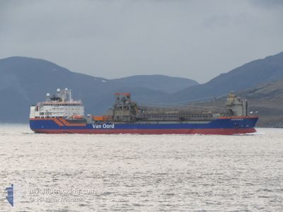
NORDNES
Pipe Burying Vessel
Current Trip
| Time Travelled | 8 days |
|---|---|
| Remaining Time | --- |
| Distance Travelled | 842.57 nm |
| Remaining Distance | --- |
| AVG Speed | 12.6 Knots |
| MAX Speed | 15.4 Knots |
| AVG Wind | 20.9 knots |
| MAX Wind | 36 knots |
| MIN Temp | 1.6°C / 34.88°F |
| MAX Temp | 7.7°C / 45.86°F |
| Draught | 10.8 m |
| Position Received | 1 d ago |
Current Position
| Longitude | 9.34472° |
|---|---|
| Latitude | 65.78536° |
| Status | Under way using engine |
| Speed | 12.1 Knots |
| Course | 242.4° |
| Area | Norwegian Sea |
| Station | T-AIS |
| Position Received | 1 d ago |
Info
Information
The current position of NORDNES is in Norwegian Sea with coordinates 65.78536° / 9.34472° as reported on 2024-04-14 19:37 by AIS to our vessel tracker app. The vessel's current speed is 12.1 Knots and is heading at the port of BERLIN. The estimated time of arrival as calculated by MyShipTracking vessel tracking app is 2024-04-15 00:45 LT
The vessel NORDNES (IMO: 9229910, MMSI: 244962000) is a Pipe Burying Vessel that was built in 2001 ( 23 years old ). It's sailing under the flag of [NL] Netherlands.
In this page you can find informations about the vessels current position, last detected port calls, and current voyage information. If the vessels is not in coverage by AIS you will find the latest position.
The current position of NORDNES is detected by our AIS receivers and we are not responsible for the reliability of the data. The last position was recorded while the vessel was in Coverage by the Ais receivers of our vessel tracking app.
The current draught of NORDNES as reported by AIS is 10.8 meters
Weather
| Temperature | 2.9°C / 37.22°F |
|---|---|
| Wind Speed | 10 knots |
| Direction | 328° NNW |
| Pressure | 1005.1 hPa |
| Humidity | 54.5 % |
| Cloud Coverage | 100 % |
Featured Company
Last Port Calls
| Port | Arrival | Departure | Time In Port |
|---|---|---|---|
| 2024-04-06 21:18 | 2024-04-07 13:19 | 16 h | |
| 2024-04-03 16:27 | 2024-04-03 23:29 | 7 h | |
| 2024-04-02 22:27 | 2024-04-03 10:28 | 12 h | |
| 2024-03-22 08:12 | 2024-03-27 12:59 | 5 d | |
| 2024-03-16 00:44 | 2024-03-16 17:40 | 16 h | |
| 2024-03-08 08:48 | 2024-03-09 19:22 | 1 d | |
| 2024-02-26 13:18 | 2024-02-28 01:21 | 1 d | |
| 2024-02-18 06:56 | 2024-02-18 23:29 | 16 h | |
| 2024-02-15 11:39 | 2024-02-15 18:17 | 6 h | |
| 2024-02-05 09:29 | 2024-02-06 15:33 | 1 d |
Most Visited Ports (Last year)
| Port | Arrivals | |
|---|---|---|
| 24 | ||
| 5 | ||
| 3 | ||
| 2 | ||
| 1 | ||
| 1 |
Last Trips
| Origin | Departure | Destination | Arrival | Distance | |
|---|---|---|---|---|---|
| 2024-04-04 01:29 | 2024-04-06 23:18 | 294.85 nm | |||
| 2024-04-03 12:28 | 2024-04-03 18:27 | 3.12 nm | |||
| 2024-03-27 13:59 | 2024-04-03 00:27 | 602.90 nm | |||
| 2024-03-16 18:40 | 2024-03-22 09:12 | 600.26 nm | |||
| 2024-03-09 20:22 | 2024-03-16 01:44 | 425.89 nm | |||
| 2024-02-28 02:21 | 2024-03-08 09:48 | 619.73 nm | |||
| 2024-02-19 00:29 | 2024-02-26 14:18 | 603.41 nm | |||
| 2024-02-15 19:17 | 2024-02-18 07:56 | 271.64 nm | |||
| 2024-02-06 16:33 | 2024-02-15 12:39 | 645.98 nm | |||
| 2024-01-24 21:11 | 2024-02-05 10:29 | 678.14 nm |
Events
| Time | Event | Details | Position / Dest | Info |
|---|---|---|---|---|
| 2024-04-14 19:37 | OUT of Coverage |
65.78536 / 9.34472
Norwegian Sea
BERLING PROJECT
|
Speed: 12.1 kn Course: 242.4° |
|
| 2024-04-14 10:30 | Draught Changed | 10.8 8 |
66.03009 / 12.67522
BERLING PROJECT
|
Speed: 8.9 kn Course: 245.7° |
| 2024-04-14 10:30 | Destination Changed | BERLING PROJECT NO JSS |
66.03009 / 12.67522
BERLING PROJECT
|
Speed: 8.9 kn Course: 245.7° |
| 2024-04-14 10:30 | ETA Changed | 2024/04/15 00:45 2024/04/13 17:00 |
66.03009 / 12.67522
BERLING PROJECT
|
Speed: 8.9 kn Course: 245.7° |
| 2024-04-14 10:29 | Status Changed | Under way using engine Moored |
66.03009 / 12.67522
NO JSS
|
Speed: 9.2 kn Course: 245.2° |
| 2024-04-14 09:46 | START Moving | 1.28 nm, South of SANDNESSJOEN |
66.00523 / 12.65638
NO JSS
|
Speed: 5.3 kn Course: 60.4° |
| 2024-04-13 18:32 | Status Changed | Moored Under way using engine |
66.00418 / 12.64973
NO JSS
|
Speed: Course: 45° |
| 2024-04-13 18:10 | STOP Moving | 1.31 nm, South of SANDNESSJOEN |
66.00411 / 12.64975
NO JSS
|
Speed: 0.1 kn Course: 47° |
| 2024-04-13 08:41 | Draught Changed | 8 10.8 |
65.64737 / 8.90166
NO JSS
|
Speed: 13.5 kn Course: 57.9° |
| 2024-04-13 08:41 | Destination Changed | NO JSS BERLING PROJECT |
65.64737 / 8.90166
NO JSS
|
Speed: 13.5 kn Course: 57.9° |