
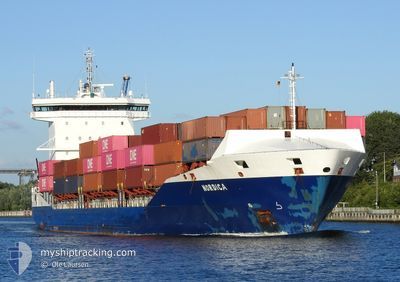
NORDICA
Container Ship
Current Trip
| Time Travelled | 2 days |
|---|---|
| Remaining Time | 1 day |
| Distance Travelled | 616.47 nm |
| Remaining Distance | 394.29 nm |
| AVG Speed | 10.4 Knots |
| MAX Speed | 18.3 Knots |
| AVG Wind | 11.2 knots |
| MAX Wind | 25 knots |
| MIN Temp | 1.9°C / 35.42°F |
| MAX Temp | 8.4°C / 47.12°F |
| Draught | 6.9 m |
| Position Received | 2 h, 12 m ago |
Current Position
| Longitude | 16.90924° |
|---|---|
| Latitude | 56.09378° |
| Status | Under way using engine |
| Speed | 12.9 Knots |
| Course | 53.8° |
| Area | Baltic Sea |
| Station | T-AIS |
| Position Received | 2 h, 12 m ago |
Info
Information
The current position of NORDICA is in Baltic Sea with coordinates 56.09378° / 16.90924° as reported on 2024-04-25 17:57 by AIS to our vessel tracker app. The vessel's current speed is 12.9 Knots and is heading at the port of KOTKA. The estimated time of arrival as calculated by MyShipTracking vessel tracking app is 2024-04-27 02:18 LT
The vessel NORDICA (IMO: 9483695, MMSI: 244201000) is a Container Ship that was built in 2011 ( 13 years old ). It's sailing under the flag of [NL] Netherlands.
In this page you can find informations about the vessels current position, last detected port calls, and current voyage information. If the vessels is not in coverage by AIS you will find the latest position.
The current position of NORDICA is detected by our AIS receivers and we are not responsible for the reliability of the data. The last position was recorded while the vessel was in Coverage by the Ais receivers of our vessel tracking app.
The current draught of NORDICA as reported by AIS is 6.9 meters
Weather
| Temperature | 3.2°C / 37.76°F |
|---|---|
| Wind Speed | 4 knots |
| Direction | 294° WNW |
| Pressure | 1007.7 hPa |
| Humidity | 86.6 % |
| Cloud Coverage | 22 % |
Featured Company
Last Port Calls
| Port | Arrival | Departure | Time In Port |
|---|---|---|---|
| 2024-04-23 02:43 | 2024-04-23 14:48 | 12 h | |
| 2024-04-22 14:31 | 2024-04-23 02:38 | 12 h | |
| 2024-04-21 14:43 | 2024-04-22 12:45 | 22 h | |
| 2024-04-19 19:51 | 2024-04-21 13:01 | 1 d | |
| 2024-04-18 03:48 | 2024-04-18 19:14 | 15 h | |
| 2024-04-11 21:47 | 2024-04-12 10:42 | 12 h | |
| 2024-04-07 15:37 | 2024-04-08 02:08 | 10 h | |
| 2024-04-05 17:16 | 2024-04-06 17:54 | 1 d | |
| 2024-04-05 11:12 | 2024-04-05 15:45 | 4 h | |
| 2024-04-03 22:09 | 2024-04-05 09:31 | 1 d |
Most Visited Ports (Last year)
| Port | Arrivals | |
|---|---|---|
| 35 | ||
| 13 | ||
| 12 | ||
| 12 | ||
| 10 | ||
| 9 |
Last Trips
| Origin | Departure | Destination | Arrival | Distance | |
|---|---|---|---|---|---|
| 2024-04-23 04:38 | 2024-04-23 04:43 | 0.94 nm | |||
| 2024-04-22 14:45 | 2024-04-22 16:31 | 16.03 nm | |||
| 2024-04-21 15:01 | 2024-04-21 16:43 | 16.61 nm | |||
| 2024-04-18 21:14 | 2024-04-19 21:51 | 303.67 nm | |||
| 2024-04-12 13:42 | 2024-04-18 05:48 | 862.58 nm | |||
| 2024-04-08 04:08 | 2024-04-12 00:47 | 789.72 nm | |||
| 2024-04-06 19:54 | 2024-04-07 17:37 | 242.57 nm | |||
| 2024-04-05 17:45 | 2024-04-05 19:16 | 16.32 nm | |||
| 2024-04-05 11:31 | 2024-04-05 13:12 | 16.69 nm | |||
| 2024-04-03 22:45 | 2024-04-04 00:09 | 15.56 nm |
Events
| Time | Event | Details | Position / Dest | Info |
|---|---|---|---|---|
| 2024-04-25 18:04 | Status Changed | Default Under way using engine |
56.11012 / 16.94838
KOTKA
|
Speed: 12.9 kn Course: 53.8° |
| 2024-04-25 17:57 | OUT of Coverage |
56.09378 / 16.90924
Baltic Sea
KOTKA
|
Speed: 12.9 kn Course: 53.8° |
|
| 2024-04-25 13:32 | Change Sea Area | Swedish part of the Baltic Sea Danish part of the Kattegat |
55.61793 / 15.41835
Baltic Sea
KOTKA
|
Speed: 13.7 kn Course: 62.5° |
| 2024-04-25 11:54 | Destination Changed | KOTKA NLRTM |
55.45893 / 14.88089
KOTKA
|
Speed: 13.6 kn Course: 61.5° |
| 2024-04-25 11:54 | ETA Changed | 2024/04/27 06:00 2024/04/19 19:00 |
55.45893 / 14.88089
KOTKA
|
Speed: 13.6 kn Course: 61.5° |
| 2024-04-25 11:50 | Destination Changed | NLRTM KOTKA |
55.45126 / 14.85653
NLRTM
|
Speed: 13.6 kn Course: 61.1° |
| 2024-04-25 11:50 | ETA Changed | 2024/04/19 19:00 2024/04/27 06:00 |
55.45126 / 14.85653
NLRTM
|
Speed: 13.6 kn Course: 61.1° |
| 2024-04-25 08:50 | Change Sea Area | Danish part of the Kattegat Swedish part of the Baltic Sea |
54.98326 / 14.02655
Kattegat
KOTKA
|
Speed: 13.4 kn Course: 70.5° |
| 2024-04-25 08:41 | Change Sea Area | Swedish part of the Baltic Sea German part of the Baltic Sea |
54.97217 / 13.97291
Baltic Sea
KOTKA
|
Speed: 13.3 kn Course: 70.5° |
| 2024-04-25 04:14 | Change Sea Area | German part of the Baltic Sea Danish part of the Baltic Sea |
54.59336 / 12.33589
Baltic Sea
KOTKA
|
Speed: 14 kn Course: 59.4° |