
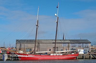
NOORDERLICHT
Sailing
Current Trip
SJLYR
| Time Travelled | 15 days |
|---|---|
| Remaining Time | --- |
| Distance Travelled | 938.81 nm |
| Remaining Distance | --- |
| AVG Speed | 6.1 Knots |
| MAX Speed | 10.2 Knots |
| AVG Wind | 10.7 knots |
| MAX Wind | 28 knots |
| MIN Temp | -9.9°C / 14.18°F |
| MAX Temp | 4.8°C / 40.64°F |
| Draught | 3.2 m |
| Position Received | 6 h, 23 m ago |
Current Position
| Longitude | 15.27374° |
|---|---|
| Latitude | 78.28943° |
| Status | Under way using engine |
| Speed | 6.7 Knots |
| Course | 96.3° |
| Area | Greenland Sea |
| Station | T-AIS |
| Position Received | 6 h, 23 m ago |
Info
Information
The current position of NOORDERLICHT is in Greenland Sea with coordinates 78.28943° / 15.27374° as reported on 2024-04-24 12:19 by AIS to our vessel tracker app. The vessel's current speed is 6.7 Knots
The vessel NOORDERLICHT (IMO: 8650813, MMSI: 244091000) is a Sailing It's sailing under the flag of [NL] Netherlands.
In this page you can find informations about the vessels current position, last detected port calls, and current voyage information. If the vessels is not in coverage by AIS you will find the latest position.
The current position of NOORDERLICHT is detected by our AIS receivers and we are not responsible for the reliability of the data. The last position was recorded while the vessel was in Coverage by the Ais receivers of our vessel tracking app.
The current draught of NOORDERLICHT as reported by AIS is 3.2 meters
Weather
| Temperature | -5.9°C / 21.38°F |
|---|---|
| Wind Speed | 3 knots |
| Direction | 95° E |
| Pressure | 1023.7 hPa |
| Humidity | 88 % |
| Cloud Coverage | 7 % |
Featured Company
Last Port Calls
| Port | Arrival | Departure | Time In Port |
|---|---|---|---|
| 2024-04-04 15:58 | 2024-04-09 06:35 | 4 d | |
| 2024-03-31 09:06 | 2024-04-02 10:19 | 2 d | |
| 2024-03-28 07:45 | 2024-03-29 06:13 | 22 h | |
| 2024-03-14 10:46 | 2024-03-23 12:21 | 9 d | |
| 2024-03-07 15:16 | 2024-03-14 09:43 | 6 d | |
| 2024-03-07 10:31 | 2024-03-07 11:23 | 51 m | |
| 2024-03-07 09:38 |
Most Visited Ports (Last year)
| Port | Arrivals | |
|---|---|---|
| 2 | ||
| 2 | ||
| 2 | ||
| 2 | ||
| 1 | ||
| 1 |
Last Trips
| Origin | Departure | Destination | Arrival | Distance | |
|---|---|---|---|---|---|
| 2024-04-02 12:19 | 2024-04-04 17:58 | 199.00 nm | |||
| 2024-03-29 07:13 | 2024-03-31 11:06 | 373.78 nm | |||
| 2024-03-23 13:21 | 2024-03-28 08:45 | 629.98 nm | |||
| 2024-03-14 10:43 | 2024-03-14 11:46 | 7.10 nm | |||
| 2024-03-07 12:23 | 2024-03-07 16:16 | 32.45 nm | |||
| 2024-03-07 10:38 | 2024-03-07 11:31 | 6.70 nm |
Events
| Time | Event | Details | Position / Dest | Info |
|---|---|---|---|---|
| 2024-04-24 12:53 | STOP Moving |
78.27589 / 15.56801
SJLYR
|
Speed: 0.2 kn Course: 116° |
|
| 2024-04-24 12:32 | Status Changed | Default Under way using engine |
78.28459 / 15.39353
SJLYR
|
Speed: 6.7 kn Course: 96.3° |
| 2024-04-24 12:19 | OUT of Coverage |
78.28943 / 15.27374
Greenland Sea
SJLYR
|
Speed: 6.7 kn Course: 96.3° |
|
| 2024-04-24 10:20 | Status Changed | Under way using engine Default |
78.17520 / 14.70480
SJLYR
|
Speed: 5.8 kn Course: 339° |
| 2024-04-24 10:13 | Status Changed | Default Under way using engine |
78.16479 / 14.72379
SJLYR
|
Speed: 5.9 kn Course: 338.4° |
| 2024-04-24 10:08 | Status Changed | Under way using engine Default |
78.15844 / 14.73522
SJLYR
|
Speed: 1.5 kn Course: 286° |
| 2024-04-24 09:37 | START Moving |
78.14105 / 14.80645
SJLYR
|
Speed: 4.1 kn Course: 310° |
|
| 2024-04-24 09:29 | Status Changed | Default Under way using engine |
78.13500 / 14.82667
SJLYR
|
Speed: 1.4 kn Course: 322° |
| 2024-04-24 09:29 | STOP Moving |
78.13500 / 14.82667
SJLYR
|
Speed: Course: -1° |
|
| 2024-04-24 09:25 | Status Changed | Under way using engine Default |
78.13577 / 14.82947
SJLYR
|
Speed: 2 kn Course: -1° |