
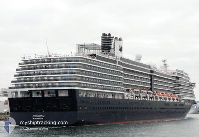
NOORDAM
Passengers Ship
Current Trip
US KHH
| Time Travelled | 17 h, 37 mins |
|---|---|
| Remaining Time | --- |
| Distance Travelled | 235.83 nm |
| Remaining Distance | --- |
| AVG Speed | 17.3 Knots |
| MAX Speed | 20 Knots |
| AVG Wind | 15 knots |
| MAX Wind | 27 knots |
| MIN Temp | 21.3°C / 70.34°F |
| MAX Temp | 23.9°C / 75.02°F |
| Draught | 8 m |
| Position Received | Now |
Current Position
| Longitude | -156.00166° |
|---|---|
| Latitude | 19.62711° |
| Status | At anchor |
| Speed | |
| Course | 143° |
| Area | North Pacific Ocean |
| Station | T-AIS |
| Position Received | Now |
Info
Information
The current position of NOORDAM is in North Pacific Ocean with coordinates 19.62711° / -156.00166° as reported on 2024-04-23 21:32 by AIS to our vessel tracker app. The vessel's current speed is 0 Knots
The vessel NOORDAM (IMO: 9230115, MMSI: 246028000) is a Passengers Ship that was built in 2006 ( 18 years old ). It's sailing under the flag of [NL] Netherlands.
In this page you can find informations about the vessels current position, last detected port calls, and current voyage information. If the vessels is not in coverage by AIS you will find the latest position.
The current position of NOORDAM is detected by our AIS receivers and we are not responsible for the reliability of the data. The last position was recorded while the vessel was in Coverage by the Ais receivers of our vessel tracking app.
The current draught of NOORDAM as reported by AIS is 8 meters
Weather
| Temperature | 23.4°C / 74.12°F |
|---|---|
| Wind Speed | 8 knots |
| Direction | 233° SW |
| Pressure | 1019.5 hPa |
| Humidity | 68.4 % |
| Cloud Coverage | 21 % |
Featured Company
Last Port Calls
| Port | Arrival | Departure | Time In Port |
|---|---|---|---|
| 2024-04-22 16:40 | 2024-04-23 03:56 | 11 h | |
| 2024-04-20 15:44 | 2024-04-22 09:03 | 1 d | |
| 2024-04-14 19:51 | 2024-04-15 05:02 | 9 h | |
| 2024-04-11 19:25 | 2024-04-12 04:44 | 9 h | |
| 2024-04-08 22:14 | 2024-04-09 07:47 | 9 h | |
| 2024-04-05 23:59 | 2024-04-06 11:36 | 11 h | |
| 2024-04-03 19:47 | 2024-04-04 06:22 | 10 h | |
| 2024-04-01 20:17 | 2024-04-02 11:03 | 14 h | |
| 2024-03-27 18:23 | 2024-03-28 04:19 | 9 h | |
| 2024-03-26 18:17 | 2024-03-27 05:52 | 11 h |
Last Trips
| Origin | Departure | Destination | Arrival | Distance | |
|---|---|---|---|---|---|
| 2024-04-21 23:03 | 2024-04-22 06:40 | 97.31 nm | |||
| 2024-04-14 18:02 | 2024-04-20 05:44 | 2273.16 nm | |||
| 2024-04-12 16:44 | 2024-04-14 08:51 | 860.71 nm | |||
| 2024-04-09 18:47 | 2024-04-12 07:25 | 800.96 nm | |||
| 2024-04-06 22:36 | 2024-04-09 09:14 | 1067.95 nm | |||
| 2024-04-04 17:22 | 2024-04-06 10:59 | 699.16 nm | |||
| 2024-04-02 22:03 | 2024-04-04 06:47 | 486.35 nm | |||
| 2024-03-28 17:19 | 2024-04-02 07:17 | 1560.62 nm | |||
| 2024-03-27 18:52 | 2024-03-28 07:23 | 173.70 nm | |||
| 2024-03-26 18:12 | 2024-03-27 07:17 | 226.33 nm |
Events
| Time | Event | Details | Position / Dest | Info |
|---|---|---|---|---|
| 2024-04-23 17:38 | Status Changed | At anchor Under way using engine |
19.62546 / -156.00171
US KHH
|
Speed: 0.1 kn Course: 160° |
| 2024-04-23 17:12 | STOP Moving |
19.62650 / -156.00268
US KHH
|
Speed: 0.3 kn Course: 14° |
|
| 2024-04-23 14:28 | Status Changed | Under way using engine Default |
20.01657 / -156.66576
US KHH
|
Speed: 16.5 kn Course: 126° |
| 2024-04-23 14:25 | IN Coverage |
20.01452 / -156.66260
North Pacific Ocean
US KHH
|
Speed: 16.5 kn Course: 124.2° |
|
| 2024-04-23 11:25 | Status Changed | Default Under way using engine |
20.55234 / -157.42711
US KHH
|
Speed: 20 kn Course: 126.8° |
| 2024-04-23 11:22 | OUT of Coverage |
20.56453 / -157.44453
North Pacific Ocean
US KHH
|
Speed: 20 kn Course: 126.8° |
|
| 2024-04-23 07:53 | Destination Changed | US KHH US NIJ |
21.21480 / -158.38899
US KHH
|
Speed: 18.7 kn Course: 130.9° |
| 2024-04-23 07:53 | ETA Changed | 2024/04/23 16:45 2024/04/22 16:30 |
21.21480 / -158.38899
US KHH
|
Speed: 18.7 kn Course: 130.9° |
| 2024-04-23 06:49 | Status Changed | Under way using engine Default |
21.43867 / -158.66179
US NIJ
|
Speed: 18.7 kn Course: 130° |
| 2024-04-23 06:41 | IN Coverage |
21.43397 / -158.65586
North Pacific Ocean
|
Speed: 18.6 kn Course: 130.6° |