
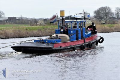
NOORD
Tug
Current Trip
| Trip Time | 2 days |
|---|---|
| Trip Distance | 131.79 nm |
| AVG Speed | 4.7 Knots |
| MAX Speed | 7.4 Knots |
| Draught | 0.2 m |
| AVG Wind | 11.6 knots |
| MAX Wind | 20 knots |
| MIN Temp | 8.3°C / 46.94°F |
| MAX Temp | 15.5°C / 59.9°F |
| Position Received | 8 d ago |
Current Position
| Longitude | 5.88973° |
|---|---|
| Latitude | 52.98349° |
| Status | Under way using engine |
| Speed | 0.1 Knots |
| Course | --- |
| Area | North Sea |
| Station | T-AIS |
| Position Received | 8 d ago |
Info
Information
The current position of NOORD is in North Sea with coordinates 52.98349° / 5.88973° as reported on 2024-04-10 15:53 by AIS to our vessel tracker app. The vessel's current speed is 0.1 Knots and is currently inside the port of HASKERDIJKEN.
The vessel NOORD (MMSI: 244700540) is a Tug It's sailing under the flag of [NL] Netherlands.
In this page you can find informations about the vessels current position, last detected port calls, and current voyage information. If the vessels is not in coverage by AIS you will find the latest position.
The current position of NOORD is detected by our AIS receivers and we are not responsible for the reliability of the data. The last position was recorded while the vessel was in Coverage by the Ais receivers of our vessel tracking app.
The current draught of NOORD as reported by AIS is 0.2 meters
Weather
| Temperature | 12°C / 53.6°F |
|---|---|
| Wind Speed | 12 knots |
| Direction | 241° WSW |
| Pressure | 1026.8 hPa |
| Humidity | 51.7 % |
| Cloud Coverage | 20 % |
Featured Company
Last Port Calls
| Port | Arrival | Departure | Time In Port |
|---|---|---|---|
| 2024-04-10 15:37 | |||
| 2024-03-27 18:19 | 2024-04-08 08:56 | 11 d | |
| 2024-03-27 16:14 | 2024-03-27 16:31 | 16 m | |
| 2024-03-27 11:59 | 2024-03-27 12:23 | 24 m | |
| 2024-03-25 17:20 | 2024-03-27 09:20 | 1 d | |
| 2024-03-25 08:04 | 2024-03-25 08:57 | 53 m | |
| 2024-03-20 11:25 | 2024-03-20 12:19 | 53 m | |
| 2024-03-19 11:25 | 2024-03-19 13:12 | 1 h | |
| 2024-03-18 17:51 | 2024-03-18 18:05 | 14 m | |
| 2024-03-18 17:39 | 2024-03-18 17:44 | 5 m |
Last Trips
| Origin | Departure | Destination | Arrival | Distance | |
|---|---|---|---|---|---|
| 2024-04-08 10:56 | 2024-04-10 17:37 | 131.79 nm | |||
| 2024-03-27 17:31 | 2024-03-27 19:19 | 8.91 nm | |||
| 2024-03-27 13:23 | 2024-03-27 17:14 | 13.57 nm | |||
| 2024-03-27 10:20 | 2024-03-27 12:59 | 7.42 nm | |||
| 2024-03-25 09:57 | 2024-03-25 18:20 | 32.42 nm | |||
| 2024-03-20 13:19 | 2024-03-25 09:04 | 1.07 nm | |||
| 2024-03-19 14:12 | 2024-03-20 12:25 | 38.20 nm | |||
| 2024-03-18 19:05 | 2024-03-19 12:25 | 39.83 nm | |||
| 2024-03-18 18:44 | 2024-03-18 18:51 | 0.20 nm | |||
| 2024-03-18 13:32 | 2024-03-18 18:39 | 24.98 nm |
Events
| Time | Event | Details | Position / Dest | Info |
|---|---|---|---|---|
| 2024-04-10 15:53 | OUT of Coverage |
52.98349 / 5.88973
North Sea
[NL] HASKERDIJKEN
|
Speed: 0.1 kn Course: 95.6° |
|
| 2024-04-10 15:37 | STOP Moving |
52.98344 / 5.88939
[NL] HASKERDIJKEN
|
Speed: 0.1 kn Course: 511° |
|
| 2024-04-10 15:37 | PORT ARRIVAL |
|
52.98344 / 5.88939
[NL] HASKERDIJKEN
|
Speed: 2.1 kn Course: 511° |
| 2024-04-10 15:06 | START Moving | 2.2 nm, South of AKKRUM |
53.01640 / 5.86126
ADAM__ _ _ _
|
Speed: 4.8 kn Course: 145.7° |
| 2024-04-10 15:00 | STOP Moving | 2.1 nm, South of AKKRUM |
53.01730 / 5.85715
ADAM__ _ _ _
|
Speed: 0.1 kn Course: 511° |
| 2024-04-10 10:58 | START Moving | 3.03 nm, West of BRILTIL |
53.24851 / 6.30715
ADAM__ _ _ _
|
Speed: 7 kn Course: 259.5° |
| 2024-04-10 10:50 | STOP Moving | 2.92 nm, West of BRILTIL |
53.24880 / 6.31036
ADAM__ _ _ _
|
Speed: 0.3 kn Course: 511° |
| 2024-04-10 10:47 | START Moving | 2.85 nm, West of BRILTIL |
53.24903 / 6.31226
ADAM__ _ _ _
|
Speed: 4.1 kn Course: 260.5° |
| 2024-04-10 10:39 | STOP Moving | 2.73 nm, West of BRILTIL |
53.24952 / 6.31546
ADAM__ _ _ _
|
Speed: 0.1 kn Course: 511° |
| 2024-04-10 09:09 | START Moving | 2.82 nm, West of GRONINGEN |
53.21535 / 6.48973
ADAM__ _ _ _
|
Speed: 5.1 kn Course: 353.2° |