
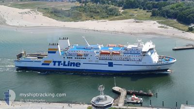
NILS DACKE
Ro-Ro/Passenger Ship
Current Trip
| Time Travelled | 15 h, 17 mins |
|---|---|
| Remaining Time | 4 h, 45 mins |
| Distance Travelled | 216.81 nm |
| Remaining Distance | 68.63 nm |
| AVG Speed | 14.3 Knots |
| MAX Speed | 15.2 Knots |
| AVG Wind | 13.3 knots |
| MAX Wind | 19 knots |
| MIN Temp | 5.7°C / 42.26°F |
| MAX Temp | 7.1°C / 44.78°F |
| Draught | 5.6 m |
| Position Received | 18 m ago |
Current Position
| Longitude | --- |
|---|---|
| Latitude | --- |
| Status | Under way using engine |
| Speed | 13.5 Knots |
| Course | 250.2° |
| Area | Kattegat |
| Station | T-AIS |
| Position Received | 18 m ago |
Info
Information
The current position of NILS DACKE is in Kattegat with coordinates 55.51017° / 14.83215° as reported on 2025-12-07 07:45 by AIS to our vessel tracker app. The vessel's current speed is 13.5 Knots and is heading at the port of TRELLEBORG. The estimated time of arrival as calculated by MyShipTracking vessel tracking app is 2025-12-07 13:48 LT
The vessel NILS DACKE (IMO: 9087465, MMSI: 212499000) is a Ro-Ro/Passenger Ship that was built in 1995 ( 30 years old ). It's sailing under the flag of [CY] Cyprus.
In this page you can find informations about the vessels current position, last detected port calls, and current voyage information. If the vessels is not in coverage by AIS you will find the latest position.
The current position of NILS DACKE is detected by our AIS receivers and we are not responsible for the reliability of the data. The last position was recorded while the vessel was in Coverage by the Ais receivers of our vessel tracking app.
The current draught of NILS DACKE as reported by AIS is 5.6 meters
Weather
| Temperature | 6.3°C / 43.34°F |
|---|---|
| Wind Speed | 11 knots |
| Direction | 169° S |
| Pressure | 1007.6 hPa |
| Humidity | 88.8 % |
| Cloud Coverage | 100 % |
Featured Company
Last Port Calls
| Port | Arrival | Departure | Time In Port |
|---|---|---|---|
| 2025-12-06 08:06 | 2025-12-06 18:46 | 10 h | |
| 2025-12-05 08:43 | 2025-12-05 18:19 | 9 h | |
| 2025-12-04 10:09 | 2025-12-04 20:01 | 9 h | |
| 2025-12-03 09:40 | 2025-12-03 20:33 | 10 h | |
| 2025-12-02 17:40 | 2025-12-02 21:34 | 3 h | |
| 2025-12-01 22:01 | 2025-12-02 00:24 | 2 h | |
| 2025-12-01 14:33 | 2025-12-01 16:58 | 2 h | |
| 2025-12-01 08:28 | 2025-12-01 11:45 | 3 h | |
| 2025-11-30 22:05 | 2025-12-01 00:38 | 2 h | |
| 2025-11-30 13:37 | 2025-11-30 16:25 | 2 h |
Most Visited Ports (Last year)
| Port | Arrivals | |
|---|---|---|
| 212 | ||
| 110 | ||
| 102 | ||
| 85 | ||
| 47 | ||
| 35 |
Last Trips
| Origin | Departure | Destination | Arrival | Distance | |
|---|---|---|---|---|---|
| 2025-12-05 18:19 | 2025-12-06 08:06 | 216.91 nm | |||
| 2025-12-04 20:01 | 2025-12-05 08:43 | 217.78 nm | |||
| 2025-12-03 20:33 | 2025-12-04 10:09 | 217.10 nm | |||
| 2025-12-02 21:34 | 2025-12-03 09:40 | 218.68 nm | |||
| 2025-12-02 00:24 | 2025-12-02 17:40 | 283.14 nm | |||
| 2025-12-01 16:58 | 2025-12-01 22:01 | 80.40 nm | |||
| 2025-12-01 11:45 | 2025-12-01 14:33 | 48.53 nm | |||
| 2025-12-01 00:38 | 2025-12-01 08:28 | 118.98 nm | |||
| 2025-11-30 16:25 | 2025-11-30 22:05 | 95.60 nm | |||
| 2025-11-30 07:25 | 2025-11-30 13:37 | 96.35 nm |
Events
| Time | Event | Details | Position / Dest | Info |
|---|---|---|---|---|
| 2025-12-07 07:53 | Status Changed | Default Under way using engine |
55.49858 / 14.78433
SETRG
|
Speed: 13.5 kn Course: 250.2° |
| 2025-12-07 07:44 | Status Changed | Under way using engine Default |
55.51162 / 14.83920
SETRG
|
Speed: 13.5 kn Course: 250° |
| 2025-12-07 07:41 | Status Changed | Default Under way using engine |
55.51546 / 14.85767
SETRG
|
Speed: 13.5 kn Course: 251.3° |
| 2025-12-07 07:36 | Status Changed | Under way using engine Default |
55.52190 / 14.89002
SETRG
|
Speed: 13.5 kn Course: 250° |
| 2025-12-07 07:33 | Status Changed | Default Under way using engine |
55.52502 / 14.90583
SETRG
|
Speed: 13.5 kn Course: 250.1° |
| 2025-12-07 07:27 | Detected in Sea | Danish part of the Kattegat |
55.53297 / 14.94528
Kattegat
SETRG
|
Speed: 13.5 kn Course: 250.1° |
| 2025-12-07 07:24 | Status Changed | Under way using engine Default |
55.53608 / 14.96095
SETRG
|
Speed: 13.4 kn Course: 252° |
| 2025-12-07 07:24 | IN Coverage |
55.53297 / 14.94528
Kattegat
SETRG
|
Speed: 13.5 kn Course: 250.1° |
|
| 2025-12-06 17:31 | Status Changed | Default Under way using engine |
55.74430 / 20.77823
SETRG
|
Speed: 15.2 kn Course: 271.8° |
| 2025-12-06 17:20 | OUT of Coverage |
55.74388 / 20.85427
Baltic Sea
SETRG
|
Speed: 15.2 kn Course: 271.8° |