
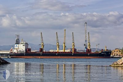
NIKOS N
Bulk Carrier
Current Trip
| Time Travelled | 46 days |
|---|---|
| Remaining Time | --- |
| Distance Travelled | 10470.58 nm |
| Remaining Distance | --- |
| AVG Speed | 11.1 Knots |
| MAX Speed | 15.8 Knots |
| AVG Wind | 12.9 knots |
| MAX Wind | 30 knots |
| MIN Temp | 16.9°C / 62.42°F |
| MAX Temp | 30.5°C / 86.9°F |
| Draught | 12.7 m |
| Position Received | 9 d ago |
Current Position
| Longitude | 16.83929° |
|---|---|
| Latitude | -33.08830° |
| Status | Under way using engine |
| Speed | 12.1 Knots |
| Course | 318.5° |
| Area | South Atlantic Ocean |
| Station | T-AIS |
| Position Received | 9 d ago |
Info
Information
The current position of NIKOS N is in South Atlantic Ocean with coordinates -33.08830° / 16.83929° as reported on 2024-04-10 00:32 by AIS to our vessel tracker app. The vessel's current speed is 12.1 Knots and is heading at the port of AVILES. The estimated time of arrival as calculated by MyShipTracking vessel tracking app is 2024-04-28 05:00 LT
The vessel NIKOS N (IMO: 9412646, MMSI: 538007185) is a Bulk Carrier that was built in 2011 ( 13 years old ). It's sailing under the flag of [MH] Marshall Is.
In this page you can find informations about the vessels current position, last detected port calls, and current voyage information. If the vessels is not in coverage by AIS you will find the latest position.
The current position of NIKOS N is detected by our AIS receivers and we are not responsible for the reliability of the data. The last position was recorded while the vessel was in Coverage by the Ais receivers of our vessel tracking app.
The current draught of NIKOS N as reported by AIS is 12.7 meters
Weather
| Temperature | 29.1°C / 84.38°F |
|---|---|
| Wind Speed | 11 knots |
| Direction | 153° SSE |
| Pressure | 1010.9 hPa |
| Humidity | 76.3 % |
| Cloud Coverage | 65 % |
Featured Company
Events
| Time | Event | Details | Position / Dest | Info |
|---|---|---|---|---|
| 2024-04-10 00:36 | Status Changed | Default Under way using engine |
-33.07768 / 16.82842
ES AVS
|
Speed: 12.1 kn Course: 318.5° |
| 2024-04-10 00:32 | OUT of Coverage |
-33.08830 / 16.83929
South Atlantic Ocean
ES AVS
|
Speed: 12.1 kn Course: 318.5° |
|
| 2024-04-10 00:31 | Status Changed | Under way using engine Default |
-33.08952 / 16.84057
ES AVS
|
Speed: 12.1 kn Course: 319° |
| 2024-04-10 00:12 | Status Changed | Default Under way using engine |
-33.13903 / 16.89215
ES AVS
|
Speed: 12.3 kn Course: 319.8° |
| 2024-04-09 23:57 | Status Changed | Under way using engine Default |
-33.17680 / 16.92954
ES AVS
|
Speed: 12.6 kn Course: 320° |
| 2024-04-09 23:40 | Status Changed | Default Under way using engine |
-33.22595 / 16.97915
ES AVS
|
Speed: 12.9 kn Course: 318.9° |
| 2024-04-09 23:34 | Status Changed | Under way using engine Default |
-33.24056 / 16.99419
ES AVS
|
Speed: 12.8 kn Course: 320° |
| 2024-04-09 23:27 | IN Coverage |
-33.24056 / 16.99419
South Atlantic Ocean
ES AVS
|
Speed: 12.8 kn Course: 319° |
|
| 2024-04-09 21:35 | Status Changed | Default Under way using engine |
-33.56425 / 17.32095
ES AVS
|
Speed: 12.1 kn Course: 326.4° |
| 2024-04-09 21:23 | OUT of Coverage |
-33.59584 / 17.34673
South Atlantic Ocean
ES AVS
|
Speed: 12.1 kn Course: 326.4° |