
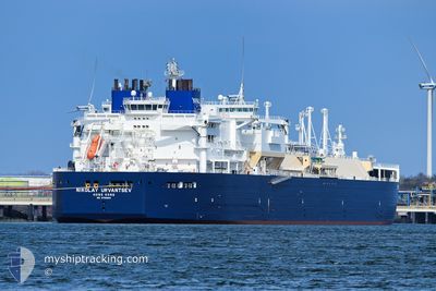
NIKOLAY URVANTSEV
Tanker B
Current Trip
AS PER ORDERS
| Time Travelled | 5 days |
|---|---|
| Remaining Time | --- |
| Distance Travelled | 1018.92 nm |
| Remaining Distance | --- |
| AVG Speed | 8.9 Knots |
| MAX Speed | 17.6 Knots |
| AVG Wind | 13.9 knots |
| MAX Wind | 26 knots |
| MIN Temp | -24.6°C / -12.28°F |
| MAX Temp | -0.4°C / 31.28°F |
| Draught | 10.3 m |
| Position Received | 19 d ago |
Current Position
| Longitude | 27.04454° |
|---|---|
| Latitude | 72.33569° |
| Status | Under way using engine |
| Speed | 20.9 Knots |
| Course | 50.9° |
| Area | Barentsz Sea |
| Station | T-AIS |
| Position Received | 19 d ago |
Info
Information
The current position of NIKOLAY URVANTSEV is in Barentsz Sea with coordinates 72.33569° / 27.04454° as reported on 2024-04-05 23:35 by AIS to our vessel tracker app. The vessel's current speed is 20.9 Knots
The vessel NIKOLAY URVANTSEV (IMO: 9750660, MMSI: 477327300) is a Tanker B It's sailing under the flag of [HK] Hong Kong.
In this page you can find informations about the vessels current position, last detected port calls, and current voyage information. If the vessels is not in coverage by AIS you will find the latest position.
The current position of NIKOLAY URVANTSEV is detected by our AIS receivers and we are not responsible for the reliability of the data. The last position was recorded while the vessel was in Coverage by the Ais receivers of our vessel tracking app.
The current draught of NIKOLAY URVANTSEV as reported by AIS is 10.3 meters
Weather
| Temperature | -1.7°C / 28.94°F |
|---|---|
| Wind Speed | 13 knots |
| Direction | 144° SE |
| Pressure | 1021.7 hPa |
| Humidity | 85.8 % |
| Cloud Coverage | 100 % |
Featured Company
Last Port Calls
| Port | Arrival | Departure | Time In Port |
|---|---|---|---|
| 2024-04-20 10:36 | |||
| 2024-04-09 02:04 | 2024-04-10 00:28 | 22 h | |
| 2024-03-31 05:33 | 2024-04-01 15:49 | 1 d | |
| 2024-03-20 21:42 | 2024-03-22 01:56 | 1 d | |
| 2024-03-09 07:20 | 2024-03-10 06:04 | 22 h | |
| 2024-02-27 19:27 | |||
| 2024-02-14 05:19 | 2024-02-15 03:56 | 22 h | |
| 2024-02-03 23:09 |
Last Trips
| Origin | Departure | Destination | Arrival | Distance | |
|---|---|---|---|---|---|
| 2024-04-01 17:49 | 2024-04-09 07:04 | 3190.96 nm | |||
| 2024-03-22 06:56 | 2024-03-31 07:33 | 3196.76 nm | |||
| 2024-03-10 11:04 | 2024-03-21 02:42 | 2588.54 nm | |||
| 2024-02-28 00:27 | 2024-03-09 12:20 | 2340.02 nm | |||
| 2024-02-04 04:09 | 2024-02-14 06:19 | 3412.24 nm |
Events
| Time | Event | Details | Position / Dest | Info |
|---|---|---|---|---|
| 2024-04-21 16:46 | START Moving |
74.82833 / 70.76166
AS PER ORDERS
|
Speed: 4 kn Course: -1° |
|
| 2024-04-21 16:16 | STOP Moving |
74.84500 / 70.76833
AS PER ORDERS
|
Speed: Course: -1° |
|
| 2024-04-21 03:19 | START Moving |
73.57333 / 72.49667
AS PER ORDERS
|
Speed: 5 kn Course: 346° |
|
| 2024-04-21 02:51 | STOP Moving |
73.56512 / 72.57129
AS PER ORDERS
|
Speed: 0.1 kn Course: 12° |
|
| 2024-04-20 17:13 | START Moving |
72.14333 / 73.12666
AS PER ORDERS
|
Speed: 4 kn Course: -1° |
|
| 2024-04-20 16:01 | STOP Moving |
72.14833 / 73.13834
AS PER ORDERS
|
Speed: Course: -1° |
|
| 2024-04-20 11:25 | START Moving | 5.41 nm, North East of SABETTA |
71.33947 / 72.28719
AS PER ORDERS
|
Speed: 8.7 kn Course: 53° |
| 2024-04-20 11:14 | STOP Moving | 4.9 nm, North East of SABETTA |
71.33409 / 72.26647
AS PER ORDERS
|
Speed: 0.1 kn Course: 49° |
| 2024-04-20 10:36 | PORT DEPARTURE |
|
71.30645 / 72.17549
AS PER ORDERS
|
Speed: 0.9 kn Course: 63° |