
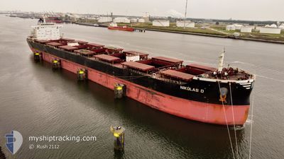
NIKOLAS D
Cargo
Current Trip
| Time Travelled | 3 days |
|---|---|
| Remaining Time | --- |
| Distance Travelled | 1079.35 nm |
| Remaining Distance | --- |
| AVG Speed | 11.6 Knots |
| MAX Speed | 12.7 Knots |
| AVG Wind | 9.1 knots |
| MAX Wind | 13.1 knots |
| MIN Temp | 17.1°C / 62.78°F |
| MAX Temp | 28.9°C / 84.02°F |
| Draught | 12.6 m |
| Position Received | 2 d ago |
Current Position
| Longitude | -40.51351° |
|---|---|
| Latitude | -22.07993° |
| Status | Under way using engine |
| Speed | 11.6 Knots |
| Course | 49.3° |
| Area | South Atlantic Ocean |
| Station | T-AIS |
| Position Received | 2 d ago |
Info
Information
The current position of NIKOLAS D is in South Atlantic Ocean with coordinates -22.07993° / -40.51351° as reported on 2024-04-23 19:02 by AIS to our vessel tracker app. The vessel's current speed is 11.6 Knots and is heading at the port of AMSTERDAM. The estimated time of arrival as calculated by MyShipTracking vessel tracking app is 2024-05-09 20:00 LT
The vessel NIKOLAS D (IMO: 9474723, MMSI: 352993000) is a Cargo It's sailing under the flag of [PA] Panama.
In this page you can find informations about the vessels current position, last detected port calls, and current voyage information. If the vessels is not in coverage by AIS you will find the latest position.
The current position of NIKOLAS D is detected by our AIS receivers and we are not responsible for the reliability of the data. The last position was recorded while the vessel was in Coverage by the Ais receivers of our vessel tracking app.
The current draught of NIKOLAS D as reported by AIS is 12.6 meters
Weather
| Temperature | 28.6°C / 83.48°F |
|---|---|
| Wind Speed | 8 knots |
| Direction | 43° NE |
| Pressure | 1011.2 hPa |
| Humidity | 73.5 % |
| Cloud Coverage | 5 % |
Featured Company
Last Port Calls
| Port | Arrival | Departure | Time In Port |
|---|---|---|---|
| 2024-04-19 22:11 | 2024-04-22 00:19 | 2 d | |
| 2024-02-29 07:08 | 2024-03-02 11:28 | 2 d | |
| 2024-02-04 03:28 | 2024-02-06 03:31 | 2 d |
Most Visited Ports (Last year)
| Port | Arrivals | |
|---|---|---|
| 3 | ||
| 1 | ||
| 1 | ||
| 1 | ||
| 1 | ||
| 1 |
Last Trips
| Origin | Departure | Destination | Arrival | Distance | |
|---|---|---|---|---|---|
| 2024-03-02 16:58 | 2024-04-19 19:11 | 9442.40 nm | |||
| 2024-02-06 13:31 | 2024-02-29 12:38 | 5614.84 nm | |||
| 2024-01-15 15:02 | 2024-02-04 13:28 | 3683.98 nm |
Events
| Time | Event | Details | Position / Dest | Info |
|---|---|---|---|---|
| 2024-04-23 19:06 | Status Changed | Default Under way using engine |
-22.07176 / -40.50333
NL AMS
|
Speed: 11.6 kn Course: 49.3° |
| 2024-04-23 19:02 | OUT of Coverage |
-22.07993 / -40.51351
South Atlantic Ocean
NL AMS
|
Speed: 11.6 kn Course: 49.3° |
|
| 2024-04-23 19:02 | Status Changed | Under way using engine Default |
-22.08024 / -40.51391
NL AMS
|
Speed: 11.6 kn Course: 48° |
| 2024-04-23 19:00 | Status Changed | Default Under way using engine |
-22.08419 / -40.51871
NL AMS
|
Speed: 11.5 kn Course: 47.3° |
| 2024-04-23 18:46 | Status Changed | Under way using engine Default |
-22.11464 / -40.55546
NL AMS
|
Speed: 11.4 kn Course: 49° |
| 2024-04-23 18:35 | Status Changed | Default Under way using engine |
-22.13833 / -40.58500
NL AMS
|
Speed: 11.4 kn Course: 50.4° |
| 2024-04-23 18:04 | Status Changed | Under way using engine Default |
-22.19956 / -40.66637
NL AMS
|
Speed: 11.3 kn Course: 52° |
| 2024-04-23 17:53 | IN Coverage |
-22.19956 / -40.66637
South Atlantic Ocean
NL AMS
|
Speed: 11.3 kn Course: 51.8° |
|
| 2024-04-23 16:44 | Status Changed | Default Under way using engine |
-22.36618 / -40.86972
NL AMS
|
Speed: 11.2 kn Course: 48.6° |
| 2024-04-23 16:39 | OUT of Coverage |
-22.37647 / -40.88258
South Atlantic Ocean
NL AMS
|
Speed: 11.2 kn Course: 48.6° |