
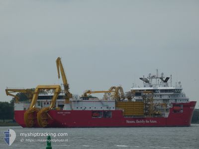
NEXANS AURORA
Dredging or underwater ops
Current Trip
| Time Travelled | 5 days |
|---|---|
| Remaining Time | 4 days |
| Distance Travelled | 1740.29 nm |
| Remaining Distance | 1130.48 nm |
| AVG Speed | 12.2 Knots |
| MAX Speed | 14.9 Knots |
| AVG Wind | 16.2 knots |
| MAX Wind | 36.9 knots |
| MIN Temp | 10.4°C / 50.72°F |
| MAX Temp | 17.4°C / 63.32°F |
| Draught | 6.5 m |
| Position Received | 3 h, 50 m ago |
Current Position
| Longitude | -4.42279° |
|---|---|
| Latitude | 49.23840° |
| Status | Under way using engine |
| Speed | 10.9 Knots |
| Course | 59.5° |
| Area | English Channel |
| Station | T-AIS |
| Position Received | 3 h, 50 m ago |
Info
Information
The current position of NEXANS AURORA is in English Channel with coordinates 49.23840° / -4.42279° as reported on 2024-04-23 11:22 by AIS to our vessel tracker app. The vessel's current speed is 10.9 Knots and is heading at the port of HALDEN. The estimated time of arrival as calculated by MyShipTracking vessel tracking app is 2024-04-27 18:20 LT
The vessel NEXANS AURORA (IMO: 9862059, MMSI: 257682000) is a Dredging or underwater ops It's sailing under the flag of [NO] Norway.
In this page you can find informations about the vessels current position, last detected port calls, and current voyage information. If the vessels is not in coverage by AIS you will find the latest position.
The current position of NEXANS AURORA is detected by our AIS receivers and we are not responsible for the reliability of the data. The last position was recorded while the vessel was in Coverage by the Ais receivers of our vessel tracking app.
The current draught of NEXANS AURORA as reported by AIS is 6.5 meters
Weather
| Temperature | 10.4°C / 50.72°F |
|---|---|
| Wind Speed | 7 knots |
| Direction | 27° NNE |
| Pressure | 1025.4 hPa |
| Humidity | 77.1 % |
| Cloud Coverage | 67 % |
Featured Company
Last Port Calls
| Port | Arrival | Departure | Time In Port |
|---|---|---|---|
| 2024-04-17 05:15 | 2024-04-17 17:02 | 11 h | |
| 2024-04-03 18:20 | 2024-04-03 21:55 | 3 h | |
| 2024-03-18 23:13 | 2024-03-21 05:34 | 2 d | |
| 2024-03-14 05:22 | 2024-03-17 13:07 | 3 d | |
| 2024-03-08 19:36 | 2024-03-08 22:16 | 2 h | |
| 2024-03-08 05:54 | 2024-03-08 07:40 | 1 h | |
| 2024-03-07 03:49 | 2024-03-07 22:22 | 18 h | |
| 2024-03-06 05:54 | 2024-03-06 14:01 | 8 h | |
| 2024-02-25 16:04 | 2024-03-04 08:41 | 7 d | |
| 2024-02-09 07:23 |
Most Visited Ports (Last year)
| Port | Arrivals | |
|---|---|---|
| 8 | ||
| 3 | ||
| 2 | ||
| 2 | ||
| 2 | ||
| 2 |
Last Trips
| Origin | Departure | Destination | Arrival | Distance | |
|---|---|---|---|---|---|
| 2024-04-03 23:55 | 2024-04-17 07:15 | 188.83 nm | |||
| 2024-03-21 06:34 | 2024-04-03 20:20 | 2768.43 nm | |||
| 2024-03-17 14:07 | 2024-03-19 00:13 | 324.98 nm | |||
| 2024-03-08 23:16 | 2024-03-14 06:22 | 449.22 nm | |||
| 2024-03-08 08:40 | 2024-03-08 20:36 | 3.58 nm | |||
| 2024-03-07 23:22 | 2024-03-08 06:54 | 0.18 nm | |||
| 2024-03-06 15:01 | 2024-03-07 04:49 | 132.98 nm | |||
| 2024-03-04 09:41 | 2024-03-06 06:54 | 58.30 nm | |||
| 2024-02-09 08:23 | 2024-02-25 17:04 | 918.35 nm |
Events
| Time | Event | Details | Position / Dest | Info |
|---|---|---|---|---|
| 2024-04-23 11:22 | OUT of Coverage |
49.23840 / -4.42279
English Channel
NO HAL
|
Speed: 10.9 kn Course: 59.5° |
|
| 2024-04-23 09:19 | Detected in Sea | French part of the English Channel |
49.04845 / -4.89711
English Channel
NO HAL
|
Speed: 10.8 kn Course: 63.3° |
| 2024-04-23 07:39 | Detected in Sea | French part of the Celtic Sea |
48.88576 / -5.33251
Celtic Sea
NO HAL
|
Speed: 12.6 kn Course: 59.1° |
| 2024-04-23 07:39 | IN Coverage |
48.88576 / -5.33251
Celtic Sea
NO HAL
|
Speed: 12.6 kn Course: 59.1° |
|
| 2024-04-22 01:25 | OUT of Coverage |
43.75723 / -9.43898
North Atlantic Ocean
NO HAL
|
Speed: 8.2 kn Course: 0.6° |
|
| 2024-04-21 21:26 | IN Coverage |
43.30208 / -9.71988
North Atlantic Ocean
NO HAL
|
Speed: 7.1 kn Course: 22.7° |
|
| 2024-04-21 18:04 | OUT of Coverage |
42.79383 / -9.79204
North Atlantic Ocean
NO HAL
|
Speed: 11.8 kn Course: 358.4° |
|
| 2024-04-21 17:36 | IN Coverage |
42.70048 / -9.79056
North Atlantic Ocean
NO HAL
|
Speed: 12.9 kn Course: 359.6° |
|
| 2024-04-21 15:05 | OUT of Coverage |
42.12800 / -9.79595
North Atlantic Ocean
NO HAL
|
Speed: 13.9 kn Course: 2.1° |
|
| 2024-04-21 13:37 | Change Sea Area | Spanish part of the North Atlantic Ocean Portuguese part of the North Atlantic Ocean |
41.78927 / -9.80534
North Atlantic Ocean
NO HAL
|
Speed: 14.2 kn Course: 0.9° |