
NEW PROSPERITY
Tanker
Current Trip
CN JYG
| Time Travelled | --- |
|---|---|
| Remaining Time | --- |
| Distance Travelled | 12705.21 nm |
| Remaining Distance | --- |
| AVG Speed | 12.4 Knots |
| MAX Speed | 15 Knots |
| AVG Wind | 12.3 knots |
| MAX Wind | 35 knots |
| MIN Temp | 14.8°C / 58.64°F |
| MAX Temp | 29.9°C / 85.82°F |
| Draught | 20 m |
| Position Received | 1 d ago |
Current Position
| Longitude | 96.88927° |
|---|---|
| Latitude | 6.10597° |
| Status | Under way using engine |
| Speed | 12 Knots |
| Course | 99° |
| Area | Malacca Strait |
| Station | T-AIS |
| Position Received | 1 d ago |
Info
Information
The current position of NEW PROSPERITY is in Malacca Strait with coordinates 6.10597° / 96.88927° as reported on 2024-04-18 04:19 by AIS to our vessel tracker app. The vessel's current speed is 12 Knots
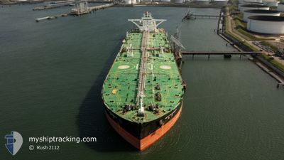
The vessel NEW PROSPERITY (MMSI: 477699100) is a Tanker It's sailing under the flag of [HK] Hong Kong.
In this page you can find informations about the vessels current position, last detected port calls, and current voyage information. If the vessels is not in coverage by AIS you will find the latest position.
The current position of NEW PROSPERITY is detected by our AIS receivers and we are not responsible for the reliability of the data. The last position was recorded while the vessel was in Coverage by the Ais receivers of our vessel tracking app.
The current draught of NEW PROSPERITY as reported by AIS is 20 meters
Weather
| Temperature | 29.4°C / 84.92°F |
|---|---|
| Wind Speed | 5 knots |
| Direction | 359° N |
| Pressure | 1010.3 hPa |
| Humidity | 69.2 % |
| Cloud Coverage | 94 % |
Featured Company
Most Visited Ports (Last year)
| Port | Arrivals | |
|---|---|---|
| 2 | ||
| 2 | ||
| 2 | ||
| 1 | ||
| 1 |
Last Trips
| Origin | Departure | Destination | Arrival | Distance |
|---|
Events
| Time | Event | Details | Position / Dest | Info |
|---|---|---|---|---|
| 2024-04-18 04:19 | OUT of Coverage |
6.10597 / 96.88927
Malacca Strait
|
Speed: 12 kn Course: 99° |
|
| 2024-04-18 02:43 | Draught Changed | 20 20.7 |
6.15576 / 96.55882
CN JYG
|
Speed: 12.1 kn Course: 101° |
| 2024-04-18 02:41 | Change Sea Area | Indonesian part of the Malacca Strait Saint Lucia part of the Caribbean Sea |
6.15621 / 96.55652
Malacca Strait
CN JYG
|
Speed: 12.2 kn Course: 102° |
| 2024-04-18 02:41 | Status Changed | Under way using engine Default |
6.15621 / 96.55652
CN JYG
|
Speed: 12.2 kn Course: 99° |
| 2024-04-18 02:41 | IN Coverage |
6.15621 / 96.55652
Malacca Strait
CN JYG
|
Speed: 12.2 kn Course: 102° |