
NEW HONOR
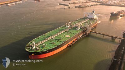
Tanker
Current Trip
| Time Travelled | --- |
|---|---|
| Remaining Time | --- |
| Distance Travelled | 8817.75 nm |
| Remaining Distance | --- |
| AVG Speed | 12.7 Knots |
| MAX Speed | 12.7 Knots |
| AVG Wind | 11.1 knots |
| MAX Wind | 31.8 knots |
| MIN Temp | 2.7°C / 36.86°F |
| MAX Temp | 29.9°C / 85.82°F |
| Draught | 10.8 m |
| Position Received | 2 h, 52 m ago |
Current Position
| Longitude | 103.50726° |
|---|---|
| Latitude | 1.21448° |
| Status | Under way using engine |
| Speed | 15.8 Knots |
| Course | 284.7° |
| Area | Singapore Strait |
| Station | T-AIS |
| Position Received | 2 h, 52 m ago |
Info
Information
The current position of NEW HONOR is in Singapore Strait with coordinates 1.21448° / 103.50726° as reported on 2024-04-25 11:36 by AIS to our vessel tracker app. The vessel's current speed is 15.8 Knots and is heading at the port of RAS TANURA. The estimated time of arrival as calculated by MyShipTracking vessel tracking app is 2024-05-07 15:00 LT
The vessel NEW HONOR (IMO: 9799159, MMSI: 477237400) is a Tanker It's sailing under the flag of [HK] Hong Kong.
In this page you can find informations about the vessels current position, last detected port calls, and current voyage information. If the vessels is not in coverage by AIS you will find the latest position.
The current position of NEW HONOR is detected by our AIS receivers and we are not responsible for the reliability of the data. The last position was recorded while the vessel was in Coverage by the Ais receivers of our vessel tracking app.
The current draught of NEW HONOR as reported by AIS is 10.8 meters
Weather
| Temperature | 29.3°C / 84.74°F |
|---|---|
| Wind Speed | 6 knots |
| Direction | 88° E |
| Pressure | 1008.2 hPa |
| Humidity | 76 % |
| Cloud Coverage | 100 % |
Featured Company
Last Port Calls
Most Visited Ports (Last year)
| Port | Arrivals | |
|---|---|---|
| 1 | ||
| 1 |
Last Trips
| Origin | Departure | Destination | Arrival | Distance |
|---|
Events
| Time | Event | Details | Position / Dest | Info |
|---|---|---|---|---|
| 2024-04-25 11:40 | Status Changed | Default Under way using engine |
1.21957 / 103.48766
RASTANURA,KSA
|
Speed: 15.8 kn Course: 284.7° |
| 2024-04-25 11:36 | OUT of Coverage |
1.21448 / 103.50726
Singapore Strait
RASTANURA,KSA
|
Speed: 15.8 kn Course: 284.7° |
|
| 2024-04-25 11:20 | Change Sea Area | Malaysian part of the Singapore Strait Indonesian part of the Singapore Strait |
1.19651 / 103.57296
Singapore Strait
RASTANURA,KSA
|
Speed: 16 kn Course: 285.3° |
| 2024-04-25 10:41 | Change Sea Area | Indonesian part of the Singapore Strait Singaporean part of the Singapore Strait |
1.14625 / 103.71635
Singapore Strait
RASTANURA,KSA
|
Speed: 11.4 kn Course: 298.9° |
| 2024-04-25 09:02 | Change Sea Area | Singaporean part of the Singapore Strait Indonesian part of the Singapore Strait |
1.26415 / 104.02008
Singapore Strait
RASTANURA,KSA
|
Speed: 11.6 kn Course: 251.6° |
| 2024-04-25 08:59 | Change Sea Area | Indonesian part of the Singapore Strait Singaporean part of the Singapore Strait |
1.26746 / 104.02923
Singapore Strait
RASTANURA,KSA
|
Speed: 11.4 kn Course: 245.1° |
| 2024-04-25 08:47 | Change Sea Area | Singaporean part of the Singapore Strait Malaysian part of the Singapore Strait |
1.28422 / 104.05966
Singapore Strait
RASTANURA,KSA
|
Speed: 8 kn Course: 242.6° |
| 2024-04-25 08:26 | Change Sea Area | Malaysian part of the Singapore Strait Singaporean part of the Singapore Strait |
1.30409 / 104.06231
Singapore Strait
RASTANURA,KSA
|
Speed: 4.7 kn Course: 104.1° |
| 2024-04-25 08:25 | START Moving | 2.65 nm, East of TANAH MERAH |
1.30442 / 104.06117
RASTANURA,KSA
|
Speed: 4.2 kn Course: 105° |
| 2024-04-25 08:16 | Change Sea Area | Singaporean part of the Singapore Strait Malaysian part of the Singapore Strait |
1.30499 / 104.05890
Singapore Strait
RASTANURA,KSA
|
Speed: 1.5 kn Course: 271.1° |