
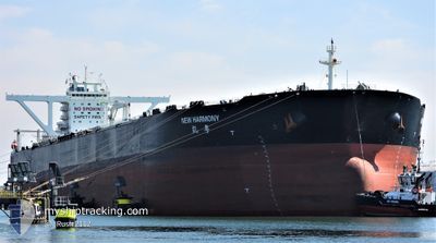
NEW HARMONY
Tanker
Current Trip
SGP PEBGC
| Time Travelled | 50 days |
|---|---|
| Remaining Time | --- |
| Distance Travelled | 13410.62 nm |
| Remaining Distance | --- |
| AVG Speed | 11.3 Knots |
| MAX Speed | 17.2 Knots |
| AVG Wind | 8.2 knots |
| MAX Wind | 24 knots |
| MIN Temp | 3.8°C / 38.84°F |
| MAX Temp | 29.9°C / 85.82°F |
| Draught | 11 m |
| Position Received | 1 m ago |
Current Position
| Longitude | 103.91464° |
|---|---|
| Latitude | 1.27291° |
| Status | At anchor |
| Speed | |
| Course | 76° |
| Area | Singapore Strait |
| Station | T-AIS |
| Position Received | 1 m ago |
Info
Information
The current position of NEW HARMONY is in Singapore Strait with coordinates 1.27291° / 103.91464° as reported on 2024-04-20 13:21 by AIS to our vessel tracker app. The vessel's current speed is 0 Knots
The vessel NEW HARMONY (IMO: 9603207, MMSI: 477390500) is a Tanker It's sailing under the flag of [HK] Hong Kong.
In this page you can find informations about the vessels current position, last detected port calls, and current voyage information. If the vessels is not in coverage by AIS you will find the latest position.
The current position of NEW HARMONY is detected by our AIS receivers and we are not responsible for the reliability of the data. The last position was recorded while the vessel was in Coverage by the Ais receivers of our vessel tracking app.
The current draught of NEW HARMONY as reported by AIS is 11 meters
Weather
| Temperature | 27.8°C / 82.04°F |
|---|---|
| Wind Speed | 12 knots |
| Direction | 328° NNW |
| Pressure | 1008.5 hPa |
| Humidity | 83.5 % |
| Cloud Coverage | 100 % |
Featured Company
Last Port Calls
| Port | Arrival | Departure | Time In Port |
|---|---|---|---|
| 2024-02-25 14:14 | 2024-02-29 14:21 | 4 d |
Most Visited Ports (Last year)
| Port | Arrivals | |
|---|---|---|
| 2 | ||
| 1 | ||
| 1 | ||
| 1 | ||
| 1 | ||
| 1 |
Last Trips
| Origin | Departure | Destination | Arrival | Distance | |
|---|---|---|---|---|---|
| 2024-01-10 04:19 | 2024-02-25 22:14 | 11119.29 nm |
Events
| Time | Event | Details | Position / Dest | Info |
|---|---|---|---|---|
| 2024-04-20 13:18 | Status Changed | At anchor Default |
1.27291 / 103.91463
SGP PEBGC
|
Speed: Course: 75° |
| 2024-04-20 13:15 | Status Changed | Default At anchor |
1.27295 / 103.91461
SGP PEBGC
|
Speed: Course: 75° |
| 2024-04-20 11:54 | Status Changed | At anchor Default |
1.27253 / 103.91475
SGP PEBGC
|
Speed: 0.1 kn Course: 60° |
| 2024-04-20 11:51 | Status Changed | Default At anchor |
1.27247 / 103.91478
SGP PEBGC
|
Speed: Course: 52° |
| 2024-04-20 08:30 | Status Changed | At anchor Under way using engine |
1.27555 / 103.91939
SGP PEBGC
|
Speed: 0.4 kn Course: 282° |
| 2024-04-20 08:19 | STOP Moving | 4 nm, East of SINGAPORE |
1.27430 / 103.91909
SGP PEBGC
|
Speed: 0.3 kn Course: 280° |
| 2024-04-20 07:11 | Change Sea Area | Singaporean part of the Singapore Strait Indonesian part of the Singapore Strait |
1.26062 / 104.00793
Singapore Strait
SGP PEBGC
|
Speed: 6.2 kn Course: 275.1° |
| 2024-04-20 06:47 | Change Sea Area | Indonesian part of the Singapore Strait Singaporean part of the Singapore Strait |
1.26834 / 104.04130
Singapore Strait
SGP PEBGC
|
Speed: 7.1 kn Course: 240.9° |
| 2024-04-20 06:38 | Change Sea Area | Singaporean part of the Singapore Strait Malaysian part of the Singapore Strait |
1.27458 / 104.05976
Singapore Strait
SGP PEBGC
|
Speed: 7.3 kn Course: 258.3° |
| 2024-04-20 06:28 | ETA Changed | 2024/04/20 07:30 2024/04/20 08:00 |
1.27601 / 104.07501
SGP PEBGC
|
Speed: 4.5 kn Course: 272° |