
NEW ENDEAVOR
Cargo
Current Trip
| Time Travelled | 7 days |
|---|---|
| Remaining Time | --- |
| Distance Travelled | 1233.36 nm |
| Remaining Distance | --- |
| AVG Speed | 11.8 Knots |
| MAX Speed | 14.4 Knots |
| AVG Wind | 8.1 knots |
| MAX Wind | 16.9 knots |
| MIN Temp | 3.8°C / 38.84°F |
| MAX Temp | 17°C / 62.6°F |
| Draught | 6.9 m |
| Position Received | 2 m ago |
Current Position
| Longitude | 132.94699° |
|---|---|
| Latitude | 42.78210° |
| Status | At anchor |
| Speed | 0.2 Knots |
| Course | 41° |
| Area | Japan Sea |
| Station | T-AIS |
| Position Received | 2 m ago |
Info
Information
The current position of NEW ENDEAVOR is in Japan Sea with coordinates 42.78210° / 132.94699° as reported on 2024-04-24 14:20 by AIS to our vessel tracker app. The vessel's current speed is 0.2 Knots
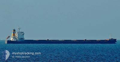
The vessel NEW ENDEAVOR (IMO: 9579638, MMSI: 352246000) is a Cargo It's sailing under the flag of [PA] Panama.
In this page you can find informations about the vessels current position, last detected port calls, and current voyage information. If the vessels is not in coverage by AIS you will find the latest position.
The current position of NEW ENDEAVOR is detected by our AIS receivers and we are not responsible for the reliability of the data. The last position was recorded while the vessel was in Coverage by the Ais receivers of our vessel tracking app.
The current draught of NEW ENDEAVOR as reported by AIS is 6.9 meters
Weather
| Temperature | 7.8°C / 46.04°F |
|---|---|
| Wind Speed | 5 knots |
| Direction | 332° NNW |
| Pressure | 1000.6 hPa |
| Humidity | 95.5 % |
| Cloud Coverage | 100 % |
Featured Company
Last Port Calls
| Port | Arrival | Departure | Time In Port |
|---|---|---|---|
| 2024-04-14 05:22 | 2024-04-16 22:31 | 2 d | |
| 2024-04-05 07:33 | 2024-04-07 13:09 | 2 d | |
| 2024-03-10 07:31 | 2024-03-10 16:18 | 8 h |
Most Visited Ports (Last year)
| Port | Arrivals | |
|---|---|---|
| 2 | ||
| 1 | ||
| 1 | ||
| 1 | ||
| 1 | ||
| 1 |
Last Trips
| Origin | Departure | Destination | Arrival | Distance | |
|---|---|---|---|---|---|
| 2024-04-07 21:09 | 2024-04-14 13:22 | 1634.78 nm | |||
| 2023-12-23 04:25 | 2024-03-10 09:31 | 4941.26 nm |
Events
| Time | Event | Details | Position / Dest | Info |
|---|---|---|---|---|
| 2024-04-21 00:30 | Status Changed | At anchor Under way using engine |
42.78180 / 132.94867
RU VYP
|
Speed: 0.2 kn Course: 37° |
| 2024-04-21 00:25 | STOP Moving | 2.34 nm, South East of NAKHODKA |
42.78180 / 132.94910
RU VYP
|
Speed: 0.3 kn Course: 25° |
| 2024-04-20 19:42 | Draught Changed | 6.9 6.8 |
42.14414 / 133.01624
RU VYP
|
Speed: 11.6 kn Course: 357.4° |
| 2024-04-20 19:42 | ETA Changed | 2024/04/21 00:01 2024/04/21 01:00 |
42.14414 / 133.01624
RU VYP
|
Speed: 11.6 kn Course: 357.4° |
| 2024-04-20 19:14 | Change Sea Area | Russian part of the Japan Sea South Korean part of the Japan Sea |
42.05607 / 133.00223
Japan Sea
RU VYP
|
Speed: 11.1 kn Course: 12.7° |
| 2024-04-20 19:14 | IN Coverage |
42.05607 / 133.00223
Japan Sea
RU VYP
|
Speed: 11.1 kn Course: 12.7° |
|
| 2024-04-19 13:22 | OUT of Coverage |
36.13514 / 130.26261
Japan Sea
RU VYP
|
Speed: 13.3 kn Course: 27.7° |
|
| 2024-04-19 09:05 | ETA Changed | 2024/04/21 01:00 2024/04/21 04:00 |
35.31052 / 129.68373
RU VYP
|
Speed: 13.3 kn Course: 29.9° |
| 2024-04-19 07:22 | Change Sea Area | South Korean part of the Japan Sea Japanese part of the Japan Sea |
34.98194 / 129.43104
Japan Sea
RU VYP
|
Speed: 14.4 kn Course: 37.5° |
| 2024-04-19 05:36 | Draught Changed | 6.8 14.8 |
34.66445 / 129.11197
RU VYP
|
Speed: 13.5 kn Course: 38.8° |