
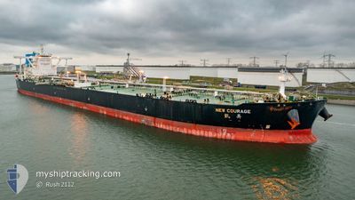
NEW COURAGE
Tanker
Current Trip
USG
| Time Travelled | 9 days |
|---|---|
| Remaining Time | --- |
| Distance Travelled | 2817.29 nm |
| Remaining Distance | --- |
| AVG Speed | 11.7 Knots |
| MAX Speed | 15.5 Knots |
| AVG Wind | 18.6 knots |
| MAX Wind | 32.6 knots |
| MIN Temp | 7.5°C / 45.5°F |
| MAX Temp | 19°C / 66.2°F |
| Draught | 11 m |
| Position Received | 8 d ago |
Current Position
| Longitude | -4.78672° |
|---|---|
| Latitude | 49.53342° |
| Status | Under way using engine |
| Speed | 13.5 Knots |
| Course | 251.8° |
| Area | English Channel |
| Station | T-AIS |
| Position Received | 8 d ago |
Info
Information
The current position of NEW COURAGE is in English Channel with coordinates 49.53342° / -4.78672° as reported on 2024-04-17 02:52 by AIS to our vessel tracker app. The vessel's current speed is 13.5 Knots
The vessel NEW COURAGE (IMO: 9686352, MMSI: 477855300) is a Tanker It's sailing under the flag of [HK] Hong Kong.
In this page you can find informations about the vessels current position, last detected port calls, and current voyage information. If the vessels is not in coverage by AIS you will find the latest position.
The current position of NEW COURAGE is detected by our AIS receivers and we are not responsible for the reliability of the data. The last position was recorded while the vessel was in Coverage by the Ais receivers of our vessel tracking app.
The current draught of NEW COURAGE as reported by AIS is 11 meters
Weather
| Temperature | 18.1°C / 64.58°F |
|---|---|
| Wind Speed | 6 knots |
| Direction | 275° W |
| Pressure | 1023.8 hPa |
| Humidity | 63.4 % |
| Cloud Coverage | 88 % |
Featured Company
Last Port Calls
| Port | Arrival | Departure | Time In Port |
|---|---|---|---|
| 2024-04-13 03:23 | 2024-04-15 19:06 | 2 d | |
| 2024-02-02 00:47 |
Most Visited Ports (Last year)
| Port | Arrivals | |
|---|---|---|
| 3 | ||
| 2 | ||
| 2 | ||
| 2 | ||
| 1 |
Last Trips
| Origin | Departure | Destination | Arrival | Distance | |
|---|---|---|---|---|---|
| 2024-02-02 08:47 | 2024-04-13 05:23 | 11693.03 nm |
Events
| Time | Event | Details | Position / Dest | Info |
|---|---|---|---|---|
| 2024-04-17 02:58 | Status Changed | Default Under way using engine |
49.52693 / -4.81672
USG
|
Speed: 13.5 kn Course: 251.8° |
| 2024-04-17 02:52 | Status Changed | Under way using engine Default |
49.53342 / -4.78672
USG
|
Speed: 13.5 kn Course: 247° |
| 2024-04-17 02:52 | OUT of Coverage |
49.53342 / -4.78672
English Channel
USG
|
Speed: 13.5 kn Course: 251.8° |
|
| 2024-04-17 02:42 | Status Changed | Default Under way using engine |
49.54781 / -4.73018
USG
|
Speed: 13.5 kn Course: 250.2° |
| 2024-04-16 21:25 | Change Sea Area | United Kingdom part of the English Channel Guernsey part of the English Channel |
49.95504 / -3.03895
English Channel
USG
|
Speed: 14.5 kn Course: 254.6° |
| 2024-04-16 21:03 | Status Changed | Under way using engine Default |
49.97825 / -2.91081
USG
|
Speed: 14.3 kn Course: 254° |
| 2024-04-16 21:01 | Status Changed | Default Under way using engine |
49.97974 / -2.90255
USG
|
Speed: 14.7 kn Course: 254.1° |
| 2024-04-16 20:50 | Status Changed | Under way using engine Default |
49.99155 / -2.83748
USG
|
Speed: 14.7 kn Course: 254° |
| 2024-04-16 20:50 | Status Changed | Default Under way using engine |
49.99242 / -2.83263
USG
|
Speed: 14.6 kn Course: 254.1° |
| 2024-04-16 18:37 | Change Sea Area | Guernsey part of the English Channel French part of the English Channel |
50.13815 / -2.02868
English Channel
USG
|
Speed: 15 kn Course: 254.3° |