
NEW COMMANDER
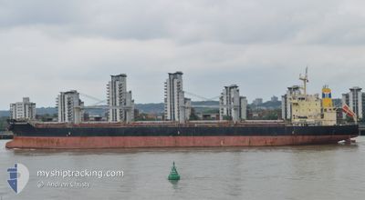
Bulk Carrier
Current Trip
| Time Travelled | 2 days |
|---|---|
| Remaining Time | --- |
| Distance Travelled | 278.66 nm |
| Remaining Distance | --- |
| AVG Speed | 9.7 Knots |
| MAX Speed | 13.9 Knots |
| AVG Wind | 9.3 knots |
| MAX Wind | 18.7 knots |
| MIN Temp | 10.3°C / 50.54°F |
| MAX Temp | 18.2°C / 64.76°F |
| Draught | 9.8 m |
| Position Received | 37 m ago |
Current Position
| Longitude | 27.25879° |
|---|---|
| Latitude | 40.62760° |
| Status | Under way using engine |
| Speed | 4.6 Knots |
| Course | 241° |
| Area | Sea of Marmara |
| Station | T-AIS |
| Position Received | 37 m ago |
Info
Information
The current position of NEW COMMANDER is in Sea of Marmara with coordinates 40.62760° / 27.25879° as reported on 2024-04-19 04:38 by AIS to our vessel tracker app. The vessel's current speed is 4.6 Knots and is heading at the port of JORF LASFAR. The estimated time of arrival as calculated by MyShipTracking vessel tracking app is 2024-04-26 13:30 LT
The vessel NEW COMMANDER (IMO: 9610652, MMSI: 373746000) is a Bulk Carrier that was built in 2012 ( 12 years old ). It's sailing under the flag of [PA] Panama.
In this page you can find informations about the vessels current position, last detected port calls, and current voyage information. If the vessels is not in coverage by AIS you will find the latest position.
The current position of NEW COMMANDER is detected by our AIS receivers and we are not responsible for the reliability of the data. The last position was recorded while the vessel was in Coverage by the Ais receivers of our vessel tracking app.
The current draught of NEW COMMANDER as reported by AIS is 9.8 meters
Weather
| Temperature | 10.3°C / 50.54°F |
|---|---|
| Wind Speed | 7 knots |
| Direction | 39° NE |
| Pressure | 1011.9 hPa |
| Humidity | 85.8 % |
| Cloud Coverage | 100 % |
Featured Company
Last Port Calls
| Port | Arrival | Departure | Time In Port |
|---|---|---|---|
| 2024-04-10 13:50 | 2024-04-16 17:02 | 6 d | |
| 2024-03-26 06:50 | 2024-04-04 06:25 | 8 d | |
| 2024-03-21 19:00 | 2024-03-25 19:42 | 4 d | |
| 2024-03-02 03:30 | 2024-03-06 03:39 | 4 d | |
| 2024-02-27 06:32 | 2024-02-27 06:35 | 3 m | |
| 2024-02-21 10:48 | 2024-02-22 15:42 | 1 d | |
| 2024-02-17 08:24 | 2024-02-20 18:55 | 3 d |
Most Visited Ports (Last year)
| Port | Arrivals | |
|---|---|---|
| 3 | ||
| 2 | ||
| 2 | ||
| 2 | ||
| 1 | ||
| 1 |
Last Trips
| Origin | Departure | Destination | Arrival | Distance | |
|---|---|---|---|---|---|
| 2024-04-04 08:25 | 2024-04-10 16:50 | 1413.92 nm | |||
| 2024-03-25 20:42 | 2024-03-26 07:50 | 110.37 nm | |||
| 2024-03-06 06:39 | 2024-03-21 20:00 | 4592.85 nm | |||
| 2024-02-27 07:35 | 2024-03-02 06:30 | 795.82 nm | |||
| 2024-02-22 16:42 | 2024-02-27 07:32 | 336.34 nm | |||
| 2024-02-20 19:55 | 2024-02-21 11:48 | 150.38 nm | |||
| 2023-12-30 04:56 | 2024-02-17 09:24 | 10034.87 nm |
Events
| Time | Event | Details | Position / Dest | Info |
|---|---|---|---|---|
| 2024-04-18 18:50 | Change Sea Area | Turkish part of the Sea of Marmara Turkish part of the Black Sea |
41.22820 / 29.12593
Sea of Marmara
MA JFL
|
Speed: 7.1 kn Course: 199.2° |
| 2024-04-18 16:54 | START Moving | 13.85 nm, North West of RUMELI FENERI |
41.43765 / 28.97553
MA JFL
|
Speed: 3.3 kn Course: 147° |
| 2024-04-18 11:40 | STOP Moving | 13.57 nm, North of RUMELI FENERI |
41.44781 / 29.02586
MA JFL
|
Speed: 0.3 kn Course: 61° |
| 2024-04-18 10:21 | START Moving | 8.38 nm, North of RUMELI FENERI |
41.36694 / 29.06829
MA JFL
|
Speed: 3.5 kn Course: 349° |
| 2024-04-18 07:29 | Draught Changed | 9.8 6.3 |
41.42281 / 29.02047
MA JFL
|
Speed: 1.7 kn Course: 68° |
| 2024-04-18 04:06 | Status Changed | Under way using engine Default |
41.47676 / 28.99956
MA JFL
|
Speed: 0.1 kn Course: 338° |
| 2024-04-18 03:38 | Status Changed | Default Under way using engine |
41.47594 / 28.99762
MA JFL
|
Speed: 0.2 kn Course: 341° |
| 2024-04-17 19:25 | Status Changed | Under way using engine Default |
41.48078 / 29.02361
MA JFL
|
Speed: 0.1 kn Course: 344° |
| 2024-04-17 19:25 | IN Coverage |
41.48078 / 29.02361
Black Sea
MA JFL
|
Speed: 0.1 kn Course: 241.5° |
|
| 2024-04-17 18:10 | OUT of Coverage |
41.48335 / 29.02390
Black Sea
MA JFL
|
Speed: 0.1 kn Course: 241.5° |