
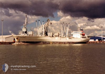
NESTOS REEFER "
Reefer
Current Trip
CL TAL
| Time Travelled | 30 days |
|---|---|
| Remaining Time | --- |
| Distance Travelled | 7092.00 nm |
| Remaining Distance | --- |
| AVG Speed | 11.5 Knots |
| MAX Speed | 14.5 Knots |
| AVG Wind | 13.1 knots |
| MAX Wind | 32.5 knots |
| MIN Temp | 7.2°C / 44.96°F |
| MAX Temp | 29.6°C / 85.28°F |
| Draught | 5 m |
| Position Received | 2024-01-27 17:00 |
Current Position
| Longitude | -56.79220° |
|---|---|
| Latitude | -41.65053° |
| Status | Under way using engine |
| Speed | 13.5 Knots |
| Course | 211.5° |
| Area | South Atlantic Ocean |
| Station | T-AIS |
| Position Received | 2024-01-27 17:00 |
Info
Information
The current position of NESTOS REEFER " is in South Atlantic Ocean with coordinates -41.65053° / -56.79220° as reported on 2024-01-27 17:00 by AIS to our vessel tracker app. The vessel's current speed is 13.5 Knots
The vessel NESTOS REEFER " (IMO: 9045156, MMSI: 370115000) is a Reefer that was built in 1992 ( 32 years old ). It's sailing under the flag of [PA] Panama.
In this page you can find informations about the vessels current position, last detected port calls, and current voyage information. If the vessels is not in coverage by AIS you will find the latest position.
The current position of NESTOS REEFER " is detected by our AIS receivers and we are not responsible for the reliability of the data. The last position was recorded while the vessel was in Coverage by the Ais receivers of our vessel tracking app.
The current draught of NESTOS REEFER " as reported by AIS is 5 meters
Weather
| Temperature | 10.3°C / 50.54°F |
|---|---|
| Wind Speed | 19 knots |
| Direction | 321° NW |
| Pressure | 1000.1 hPa |
| Humidity | 89 % |
| Cloud Coverage | 28 % |
Featured Company
Last Port Calls
| Port | Arrival | Departure | Time In Port |
|---|---|---|---|
| 2024-03-20 17:48 | 2024-03-26 05:29 | 5 d | |
| 2024-02-05 13:54 | 2024-02-11 20:46 | 6 d |
Last Trips
| Origin | Departure | Destination | Arrival | Distance | |
|---|---|---|---|---|---|
| 2024-02-11 17:46 | 2024-03-20 18:48 | 7741.22 nm | |||
| 2024-01-12 13:09 | 2024-02-05 10:54 | 7256.74 nm |
Events
| Time | Event | Details | Position / Dest | Info |
|---|---|---|---|---|
| 2024-04-25 08:43 | START Moving |
-45.92905 / -59.82577
CL TAL
|
Speed: 3.4 kn Course: 332° |
|
| 2024-04-24 20:26 | STOP Moving |
-45.77177 / -59.91296
CL TAL
|
Speed: 0.3 kn Course: 279° |
|
| 2024-04-24 10:51 | START Moving |
-45.58669 / -59.87019
CL TAL
|
Speed: 4.6 kn Course: 196° |
|
| 2024-04-24 10:44 | STOP Moving |
-45.58287 / -59.86683
CL TAL
|
Speed: 0.2 kn Course: 212° |
|
| 2024-04-24 10:15 | START Moving |
-45.55820 / -59.86010
CL TAL
|
Speed: 5 kn Course: 189° |
|
| 2024-04-24 10:01 | STOP Moving |
-45.54271 / -59.85572
CL TAL
|
Speed: 0.3 kn Course: 193° |
|
| 2024-04-24 09:46 | START Moving |
-45.53171 / -59.85338
CL TAL
|
Speed: 4.5 kn Course: 190° |
|
| 2024-04-23 11:47 | STOP Moving |
-45.72066 / -60.05418
CL TAL
|
Speed: 0.3 kn Course: 281° |
|
| 2024-04-23 07:20 | START Moving |
-45.43013 / -60.24192
CL TAL
|
Speed: 5.1 kn Course: 331° |
|
| 2024-04-23 01:36 | STOP Moving |
-45.42621 / -60.23615
CL TAL
|
Speed: 0.3 kn Course: 271° |