
NEPTUNE
General Cargo
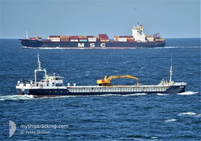
Current Trip
RUYEY
| Time Travelled | 4 days |
|---|---|
| Remaining Time | --- |
| Distance Travelled | 254.25 nm |
| Remaining Distance | --- |
| AVG Speed | 9.4 Knots |
| MAX Speed | 9.4 Knots |
| AVG Wind | 10.5 knots |
| MAX Wind | 24 knots |
| MIN Temp | 11.1°C / 51.98°F |
| MAX Temp | 17.4°C / 63.32°F |
| Draught | 3.6 m |
| Position Received | 2024-03-16 21:47 |
Current Position
| Longitude | 29.27528° |
|---|---|
| Latitude | 41.26771° |
| Status | Under way using engine |
| Speed | 10.1 Knots |
| Course | 88.1° |
| Area | Black Sea |
| Station | T-AIS |
| Position Received | 2024-03-16 21:47 |
Info
Information
The current position of NEPTUNE is in Black Sea with coordinates 41.26771° / 29.27528° as reported on 2024-03-16 21:47 by AIS to our vessel tracker app. The vessel's current speed is 10.1 Knots
The vessel NEPTUNE (IMO: 9011961, MMSI: 518790000) is a General Cargo that was built in 1991 ( 33 years old ). It's sailing under the flag of [CK] Cook Is.
In this page you can find informations about the vessels current position, last detected port calls, and current voyage information. If the vessels is not in coverage by AIS you will find the latest position.
The current position of NEPTUNE is detected by our AIS receivers and we are not responsible for the reliability of the data. The last position was recorded while the vessel was in Coverage by the Ais receivers of our vessel tracking app.
The current draught of NEPTUNE as reported by AIS is 3.6 meters
Weather
| Temperature | 16.1°C / 60.98°F |
|---|---|
| Wind Speed | 15 knots |
| Direction | 149° SSE |
| Pressure | 1006.3 hPa |
| Humidity | 76.8 % |
| Cloud Coverage | 98 % |
Featured Company
Last Port Calls
| Port | Arrival | Departure | Time In Port |
|---|---|---|---|
| 2024-04-20 20:32 | |||
| 2024-04-11 01:53 | 2024-04-12 23:05 | 1 d | |
| 2024-03-29 15:57 | 2024-04-01 09:17 | 2 d | |
| 2024-03-25 18:02 | 2024-03-26 11:49 | 17 h | |
| 2024-03-11 11:17 | 2024-03-13 03:52 | 1 d | |
| 2024-03-09 22:54 | 2024-03-11 01:35 | 1 d | |
| 2024-02-28 15:37 | |||
| 2024-02-02 10:57 | 2024-02-04 12:58 | 2 d |
Last Trips
| Origin | Departure | Destination | Arrival | Distance | |
|---|---|---|---|---|---|
| 2024-04-01 12:17 | 2024-04-11 04:53 | 420.89 nm | |||
| 2024-03-26 14:49 | 2024-03-29 18:57 | 470.58 nm | |||
| 2024-03-13 06:52 | 2024-03-25 21:02 | 625.95 nm | |||
| 2024-03-11 04:35 | 2024-03-11 14:17 | 80.55 nm | |||
| 2024-02-04 15:58 | 2024-02-28 18:37 | 547.85 nm | |||
| 2024-01-24 02:09 | 2024-02-02 13:57 | 550.81 nm |
Events
| Time | Event | Details | Position / Dest | Info |
|---|---|---|---|---|
| 2024-04-25 06:34 | STOP Moving | 11.62 nm, South of TAMAN |
44.93147 / 36.62479
RUYEY
|
Speed: 0.2 kn Course: 138° |
| 2024-04-25 03:40 | START Moving | 11.68 nm, South of TAMAN |
44.93052 / 36.62363
RUYEY
|
Speed: 29 kn Course: 290° |
| 2024-04-24 16:30 | STOP Moving | 11.63 nm, South of TAMAN |
44.93129 / 36.62500
RUYEY
|
Speed: 0.3 kn Course: 143° |
| 2024-04-24 10:57 | START Moving | 11.34 nm, South of TAMAN |
44.93584 / 36.62736
RUYEY
|
Speed: 5.8 kn Course: 88° |
| 2024-04-24 10:47 | STOP Moving | 11.66 nm, South of TAMAN |
44.93074 / 36.62531
RUYEY
|
Speed: 0.1 kn Course: 144° |
| 2024-04-24 09:57 | START Moving | 11.98 nm, South of TAMAN |
44.92462 / 36.63475
RUYEY
|
Speed: 3.1 kn Course: 157° |
| 2024-04-24 08:56 | STOP Moving | 11.72 nm, South of TAMAN |
44.92963 / 36.62583
RUYEY
|
Speed: 0.2 kn Course: 98° |
| 2024-04-23 20:43 | STOP Moving | 11.79 nm, South of TAMAN |
44.92833 / 36.62749
RUYEY
|
Speed: 0.3 kn Course: 32° |
| 2024-04-23 16:29 | STOP Moving | 11.68 nm, South of TAMAN |
44.92997 / 36.62990
RUYEY
|
Speed: 0.1 kn Course: 227° |
| 2024-04-23 16:28 | START Moving | 11.84 nm, South of TAMAN |
44.92772 / 36.62501
RUYEY
|
Speed: 37.9 kn Course: 240° |