
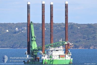
NEPTUNE
Offshore Construction Jack Up
Current Trip
HINKLEY POINT C
| Time Travelled | 12 h, 9 mins |
|---|---|
| Remaining Time | --- |
| Distance Travelled | 40.93 nm |
| Remaining Distance | --- |
| AVG Speed | 6 Knots |
| MAX Speed | 6.9 Knots |
| AVG Wind | 12 knots |
| MAX Wind | 14.9 knots |
| MIN Temp | 7.4°C / 45.32°F |
| MAX Temp | 10.9°C / 51.62°F |
| Draught | 7 m |
| Position Received | 4 h, 44 m ago |
Current Position
| Longitude | -5.70197° |
|---|---|
| Latitude | 49.86460° |
| Status | Under way using engine |
| Speed | 4.8 Knots |
| Course | 279° |
| Area | Celtic Sea |
| Station | T-AIS |
| Position Received | 4 h, 44 m ago |
Info
Information
The current position of NEPTUNE is in Celtic Sea with coordinates 49.86460° / -5.70197° as reported on 2024-04-19 08:45 by AIS to our vessel tracker app. The vessel's current speed is 4.8 Knots
The vessel NEPTUNE (IMO: 9616864, MMSI: 253532000) is a Offshore Construction Jack Up that was built in 2012 ( 12 years old ). It's sailing under the flag of [LU] Luxembourg.
In this page you can find informations about the vessels current position, last detected port calls, and current voyage information. If the vessels is not in coverage by AIS you will find the latest position.
The current position of NEPTUNE is detected by our AIS receivers and we are not responsible for the reliability of the data. The last position was recorded while the vessel was in Coverage by the Ais receivers of our vessel tracking app.
The current draught of NEPTUNE as reported by AIS is 7 meters
Weather
| Temperature | 10.8°C / 51.44°F |
|---|---|
| Wind Speed | 11 knots |
| Direction | 322° NW |
| Pressure | 1023.3 hPa |
| Humidity | 83.8 % |
| Cloud Coverage | 21 % |
Featured Company
Last Port Calls
| Port | Arrival | Departure | Time In Port |
|---|---|---|---|
| 2024-04-13 18:49 | 2024-04-19 01:21 | 5 d | |
| 2024-03-24 13:43 | 2024-04-10 14:15 | 17 d |
Most Visited Ports (Last year)
| Port | Arrivals | |
|---|---|---|
| 2 | ||
| 1 |
Last Trips
| Origin | Departure | Destination | Arrival | Distance | |
|---|---|---|---|---|---|
| 2024-04-10 16:15 | 2024-04-13 19:49 | 362.87 nm |
Events
| Time | Event | Details | Position / Dest | Info |
|---|---|---|---|---|
| 2024-04-19 08:45 | OUT of Coverage |
49.86460 / -5.70197
Celtic Sea
HINKLEY POINT C
|
Speed: 4.8 kn Course: 271.9° |
|
| 2024-04-19 07:34 | Change Sea Area | United Kingdom part of the Celtic Sea United Kingdom part of the English Channel |
49.86562 / -5.55472
Celtic Sea
HINKLEY POINT C
|
Speed: 5.1 kn Course: 269.3° |
| 2024-04-19 01:52 | Destination Changed | HINKLEY POINT C GBFAL |
50.12558 / -5.02667
HINKLEY POINT C
|
Speed: 6.6 kn Course: 184.4° |
| 2024-04-19 01:52 | ETA Changed | 2024/04/20 19:00 2024/04/13 19:00 |
50.12558 / -5.02667
HINKLEY POINT C
|
Speed: 6.6 kn Course: 184.4° |
| 2024-04-19 01:31 | START Moving | 0.72 nm, South West of SAINT MAWES |
50.15245 / -5.03092
GBFAL
|
Speed: 3.2 kn Course: 174° |
| 2024-04-19 01:21 | PORT DEPARTURE |
|
50.15668 / -5.03965
GBFAL
|
Speed: 0.3 kn Course: 28° |
| 2024-04-19 00:02 | Status Changed | Under way using engine Moored |
50.15710 / -5.05498
[GB] FALMOUTH
|
Speed: Course: 267° |
| 2024-04-18 23:58 | IN Coverage |
50.15710 / -5.05497
English Channel
[GB] FALMOUTH
|
Speed: Course: 114.4° |
|
| 2024-04-18 22:01 | OUT of Coverage |
50.15712 / -5.05498
English Channel
[GB] FALMOUTH
|
Speed: Course: 57.7° |
|
| 2024-04-18 21:43 | IN Coverage |
50.15713 / -5.05498
English Channel
[GB] FALMOUTH
|
Speed: Course: 177.2° |