
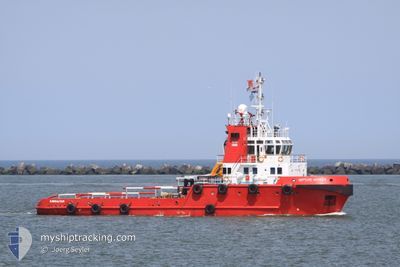
KOOLE 42
Anchor Handling Vessel
Current Trip
| Time Travelled | 14 days |
|---|---|
| Remaining Time | --- |
| Distance Travelled | 405.58 nm |
| Remaining Distance | --- |
| AVG Speed | 5.2 Knots |
| MAX Speed | 11.3 Knots |
| AVG Wind | 10.9 knots |
| MAX Wind | 16.9 knots |
| MIN Temp | 23.6°C / 74.48°F |
| MAX Temp | 33.8°C / 92.84°F |
| Draught | 4.2 m |
| Position Received | 2023-07-25 12:54 |
Current Position
| Longitude | -16.66894° |
|---|---|
| Latitude | 27.73642° |
| Status | Restricted manoeuverability |
| Speed | 7.3 Knots |
| Course | 224.9° |
| Area | North Atlantic Ocean |
| Station | T-AIS |
| Position Received | 2023-07-25 12:54 |
Info
Information
The current position of KOOLE 42 is in North Atlantic Ocean with coordinates 27.73642° / -16.66894° as reported on 2023-07-25 12:54 by AIS to our vessel tracker app. The vessel's current speed is 7.3 Knots
The vessel KOOLE 42 (IMO: 9481037, MMSI: 236491000) is a Anchor Handling Vessel that was built in 2007 ( 17 years old ). It's sailing under the flag of [GI] Gibraltar.
In this page you can find informations about the vessels current position, last detected port calls, and current voyage information. If the vessels is not in coverage by AIS you will find the latest position.
The current position of KOOLE 42 is detected by our AIS receivers and we are not responsible for the reliability of the data. The last position was recorded while the vessel was in Coverage by the Ais receivers of our vessel tracking app.
The current draught of KOOLE 42 as reported by AIS is 4.2 meters
Weather
| Temperature | 25°C / 77°F |
|---|---|
| Wind Speed | 3 knots |
| Direction | 67° ENE |
| Pressure | 1012.7 hPa |
| Humidity | 91.5 % |
| Cloud Coverage | 100 % |
Featured Company
Last Port Calls
| Port | Arrival | Departure | Time In Port |
|---|---|---|---|
| 2024-04-08 12:39 | 2024-04-08 13:43 | 1 h | |
| 2024-03-26 15:47 | 2024-04-08 10:55 | 12 d | |
| 2024-03-26 10:43 | 2024-03-26 12:23 | 1 h | |
| 2024-03-18 10:43 | 2024-03-18 15:52 | 5 h | |
| 2024-02-03 17:36 | 2024-02-03 18:36 | 59 m | |
| 2024-02-03 15:40 |
Most Visited Ports (Last year)
| Port | Arrivals | |
|---|---|---|
| 22 | ||
| 16 | ||
| 8 | ||
| 7 |
Last Trips
| Origin | Departure | Destination | Arrival | Distance | |
|---|---|---|---|---|---|
| 2024-04-08 07:55 | 2024-04-08 09:39 | 12.90 nm | |||
| 2024-03-26 09:23 | 2024-03-26 12:47 | 14.16 nm | |||
| 2024-03-18 11:52 | 2024-03-26 07:43 | 216.32 nm | |||
| 2024-02-03 15:36 | 2024-03-18 06:43 | 371.09 nm | |||
| 2024-02-03 12:40 | 2024-02-03 14:36 | 12.79 nm |
Events
| Time | Event | Details | Position / Dest | Info |
|---|---|---|---|---|
| 2024-04-23 11:05 | STOP Moving | 0.75 nm, North of GEORGETOWN |
6.80167 / -58.17500
PARAMARIBO
|
Speed: Course: -1° |
| 2024-04-23 10:21 | START Moving | 4.49 nm, North of GEORGETOWN |
6.85875 / -58.14493
PARAMARIBO
|
Speed: 6.8 kn Course: 211° |
| 2024-04-18 16:29 | STOP Moving | 4.84 nm, North of GEORGETOWN |
6.86500 / -58.14500
PARAMARIBO
|
Speed: Course: -1° |
| 2024-04-18 15:36 | START Moving | 1.92 nm, North of GEORGETOWN |
6.82104 / -58.16970
PARAMARIBO
|
Speed: 9 kn Course: 12° |
| 2024-04-18 15:20 | STOP Moving | 0.63 nm, North of GEORGETOWN |
6.79952 / -58.17553
PARAMARIBO
|
Speed: 0.1 kn Course: 165° |
| 2024-04-18 14:50 | START Moving | 4.25 nm, North of GEORGETOWN |
6.85500 / -58.14667
PARAMARIBO
|
Speed: 7 kn Course: 218° |
| 2024-04-16 13:08 | STOP Moving | 4.74 nm, North of GEORGETOWN |
6.86333 / -58.14500
PARAMARIBO
|
Speed: Course: -1° |
| 2024-04-16 13:05 | START Moving | 4.84 nm, North of GEORGETOWN |
6.86500 / -58.14500
PARAMARIBO
|
Speed: 4 kn Course: -1° |
| 2024-04-16 12:53 | STOP Moving | 4.78 nm, North of GEORGETOWN |
6.86333 / -58.14333
PARAMARIBO
|
Speed: Course: -1° |
| 2024-04-16 10:44 | START Moving | 11.53 nm, North East of GEORGETOWN |
6.95454 / -58.07370
PARAMARIBO
|
Speed: 3.3 kn Course: 170° |