
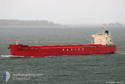
NAVIOS HERAKLES I
Cargo
Current Trip
GUANGZHOU CHINA
| Time Travelled | 23 days |
|---|---|
| Remaining Time | --- |
| Distance Travelled | 5026.33 nm |
| Remaining Distance | --- |
| AVG Speed | 8.6 Knots |
| MAX Speed | 13.5 Knots |
| AVG Wind | 19.4 knots |
| MAX Wind | 41.8 knots |
| MIN Temp | -1.9°C / 28.58°F |
| MAX Temp | 13°C / 55.4°F |
| Draught | 14.2 m |
| Position Received | 4 d ago |
Current Position
| Longitude | --- |
|---|---|
| Latitude | --- |
| Status | Under way using engine |
| Speed | 8.7 Knots |
| Course | 233.4° |
| Area | Japan Sea |
| Station | T-AIS |
| Position Received | 4 d ago |
Info
Information
The current position of NAVIOS HERAKLES I is in Japan Sea with coordinates 41.16826° / 139.98060° as reported on 2024-12-09 14:25 by AIS to our vessel tracker app. The vessel's current speed is 8.7 Knots
The vessel NAVIOS HERAKLES I (IMO: 9852937, MMSI: 372011000) is a Cargo It's sailing under the flag of [PA] Panama.
In this page you can find informations about the vessels current position, last detected port calls, and current voyage information. If the vessels is not in coverage by AIS you will find the latest position.
The current position of NAVIOS HERAKLES I is detected by our AIS receivers and we are not responsible for the reliability of the data. The last position was recorded while the vessel was in Coverage by the Ais receivers of our vessel tracking app.
The current draught of NAVIOS HERAKLES I as reported by AIS is 14.2 meters
Weather
| Temperature | 12.9°C / 55.22°F |
|---|---|
| Wind Speed | 21 knots |
| Direction | 347° NNW |
| Pressure | 1028.9 hPa |
| Humidity | 57.2 % |
| Cloud Coverage | 100 % |
Featured Company
Most Visited Ports (Last year)
| Port | Arrivals | |
|---|---|---|
| 2 | ||
| 2 | ||
| 1 | ||
| 1 | ||
| 1 | ||
| 1 |
Last Trips
| Origin | Departure | Destination | Arrival | Distance | |
|---|---|---|---|---|---|
| 2024-10-08 11:13 | 2024-11-18 03:29 | 6203.63 nm | |||
| 2024-07-25 17:06 | 2024-10-04 12:53 | 5938.52 nm |
Events
| Time | Event | Details | Position / Dest | Info |
|---|---|---|---|---|
| 2024-12-09 14:34 | Status Changed | Default Under way using engine |
41.15526 / 139.95612
GUANGZHOU CHINA
|
Speed: 8.7 kn Course: 233.4° |
| 2024-12-09 14:25 | OUT of Coverage |
41.16826 / 139.98060
Japan Sea
GUANGZHOU CHINA
|
Speed: 8.7 kn Course: 233.4° |
|
| 2024-12-09 14:13 | Status Changed | Under way using engine Default |
41.18390 / 140.01121
GUANGZHOU CHINA
|
Speed: 8.5 kn Course: 233° |
| 2024-12-09 14:02 | Status Changed | Default Under way using engine |
41.19967 / 140.03995
GUANGZHOU CHINA
|
Speed: 8.6 kn Course: 231.1° |
| 2024-12-09 13:13 | Status Changed | Under way using engine Default |
41.27293 / 140.15661
GUANGZHOU CHINA
|
Speed: 7.9 kn Course: 225° |
| 2024-12-09 13:04 | Status Changed | Default Under way using engine |
41.28577 / 140.17404
GUANGZHOU CHINA
|
Speed: 7.7 kn Course: 231.7° |
| 2024-12-09 13:00 | Status Changed | Under way using engine Default |
41.29116 / 140.18281
GUANGZHOU CHINA
|
Speed: 8.1 kn Course: 221° |
| 2024-12-09 12:42 | Status Changed | Default Under way using engine |
41.31628 / 140.22148
GUANGZHOU CHINA
|
Speed: 7.8 kn Course: 247.8° |
| 2024-12-09 12:19 | Status Changed | Under way using engine Default |
41.33291 / 140.27978
GUANGZHOU CHINA
|
Speed: 6.8 kn Course: 249° |
| 2024-12-09 12:13 | Status Changed | Default Under way using engine |
41.33615 / 140.29468
GUANGZHOU CHINA
|
Speed: 6.7 kn Course: 253.7° |