
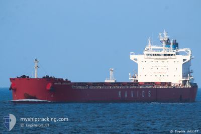
NAVIOS CENTAURUS
Bulk Carrier
Current Trip
AR NEC
| Time Travelled | --- |
|---|---|
| Remaining Time | --- |
| Distance Travelled | --- |
| Remaining Distance | --- |
| AVG Speed | --- |
| MAX Speed | --- |
| AVG Wind | --- |
| MAX Wind | --- |
| MIN Temp | --- |
| MAX Temp | --- |
| Draught | 9.2 m |
| Position Received | 3 d ago |
Current Position
| Longitude | 57.43714° |
|---|---|
| Latitude | -20.12357° |
| Status | Under way using engine |
| Speed | 4.9 Knots |
| Course | 105° |
| Area | Indian Ocean |
| Station | T-AIS |
| Position Received | 3 d ago |
Info
Information
The current position of NAVIOS CENTAURUS is in Indian Ocean with coordinates -20.12357° / 57.43714° as reported on 2024-04-15 09:13 by AIS to our vessel tracker app. The vessel's current speed is 4.9 Knots
The vessel NAVIOS CENTAURUS (IMO: 9590072, MMSI: 373131000) is a Bulk Carrier that was built in 2012 ( 12 years old ). It's sailing under the flag of [PA] Panama.
In this page you can find informations about the vessels current position, last detected port calls, and current voyage information. If the vessels is not in coverage by AIS you will find the latest position.
The current position of NAVIOS CENTAURUS is detected by our AIS receivers and we are not responsible for the reliability of the data. The last position was recorded while the vessel was in Coverage by the Ais receivers of our vessel tracking app.
The current draught of NAVIOS CENTAURUS as reported by AIS is 9.2 meters
Weather
| Temperature | 28.6°C / 83.48°F |
|---|---|
| Wind Speed | 15 knots |
| Direction | 90° E |
| Pressure | 1012 hPa |
| Humidity | 68.1 % |
| Cloud Coverage | 24 % |
Featured Company
Last Port Calls
| Port | Arrival | Departure | Time In Port |
|---|---|---|---|
| 2024-03-13 23:51 | |||
| 2024-03-08 05:45 | |||
| 2024-02-10 22:49 | 2024-02-14 23:33 | 4 d |
Most Visited Ports (Last year)
| Port | Arrivals | |
|---|---|---|
| 1 | ||
| 1 | ||
| 1 | ||
| 1 | ||
| 1 | ||
| 1 |
Last Trips
| Origin | Departure | Destination | Arrival | Distance | |
|---|---|---|---|---|---|
| 2024-03-08 02:45 | 2024-03-13 20:51 | 666.53 nm | |||
| 2024-01-05 23:58 | 2024-02-10 19:49 | 8360.51 nm |
Events
| Time | Event | Details | Position / Dest | Info |
|---|---|---|---|---|
| 2024-04-15 09:18 | Status Changed | Default Under way using engine |
-20.12474 / 57.44465
AR NEC
|
Speed: 4.9 kn Course: 105° |
| 2024-04-15 09:13 | Change Sea Area | Mauritian part of the Indian Ocean Argentinean part of the South Atlantic Ocean |
-20.12357 / 57.43714
Indian Ocean
|
Speed: 4.9 kn Course: 97.3° |
| 2024-04-15 09:13 | Status Changed | Under way using engine Default |
-20.12357 / 57.43714
AR NEC
|
Speed: 2.7 kn Course: 106° |
| 2024-04-15 09:13 | OUT of Coverage |
-20.12357 / 57.43714
Indian Ocean
|
Speed: 4.9 kn Course: 97.3° |
|
| 2024-04-15 08:56 | IN Coverage |
-20.12357 / 57.43714
Indian Ocean
|
Speed: 4.9 kn Course: 97.3° |
|
| 2024-04-15 08:00 | START Moving | 4.66 nm, West of PORT LOUIS |
-20.11928 / 57.40306
AR NEC
|
Speed: 3.2 kn Course: 59° |
| 2024-04-15 05:00 | STOP Moving | 3.95 nm, West of PORT LOUIS |
-20.14049 / 57.41244
AR NEC
|
Speed: 0.3 kn Course: 235° |